
Welcome to March! If you liked Saturday, you will absolutely love today. Yesterday’s high was 67. We’ll tack on about three more degrees today, with a sun/cloud mix. Enjoy it, because big changes are on the way.
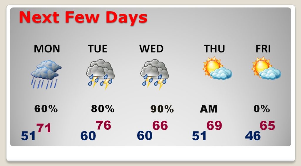
We are about to get into a week which will feature periods of rain. Rainfall will be heavy at times. Some thunderstorms are also possible. Rainfall amounts could be quite excessive through Wednesday. The rain clears out Thursday morning.
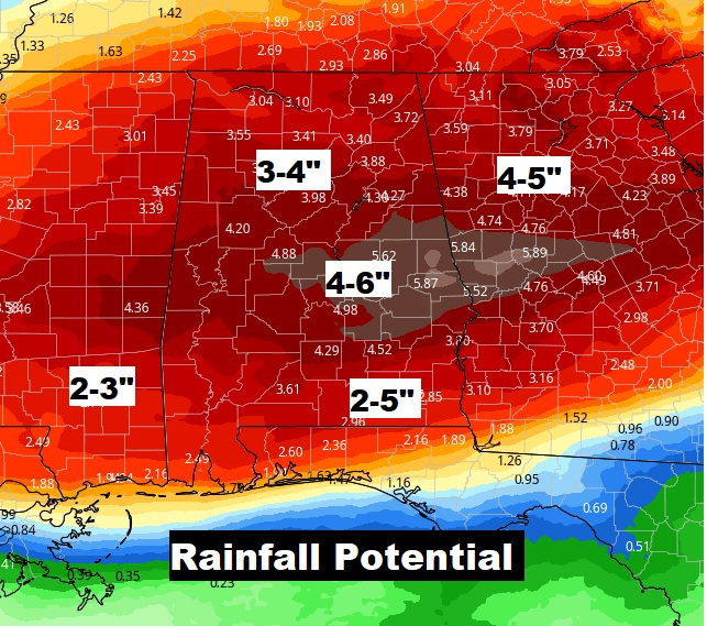
Below, I’ll show you how much rain is possible. Fortunately, the Severe Weather Threat has all but faded away. That’s the good news.
Some of the heaviest rain this week will be Tuesday and Wednesday.
TODAY & TONIGHT: Simply a beautiful first day of March. Look for a Sun/cloud mix. Today’s high near 70. Southeast wind at 5 to 10. Cloudy tonight. Showers possible late tonight. Low 51.
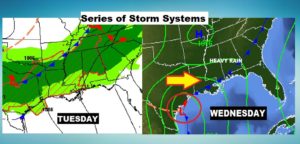
NEXT FEW DAYS: A series of storm systems will swing through the Gulf states. It won’t rain all the time, but there will be periods of rain. Rainfall could be heavy at times, particularly Tuesday through Wednesday night. Warmest day will be Tuesday with mid 70’s. Rain ends Thursday morning. Friday looks nice.
HEAVY RAINFALL POTENTIAL: Fortunately, I am removing the severe weather threat from the forecast. The parameters for severe weather are just not there.
However, rainfall totals could be quite excessive across central Alabama. In fact, some spots could easily see 4 to 6 inches. That will bring another Flash Flood Threat to the area.
I will have a complete video update for you first thing tomorrow morning. It should be online by about 4:45AM. Enjoy this comfortable day!
–Rich