..Active Weather day and night ahead…
Severe Weather will affect much of the state today and tonight, including damaging wind gusts and the threat of tornadoes. South Alabama has the strongest threat. Excessive rainfall totals are expected Today and Tonight. A Flash Flood Watch is in effect for the entire area. How much rain can we expect? What about timing and potential impacts? I’ll break down the details. Plus: Timing is everything. I’ll have the scoop on what is shaping up to be a beautiful weekend.
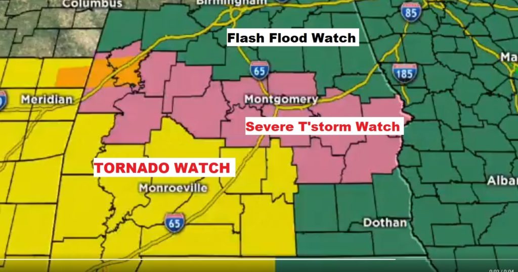
Multiple weather watches this morning, includes Severe Thunderstorm Watch Central Alabama, Tornado watch for south and SW Alabama. Flash Flood Watch for everybody.
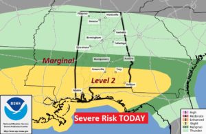
Strongest threat of severe thunderstorms and tornadoes today will be in the level 2 area along and south of a Greenville/Troy line. Marginal Risk to north of a Montgomery, Auburn Line. This runs all the way till 6AM Thursday.
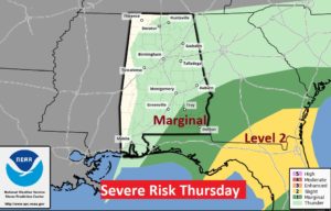
After 6AM Thursday, the Severe Risk shifts to SE Alabama, Georgia and Florida.
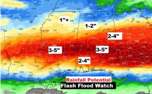
Additional rainfall of 5 inches is possible in Central Alabama. Flash Flood Watch.
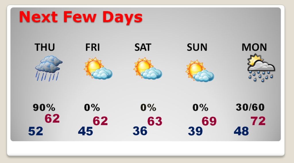
Rain ends by lunchtime Thursday. The sun is out Friday. Beautiful weekend. More rain by Monday night into Tuesday.