
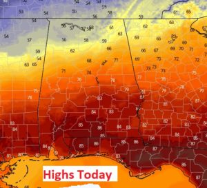
After a record tying high of 85 on Saturday, we are headed for the 80’s again today, even though it’s officially winter until Thursday. It will be yet another very nice Sunday, on the “Ides of March”. There will be at least some mention of rain in the forecast for the next few days. The rain chance will vary from day to day. But, daily high temperatures will be well above normal. Many days this week are likely to be 80 or above. We could see some stronger storms across the area on Friday.
TODAY & TONIGHT: Highs in the low to mid 80’s Partly sunny. Small Risk of a shower or thunderstorm this afternoon and the evening. Tonight’s low 62. (Normal high 70, low 45. Record high 89 in 2016)
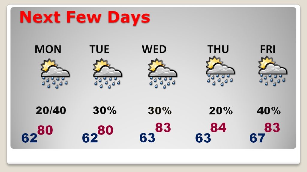
NEXT FEW DAYS: Much above normal temperatures. Highs near 80 or above each day. Scattered showers and thunderstorms. Rain probabilities vary from day to day.
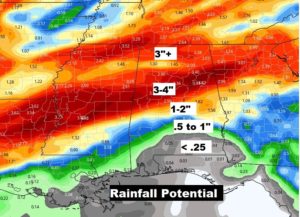
RAINFALL POTENTIAL: Once again this week, there will be a major gradient across the state on rainfall totals. While parts of north Alabama could see 3-4”, the extreme southern counties may only see less than a quarter of an inch.
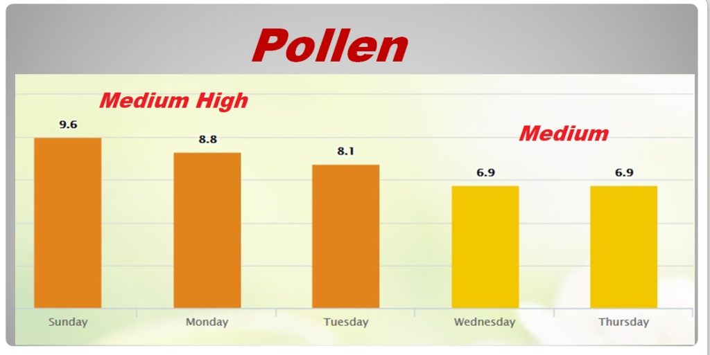
POLLEN FORECAST: Medium high range through Tuesday. Then, the medium range by mid week.
- –
I will have a complete video update for you first thing tomorrow morning. It should be online by about 4:45AM. Enjoy this nice day!
–Rich