Early this morning a cool front is heading southward through the state. A weakening line of showers could affect the area early, but big improvements are in the cards this afternoon. After a few days in the 80’s, we’re in for a big cool down, especially Friday. But, now attention turns to an ominous Easter Sunday storm system. Potentially, there could be a rather significant severe weather event across the Deep South. I’ll bring you up to date on timing, and the latest from the Storm Prediction Center. How cool will it be next week behind the storm system. I’ll bring you up to date with your toast and coffee this morning.
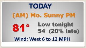
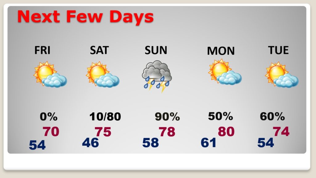
After the front moves through early this morning with a small showers threat, we”ll see big improvements this afternoon. Cooler tonight.
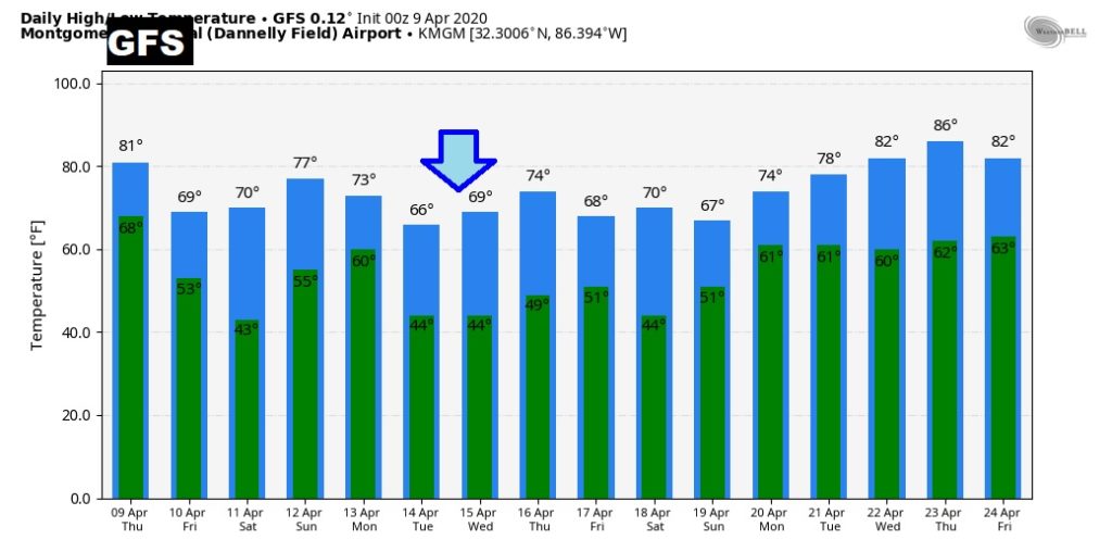
MUCH cooler Friday. Comfortable Saturday. All eyes on that ominous Easter Sunday storm system with the threat of severe weather. Showers and storms could begin overnight Saturday night.
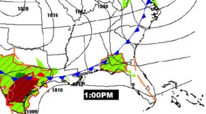
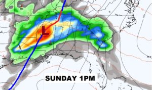
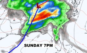
A classic looking storm system emerging out of the southern plains will set the stage for a potentially significant severe weather event scross the Deep South on Easter Sunday.
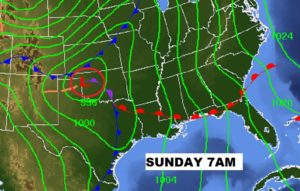
Potentially severe thunderstorms Sunday afternoon and Sunday evening with the threat of tornadoes, too.
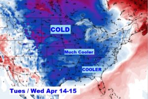
Much cooler air by about Tuesday and Wednesday…