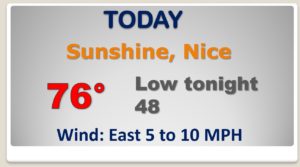
Good Morning! It’s an unusually cool Mid-April morning with patchy frost in spots. But, the chill will fade. Get ready for a warming trend by this afternoon, Friday and the weekend. Looks like another couple of dry days ahead, but showers and thunderstorms will return this weekend. Concern is growing for Sunday. Looks like another perhaps significant severe weather threat, including tornadoes. I have the latest threat level from the Storm Prediction Center. I have the latest details on the weekend forecast. Plus, we’ll look ahead to what looks like a significant storm system about a week away.
COLD start but just a beautiful day today. Nice afternoon warm up.
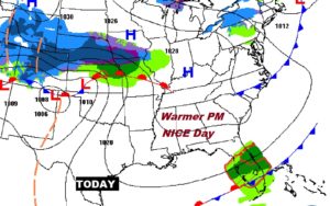
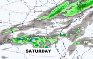
Showers & storms return this weekend. ALL EYES ON SUNDAY. Concern is growing for another severe weather/tornado threat.
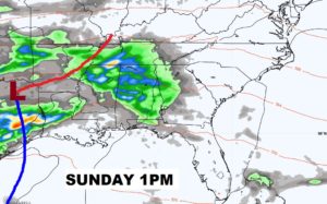
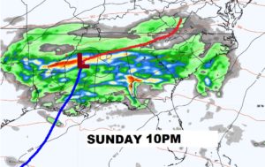
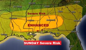
Very disturbing to already see an ENHANCED severe weather risk on Day 4…Sunday across central and south Alabama. Another tornado risk.
Warmer days Friday through Sunday. Scattered thunderstorms Saturday night. Severe Risk Sunday afternoon and Sunday night. Dry weather Monday and Tuesday.

AS surveys continue…looks like 26 Alabama tornadoes have been identified already from Easter Sunday and 78 now across the South.