Good Morning! We are going to enjoy one more tranquil day today. But, get ready. We have to deal with yet another Severe Weather Risk tomorrow. The action begins early in the morning across the west Alabama and spreads eastward. Will we see more than one Round? Some models indicate we could see a re-development in the afternoon. On this video, I’ll break down the timeline and the threat level. The Wind Damage risk will be a primary risk. The tornado threat is a bit more conditional. I’ll explain. What about the weekend? Will there be any more storms? I have tweaked the weekend forecast.
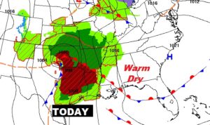
Nice QUIET day today… Warm High near 80. Clouds increase today. Look at the big storm system in Oklahoma. That’s our future late tonight and Thursday.
Potent set-up for strong/severe storms tomorrow with this powerful storm system.
\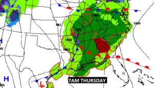
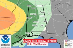
SPC’s outlook through 7AM Thursday morning, shows that even early on tmorrow morning there’s already a Marginal Severe risk across the western countess west of I-65. Damaging wind threat.
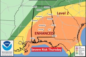
Rather significant ENHANCED Severe Risk for most of us Thursday. Damaging winds, large hail and tornadoes are possible. General broad timeline would be 7AM West to maybe 6PM far east. That’s obviously a large time window. Much depends on the small unknown “meso-scale” factors, which we can’t see today, but will be more clear by morning.
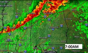
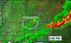
Could of Future Radar snapshots during the morning from the NAM model. Could be a significant potential wind damage event, but will it also morph into a tornado threat?
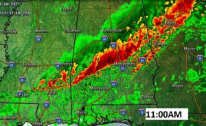
Will the atmosphere be able to RECOVER after the morning round of storms? Could we see some severe, potentially TORNADIC storms late morning into the afternoon? The jury is out, but that scenario is certainly possible. The devil is in the details.
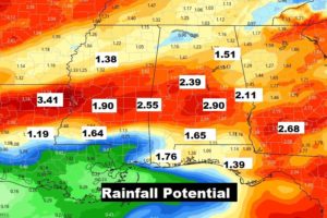
Parts of central Alabama could see an additional 2-3 inches of rain with this next system.
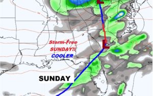
After Severe weather Thursday…Nice day Friday. Saturday rain chance is small, but we’ll have to monitor for stronger storms. Storm free Sunday! Nice string of days starts Sunday and well into next week.
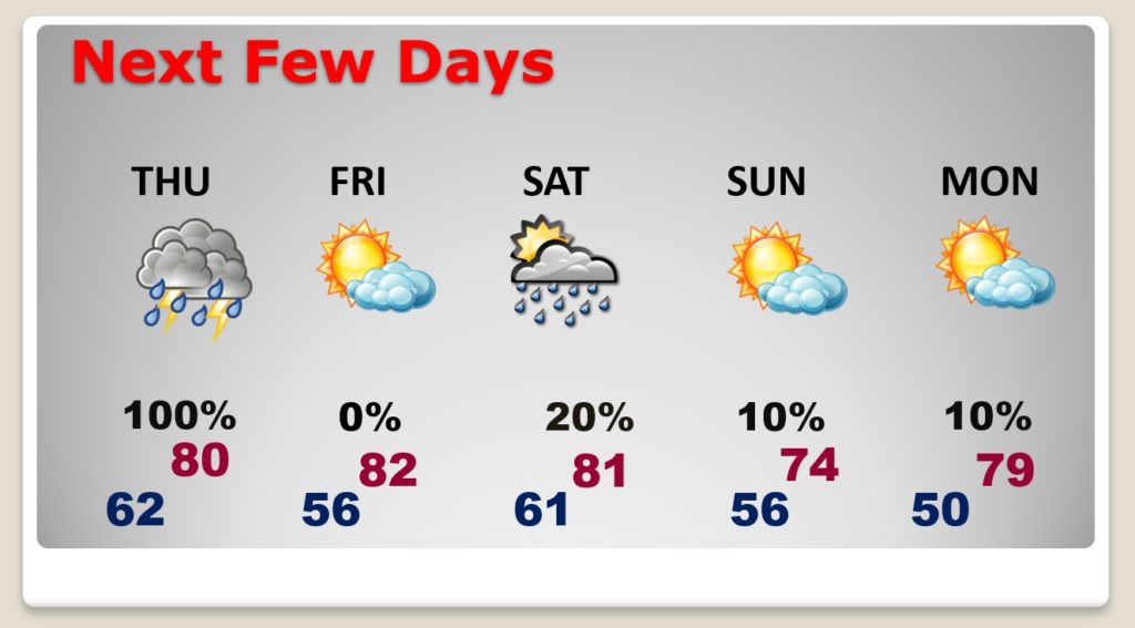
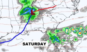
Parts of north Alabama could see some strong possibly severe storms Saturday with this approaching cool front, but the rain chances farther south are much smaller. And, FINALLY…it looks like a Storm-free Sunday!! That’ll be nice.