
Good Morning! How would you like a completely storm-free weekend for a change?
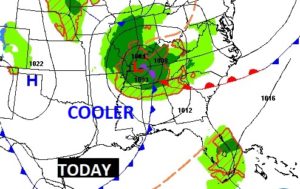
A couple of showers moved through overnight ahead of a front sweeping across the state today. But, today will be a nice. Sunshine will dominate today and Sunday. The string of nice days should stick around through Tuesday, before the next storm system arrives by mid-week. Meanwhile, some cooler, nicer air will funnel into the state tonight and hang around through Monday morning. Enjoy! This is the longest string of nice days we have seen in weeks.
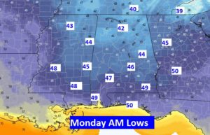
COOLER AIR AHEAD: You’ll feel that cooler air by tonight, and Sunday. Sunday’s high will only reach the low 70’s. And Sunday night/Monday will be chilly. Take a look. Lows will be in the mid 40’s here in central Alabama, with lower 40’s up north. It’s late in the ballgame for that!
TODAY: Nice day. Lots of sunshine. Breezy and warm. High in the low to mid 80’s. Breezy and cooler tonight. Low 54.
NEXT FEW DAYS: I am excited about a storm-free Sunday! Much cooler. High 73. Chilly Sunday night. Perfect Monday. Warmer Tuesday. Showers and storms Wednesday. Dry Thursday.
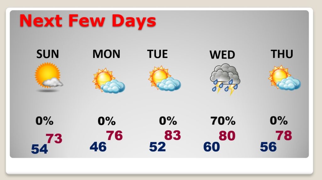
WEDNESDAY STORM SYSTEM: Next rain arrives Wednesday. An approaching cool front will bring in showers and thunderstorms. Some stronger storms are possible. Will this be a severe weather day? Too early to say yet. By the way, I went back and checked. We have had seven severe weather days since March 30th. It has been a regrettably busy severe weather April. May is typically much calmer.

– -.
I will have another Blog update tomorrow morning. Follow me on Twitter: @RichThomasWX. Enjoy this nice weather! Stay safe and well.
-Rich