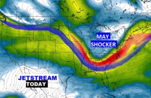
Good Morning! It’s in the 40’s this morning, but this is only stage one of rather remarkable Mother’s Day Weekend Cool-snap, which will likely set records across much of the eastern United States. Nice day today! But, showers and thunderstorms return tomorrow, ahead of the main cold front, which will move through Friday night. What follows will be a chunk of chilly air, with arctic origins. In Alabama temperatures will be running about 20 degrees below normal. How long will it stay? I will walk you through the details and I have new numbers to show you.
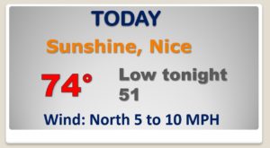
After a chilly start..this should be a NICE day. Not as windy as yesterday. Today’s high of 82 is 8 degrees too cool for this time of year. Chilly tonight but dry.
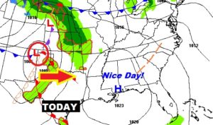
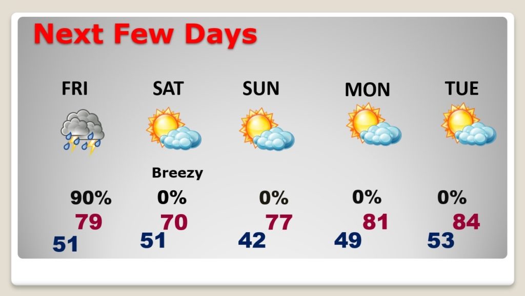
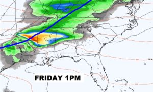
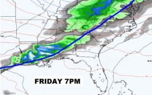
Showers and thunderstorms move in Friday afternoon and Friday evening ahead of the strong cold front we’ve been telling you about.
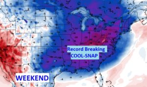
Amazing cold airmass for May with arctic origins will set low temperature records for much of the eastern half of the nation.
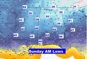
Montgomery’s Sunday morning record of 43 from 1906 is in jeopardy.
NICE recovery on Sunday…Mother’s Day afternoon. Warmer Monday and Tuesday. Back to near or above normal on the highs.