Good Morning! Colder air continues to funnel into Alabama. Record lows will be in jeopardy across the state tonight. This unusually Cold May Airmass, with arctic origins, will bring snow to parts of the Great Lakes and the Northeast. We’ll be in the 40’s for the next 3 nights.
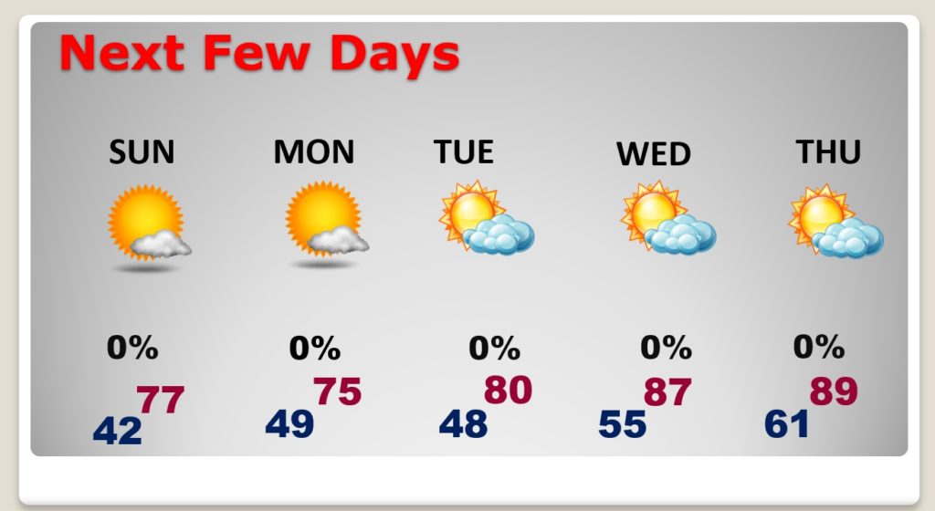
Today will be rather brisk across the state with 60’s north and near 70 south. But, expect a nice Mother’s Day afternoon recovery.
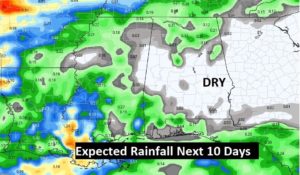
Look for a big warming trend in the week ahead. We’ll be in the upper 80’s Wednesday through Friday. We need some rain, but the rain prospects are not good.
Unusually cold air covers much of the eastern half of the nation. Widespread records are in jeopardy.
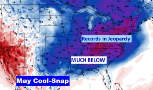
TODAY: Sunshine. Breezy and cool for May. High 72. (Normal high 82, normal low 58). North wind 10 to 15. Clear and unusually cold tonight. Several record lows are in jeopardy tonight. In Montgomery, there is a good chance we will tie or break the record of 43 from 1906.
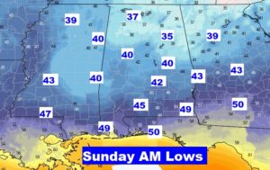
NEXT FEW DAYS: Mother’s Day will start off COLD, but expect a nice afternoon recovery, into the upper 70’s. Another re-enforcing cool front slips in late Sunday night. Chilly nights in the 40’s continue Sunday night and Monday night. A major warming trend begins Tuesday. We’ll be in the upper 80’s by Wednesday and Thursday. We should see a storm-free week ahead. We need some rain….soon.
GETTING DRY: Just Saying… We need some rain….soon. This is going to start to be an issue soon. Take a look at the Rainfall Prospects for the next 10 days. Not good.
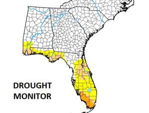
Latest drought monitor map. Currently DRY across the I-10 corridor and over Florida. This will spread northward if we don’t get some rain soon.
– -.
Good morning form Orange Beach. I will have another Blog update tomorrow morning. Follow me on Twitter: @RichThomasWX. Happy Mother’s Day weekend to all the Mom’s out there. Stay safe and well.
-Rich
