
Good morning! We are locked into a mid-summer pattern, but it’s only May. Expect more hot and humid days with a generous supply of those afternoon & evening storms each day.
In fact, the odds of encountering one of those random downpours will actually get better in the week ahead. Some towns will get luckier the others.
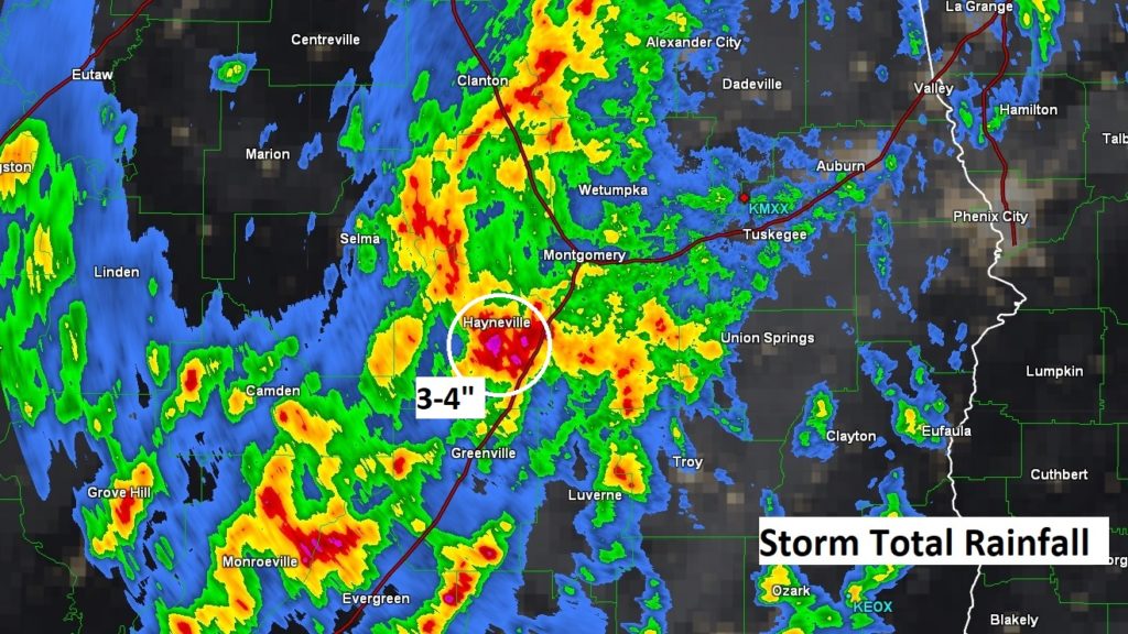
Take a look at the storm total rainfall map from just the last 2 days. Notice some of the heavier pockets of rainfall have been generally along and west of I-65. Looks like a bull-eye of particularly heavy rainfall amounts in Lowndes county. Since Thursday, the Montgomery Airport has had 2.34”. Maxwell AFB 1.15”. My rain gauge in East Montgomery has had 1.76” since Thursday. Maybe your town saw more than that.
TODAY: Rinse and Repeat. Today will be much like yesterday. Patchy AM fog will give way to sun/cloud mix. Thunderstorms will start to pop up before lunch and will become more numerous in the afternoon and evening. A couple storms could become string with gusty winds. Hot & humid. High 92. Low tonight 70. Take a look at this Future Radar loop from 10am to 9PM. This will give you an idea of how the storms will blossom in the daytime heat and become quite numerous.
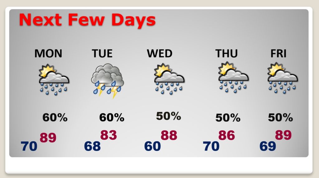
NEXT FEW DAYS: Memorial day will be rather routine with a high near 90 and scattered storms. Daily showers & storms will be in plentiful supply Tuesday through Friday. Clouds and showers will knock the high temperatures down just a bit.
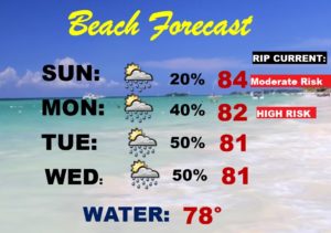
BEACH OUTLOOK: There are many folks who have started their Beach vacations. The outlook for the week ahead calls for an increasing chance of showers and storms each afternoon & evening. Be flexible with your plans. Moderate rip current risk today and a HIGH risk on Monday.
—
I’ll have another blog update for you tomorrow morning.
Stay safe and well. Enjoy your Memorial Day weekend…
–Rich