
Good morning! More heat, humidity and summertime storms are on the menu today. Be flexible with your holiday weekend plans. There will be a generous supply of storms each day through the middle of next week. It won’t rain all the time. But, the odds that you will encounter occasional storms over the holiday weekend will be rather high. There will be tropical downpours and lots of dangerous lightning. Gusty winds can be expected in the stronger storms.
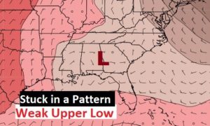
So, we are stuck in a pattern right now, with an upper level low, which will be nearly stationary over the area for several days. Steering currents are weak, and it has no place to go. There are signs of improvement late next week, as storms finally thin out.
TODAY: Hot & humid. High in the low 90’s. Heat index near 100. Partly sunny. There will be a generous supply of scattered storms around especially this afternoon this evening. Today storms will be moving from the east to the west. Please be careful and watch for dangerous lightning, especially on the Lake and the Golf courses, etc. The 4th of July weekend, statistically has more lightning deaths and injuries than other time of the year.
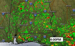
Here’s a radar snapshot at 4:00pm. Don’t take this literally. It just shows the general coverage of the storms today. (rather numerous)
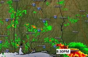
Some cities and towns have Independence Day Fireworks shows tonight. There will still be some storms around at Fireworks time, but not quite as many.
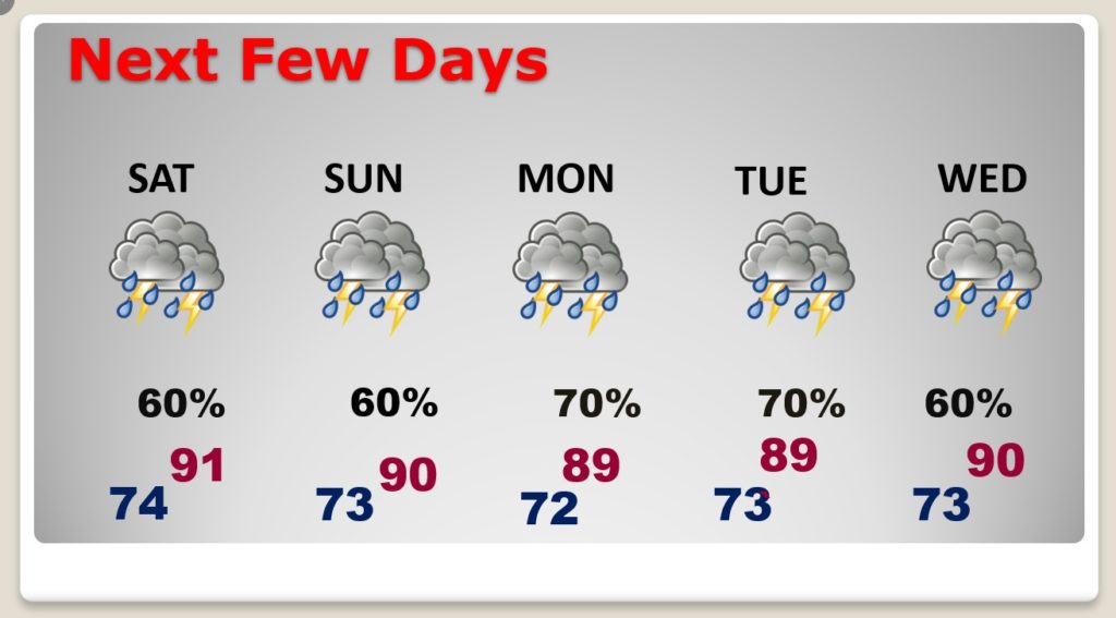
NEXT FEW DAYS: I wish I had better news for you. Thunderstorms will be rather numerous each day through Wednesday. It will be feast or famine. The storms will be random. Some towns will get more rain than others.
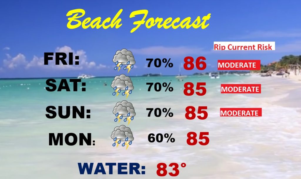
BEACH FORECAST: Be patient and have a Plan B. Showers and storms will be quite numerous on the coast during the entire holiday weekend. It won’t rain all the time. Watch out for dangerous lightning. Moderate rip current risk through Sunday.
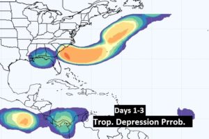
THE TROPICS: While the tropics will be generally quiet, we’re watching for some possible “home grown” mischief in our backyard over the weekend. A tropical Low may develop over the NW Florida coast, and eventually migrate northeastward into the Atlantic. It’s not completely out of the question that a depression could form in the Atlantic.
—
OUR FREE WEATHER APP will keep you on top of the action. Interactive radar will show you where the storms are now. (Plus you can turn the lightning layer..) Future radar will show you where the storms will be over the next few hours. You’ll get instant push notifications if a warning is issued for your location. Download for your phone or tablet today. Just search Rich Thomas Weather in the App Store.
—
Beautiful start to the Independence Day weekend! Happy birthday America!!

I will have another Blog Update for you tomorrow morning. Please Stay safe and well, and be careful during this holiday weekend.
–Rich