
Good morning! Some of you encountered storms yesterday. Many did not. Today, there will be more random storms. It will be feast or famine. The big story again today will be the heat. Yesterday’s high was 92° with a heat index of 102. We’ll be close to that again today.
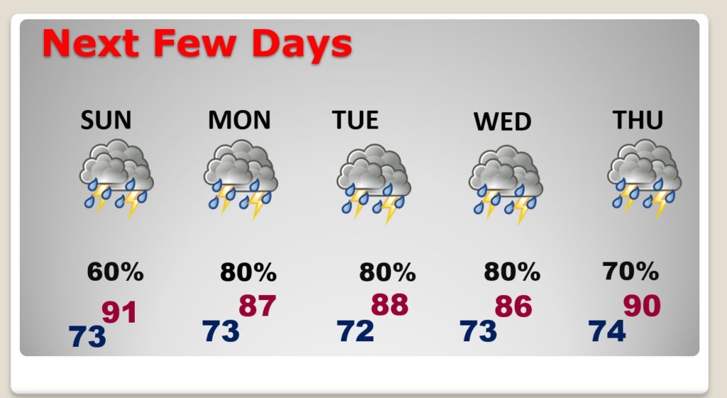
The big story in the week ahead will be the overwhelming rain chances most days. Tomorrow, we’ll be on the wet side of low pressure in southern Mississippi. The number of storms will increase dramatically.
The much higher than normal rain chances will stick around at least through Thursday.
By the end of the week, Big Heat will start to rear its ugly head again, as the heat index edges closer to the danger level.
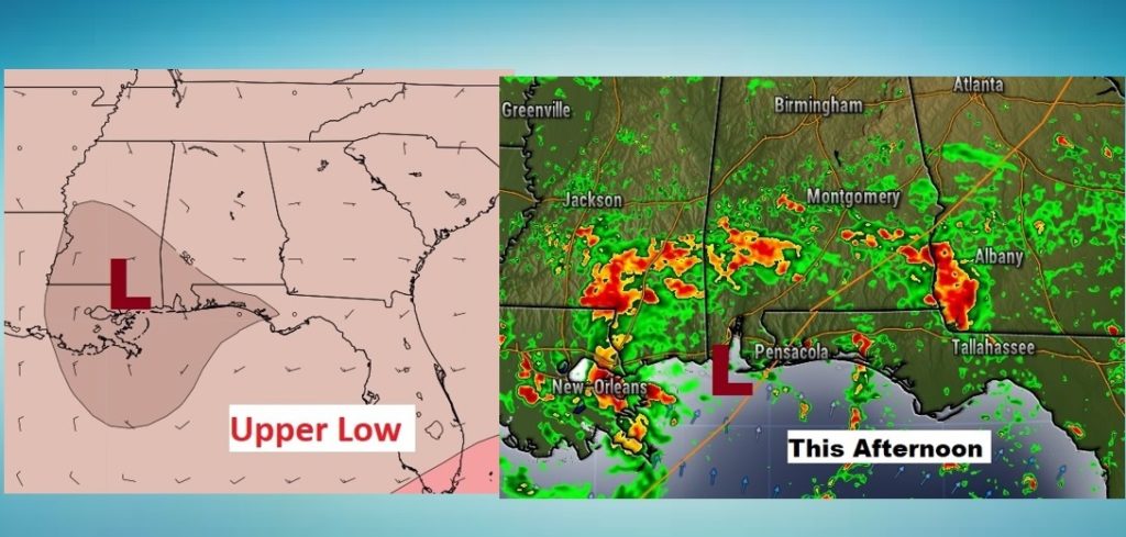
Here’s the set up today. We are on the Wet Side of an Upper Low in south Mississippi. Meanwhile a weak surface low is just south of the Mobile Bay. Storms on the coast will work northward during the day.
TODAY: Hot & humid. High 92°. Heat Index 100+. Sun/cloud mix. Most of the morning and mid-day hour will be dry. But, showers and thunderstorms will increase later in the afternoon and into the evening. The storms, which will be plentiful near the coast will migrate northward in through the afternoon and evening hours. They will fade out overnight tonight. Low 73.
Here’s a Future Radar snapshot of 6PM this evening.

NEXT FEW DAYS: Increased clouds and showers will tend to keep the temperatures mostly in the 80’s Monday through Thursday. Showers and storms are likely Monday through Thursday. Storms will thin out in number Friday, as the temperature soars.
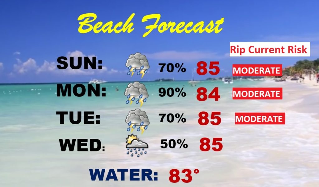
BEACH OUTLOOK: The Beach will be a rather wet and stormy locale for the next few days for multiple reasons. Moderate rip current risk.
THE TROPICS: In the Atlantic, Tropical Depression Five is southwest of Bermuda. It will become Edouard probably later today. It is expected to lose it’s tropical characteristics in about 36 hours, as it moves northeast into the open Atlantic.
Closer to home, in our back yard, is an “Area to Watch”. That little tropical Low near the Gulf coast, is being monitored for possible tropical development. It will migrate northeastward into the Atlantic. It currently has a low 30% chance of becoming a depression in the next 5 days.

–
Have you seen that Full “Buck” Moon? It was spectacular last night and early this morning. Maybe some of you got a chance to check out that cool lunar eclipse last night, too.
I’ll have a complete video update for you tomorrow morning.
Stay safe and well. Enjoy the rest of your Independence Day Holiday weekend …
–Rich