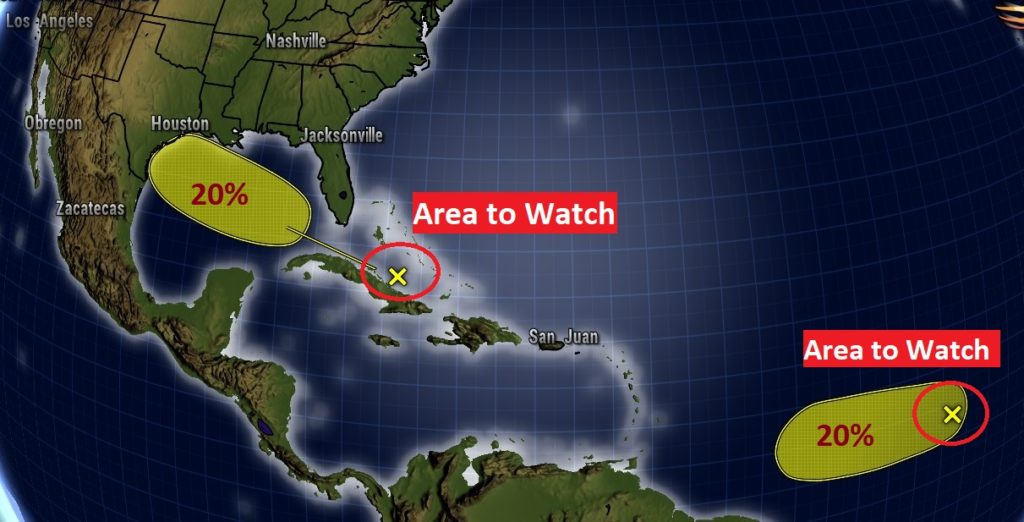
Good Morning! It’s the same song, next verse. Intense heat remains in place. We will be close to the 105 danger range again. Random PM storms should be slightly more plentiful today. And, I have also bumped up the rain chance just a notch Tuesday through Thursday. By Friday, hopefully the number of storms will be in generous supply. However, there’s really no encouraging news about any Heat Relief yet. Meanwhile, the tropics may be starting to wake up again. There are now two “X” on the map. Areas to watch….One almost in our backyard.
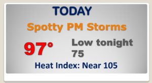
More heat and humidity and a few scattered random storms for some lucky towns. Montgomery had a high of 97 yesterday with a heat index of 106. We’ll be in the same neighborhood again today.
Hopefully, your odds of encountering one of those random storms this afternoon is slightly better than yesterday.
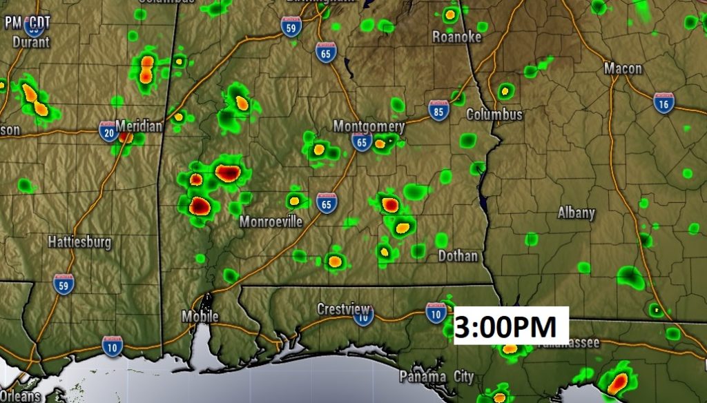
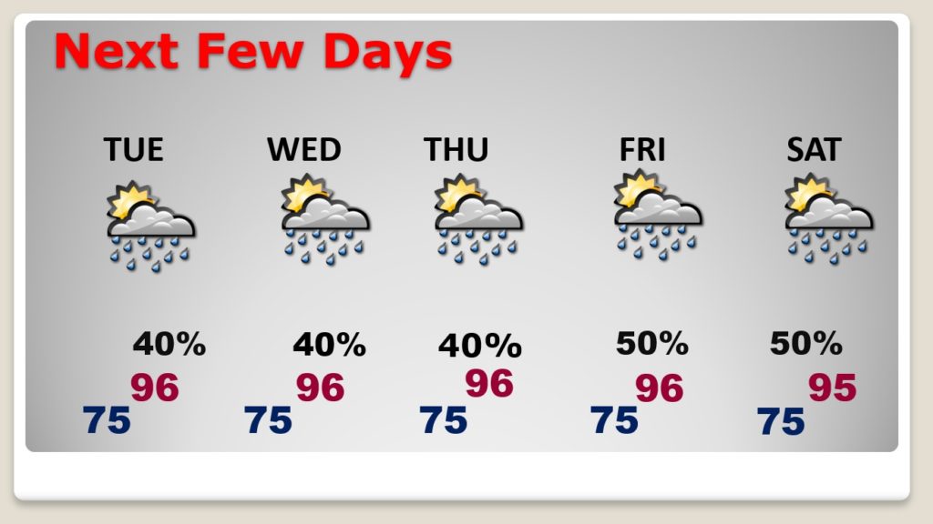
Relentless heat continues with triple digit heat indices each day. Meanwhile, the number of afternoon storms will increase a little bit Tuesday through Thursday. And, perhaps a little more plentiful by Friday and Saturday.
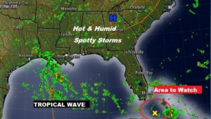
Don’t look now…But, the tropics are starting to wake up. There are a number of tropical waves between the Gulf and Africa.

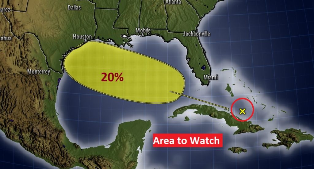
There are now TWO “Areas to Watch” on the map. One in the far tropical Atlantic. The other one is closer to home.
NHC:
Disorganized showers and thunderstorms over the central Bahamas,
central Cuba, and adjacent Atlantic waters are associated with a
tropical wave.  Environmental conditions could become a little more
conducive for development of this system over the Gulf of Mexico.
This system is expected to move west-northwestward through the
Straits of Florida today, over the southeastern Gulf of Mexico by
Tuesday, across the central Gulf on Wednesday, and reach the
northwestern Gulf on Thursday.
* Formation chance through 48 hours...low...near 0 percent.
* Formation chance through 5 days...low...20 percent.