Good morning! Welcome to August. While our weather is fairly routine this weekend, Florida is preparing for an encounter with Hurricane Isaias. Tropical storm conditions will begin by later today along part of the Florida coast. In the week ahead, Isaias will rake the U.S. East coast with tropical storm conditions. Complete details of Isaias below.
Here in Alabama, a weak front will enter the state this afternoon. It will bring some spotty showers & storms to the state. The front will fizzle by tomorrow. Showers and storms will very isolated starting tomorrow.
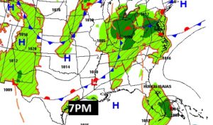
TODAY: Mostly sunny. Hot again. High 93, Heat Index near 100. Spotty PM showers or thundershowers. Low tonight 72.
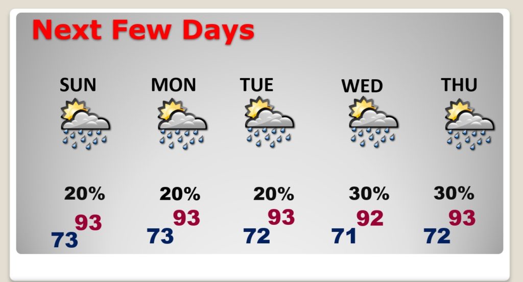
NEXT FEW DAYS: The indirect effect of Isaias will be to limit the moisture in Alabama. Showers will be isolated in nature Sunday through Tuesday. Then, back to scattered storms Wednesday and Thursday.
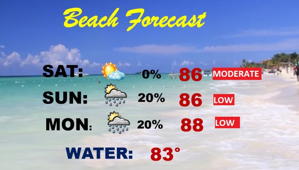
BEACH FORECAST: Yellow flags are out for a Moderate Rip Current Risk today. Low rip current risk Sunday and Monday. Today should be mostly sunny & dry. Isolated showers possible Sunday and Monday.
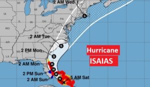
HURRICANE ISAIAS: Category 1 Hurricane Isaias is raking the central and NW Bahamas this morning, heading for an encounter with the Florida coast.
At 4AM CDT, the center of Isaias was located 80 miles SE of Nassau, Bahamas, moving NW at 12. Winds now 85 mph. Further strengthening is possible, but rapid intensification is not expected.
Here’s a close up on the Florida portion of the NHC cone. A Hurricane Warning now extends from Boca Raton to north of Daytona Beach, to the Flagler county line. Tropical storm watch along the northeast Florida coast. The track remains about the same, however any westward shift of the track could put more areas under potential hurricane conditions.
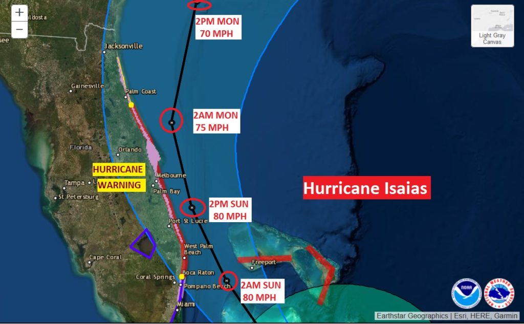
Over the next few days..Monday through Wednesday, Isaias will rake the US East Coast with tropical storm conditions, heavy rain and rough surf.
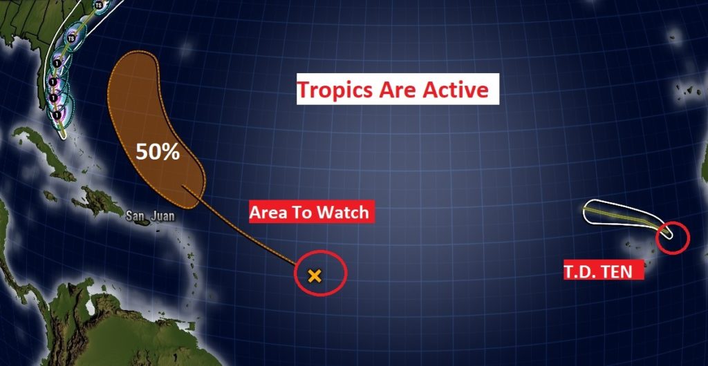
ELSEWHERE IN THE TROPICS: Isaias is not the only show in the tropics. In the Tropical Atlantic there is an area to watch, with a 50% chance of development in the next 5 days. In the far eastern Atlantic, near the Azores, Tropical Depression Ten should have a relatively short life. It will become a ‘remnant low’ later today.
—
I will have another Blog update tomorrow morning. Follow me on Twitter: @RichThomasWX. Stay safe and well.
-Rich
