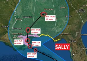
Sally is stronger now… a Category 2 Hurricane with winds of 100 mph. Moving WNW at 6. 145 miles SE of Biloxi. Hurricane Warning has been extended eastward to Pensacola. The track continues shifting eastward. Sally is expected to slow down dramatically which will exasperate hurricane conditions. Landfall is forecast for late Tuesday night along the Mississippi coast. Then there will be a sharp curve to the east into Alabama Wednesday and Thursday. Here’s new track map.

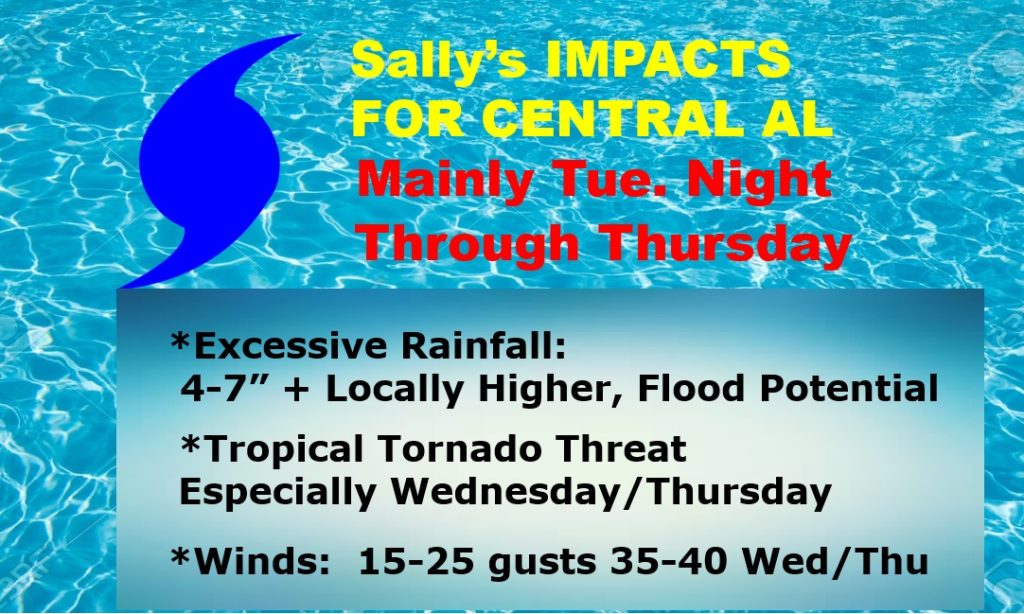
CENTRAL ALABAMA: This is subject for much review as we learn more about Sally’s future forward speed, intensity and track. But, it appears we could see Flooding Rainfall. Flash Flood Watch in effect. Rainfall amounts could be excessive. (especially closer to the coast). The threat of Tropical Tornadoes will begin as early as daytime Tuesday in south Alabama. It looks like there could be a significant tropical tornado threat for much of central and south Alabama on Wednesday. It looks like Sally will have a very prolonged grip on Alabama’s weather long into Friday.

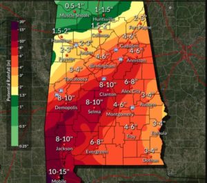
RAINFALL POTENTIAL: This map speaks for itself. Excessive rainfall totals are anticipated. And, this is certainly subject for revision as we continue to learn more about Sally’s changing track, and timing. Flooding rainfall will be perhaps the biggest impact Sally will have on our local weather.

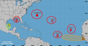
ELSEWHERE IN THE TROPICS: Unbelievable. FIVE named Tropical systems and two Areas to Watch. Brand New today is tropical storm Teddy and Tropical Storm Vicky. There is 0nly one more name on the list before we switch to the Greek alphabet.

LIGHT AT THE END OF THE TUNNEL: A weekend Cold front will bring in some much nicer air over the upcoming weekend, with sunshine, lower humidity and nicer humidity.
I will have a complete video update for you in the morning. Stay safe and well. Stay weather aware. .
–Rich
