
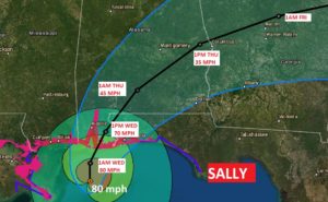
Sally, late this afternoon, is an 80 mph Cat. 1 Hurricane located 85 miles south of Mobile, creeping northward at 2 mph. Pressure 979 millibars. It’s expected to make landfall, perhaps late tonight or early Wednesday between Gulf Shores and Pensacola. Then, it makes a jog northeast into Central Alabama, moving very slowly.
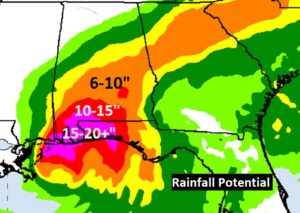
Rainfall potential is rather stunning due to the slow movement of the storm. The heavy rain will be rather relentless Wednesday, Wednesday night, Thursday, and even Thursday night. Much of central Alabama, on this map, is in the 6 to 10” accumulation range. Locally more in spots. Then, as you trend southwestward, you get into 10 to 15”, and closer to the coast perhaps 20” or locally 30”. A prolific amount of rain. Flash Flood Watch continues. Many area rivers will also go into Flood Stage with this much rainfall.
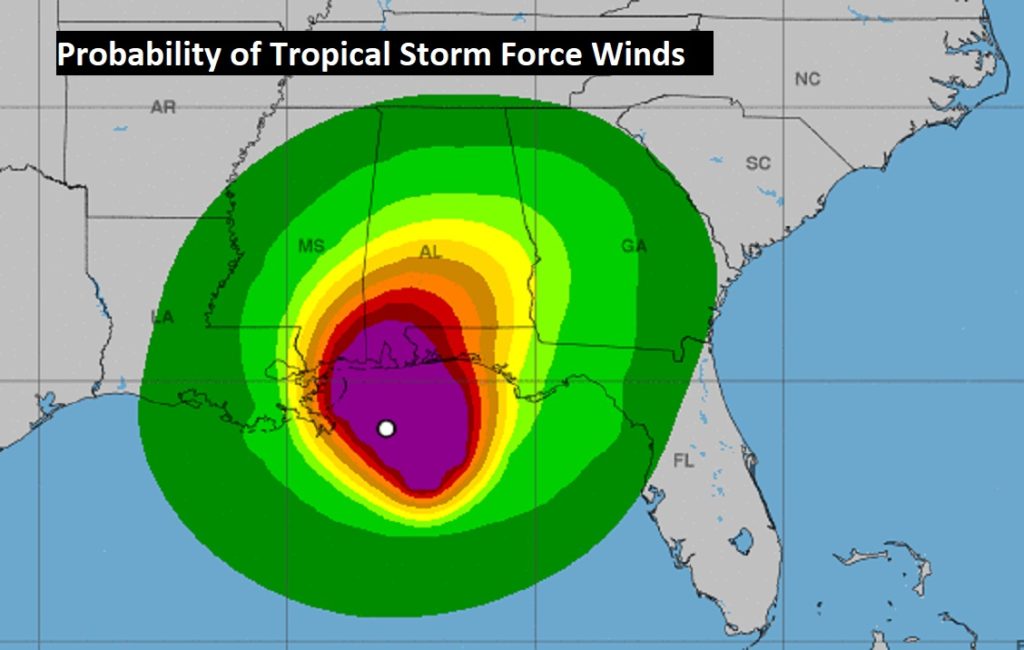
Tropical Storm Force wind gusts are possible even as far north as the Montgomery area with Sally. Probabilities that far north are 50 to 60%.
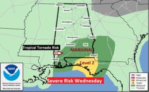
On Wednesday, the threat of tropical tornadoes are possible across central and south Alabama. Spin up tornadoes are rather common with landfalling tropical systems, on the eastern side of their tracks.
I’ll have a complete video update in the morning. Updates sooner as needed. Stay safe and well. Stay weather aware.
–Rich