
**PLEASE forgive me. Due to an extreme migraine headache this morning, I had to shift gears and produce a blog update instead or a video. A Blog can be produced in half the time. Please bear with me. Thank you.
Good morning! Welcome to the first day of Fall. Today’s first day of Fall will feel a lot like the last day of summer…comfortably cool, with a nice breeze and dry. Considerable cloudiness will be the product of high clouds streaming off of tropical storm Beta in the west Gulf. More on Beta and it’s future effects on our weather below.
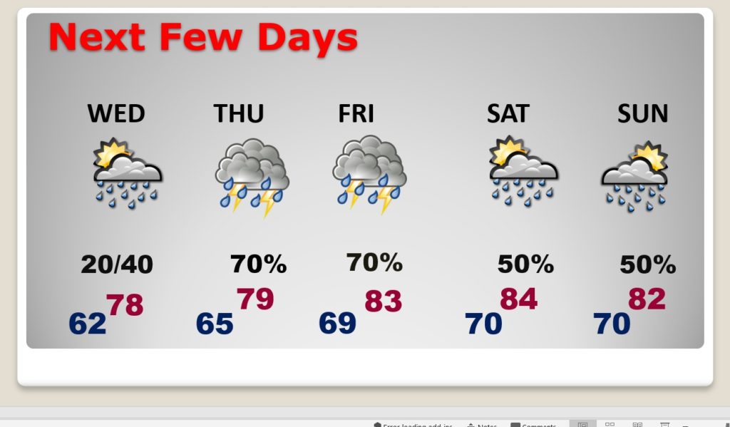
TODAY: Considerable high cloudiness from Beta. Pleasantly cool. Breezy again with East wind 11 to 16 mph. High 76. Low tonight 62.
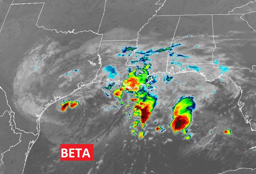
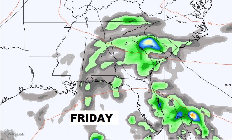
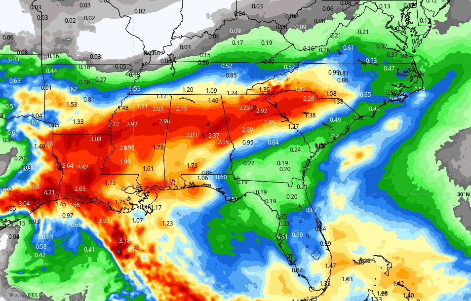
TROPICAL STORM BETA: Beta is a minimal Tropical Storm with winds of 40 mph expected to stall on the Texas coast near Port O’Connor. It will then be picked up and slide northeastward as a Depression through Louisiana and Mississippi through Thursday night, dumping heavy rainfall amounts.
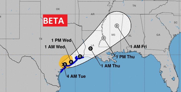
BETA’S RAIN WILL MOVE EAST: Beta will be a tropical depression by mid-week. We’ll be on the wet side f the system. Expect a round f of occasional tropical downpours Wednesday night through Friday and some lingering showers Saturday.
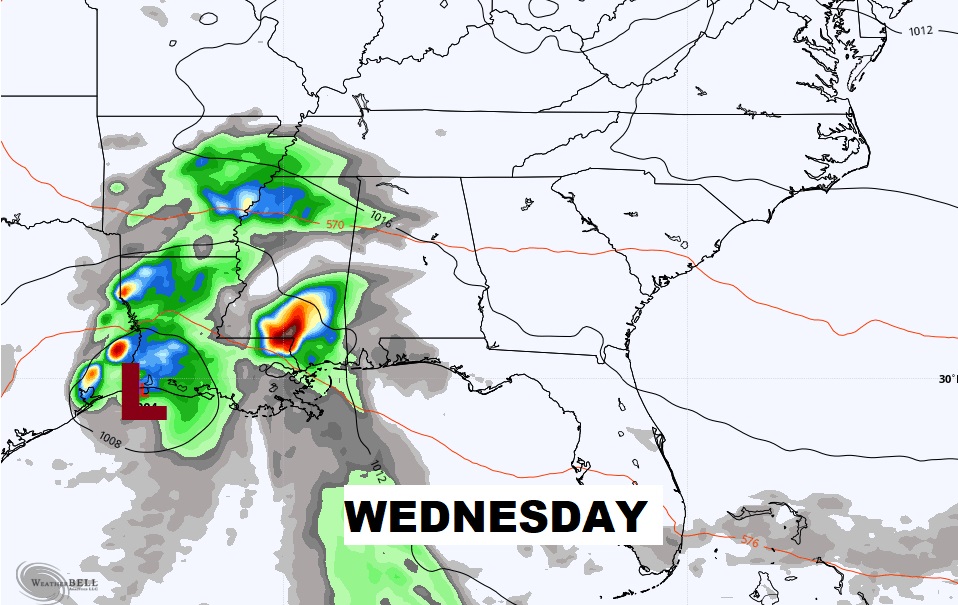
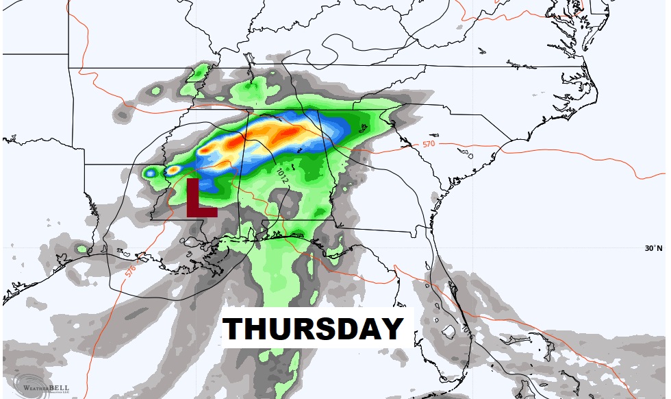
NEXT FEW DAYS: Dry and comfortable today. Risk of isolated showers Wednesday. But, look for an increasing chance of showers and storms and heavy downpours. We’ll be on the east side of Tropical Depression Beta’s track. We’ll be back in the 80’s Friday through Sunday.
AUTUMNAL EQUINOX: Fall officially arrives this morning at 8:31 AM CDT. Equinox means equal day and equal night at the equator. Here, it’s not exactly equal but kinda close. Sunrise at 6:33 AM an sunset at 6:41 PM.

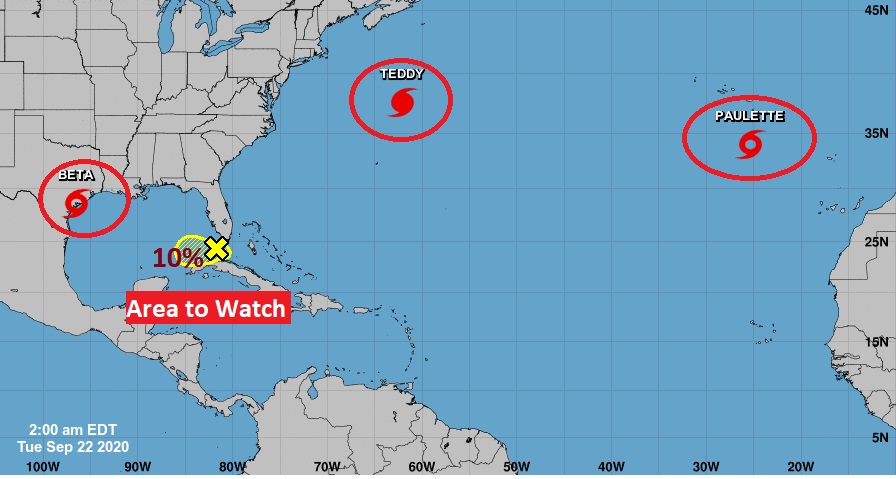
ELSEWHERE IN THE TROPICS: Large, dangerous Teddy continues to be the star of the show, as it makes a steady trek toward the Canadian maritime provinces. Wilfred is dead and off the map. The remnants of Paulette have re-intensified into and eastern Atlantic tropical storm. There is also an area to watch near the Florida Keys.
- – –
I promise, we’ll be back to a regular video schedule first thing tomorrow morning. Bear with me as I try to cope with this series of migraines. Thanks for understanding.
–Rich