**Blog instead of a video today. Migraine again. Bear with me. Theses (historically) won’t last much longer.
Good morning! Many towns had some nice downpours yesterday evening/night as the first of two cool fronts swept into the state. Areas in yellow and orange on this map had 1 to 2.5 inches.
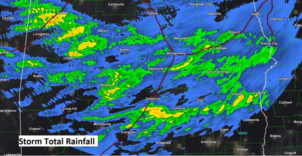
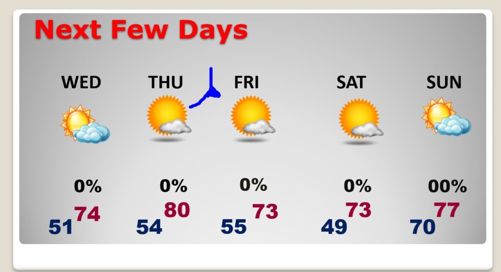
There will be some leftover showers today through mid-day. It will be refreshinginly cooler today and tonight. But, the best air will be later in the week. We will actually warm back up to around 80 on Thursday before Cold Front number two. That second front will deliver some rather chilly nights especially by Friday and Saturday night. It should be an epic, refreshing first weekend of October.
TODAY: Risk of showers through mid-day, before ending. It will become mostly sunny in the afternoon. High today near 70. Chilly tonight. Jacket weather. Low 51.
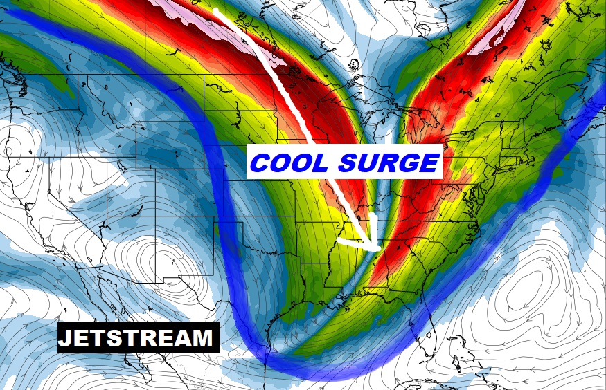
COLD FRONT NUMBER TWO: The second cold front this week is a dry front. It will arrive Thursday PM. Behind it will be the coolest air of the season so far. Coolest mornings will be Saturday and Sunday morning. Perfect Football Weather for the first weekend in October.
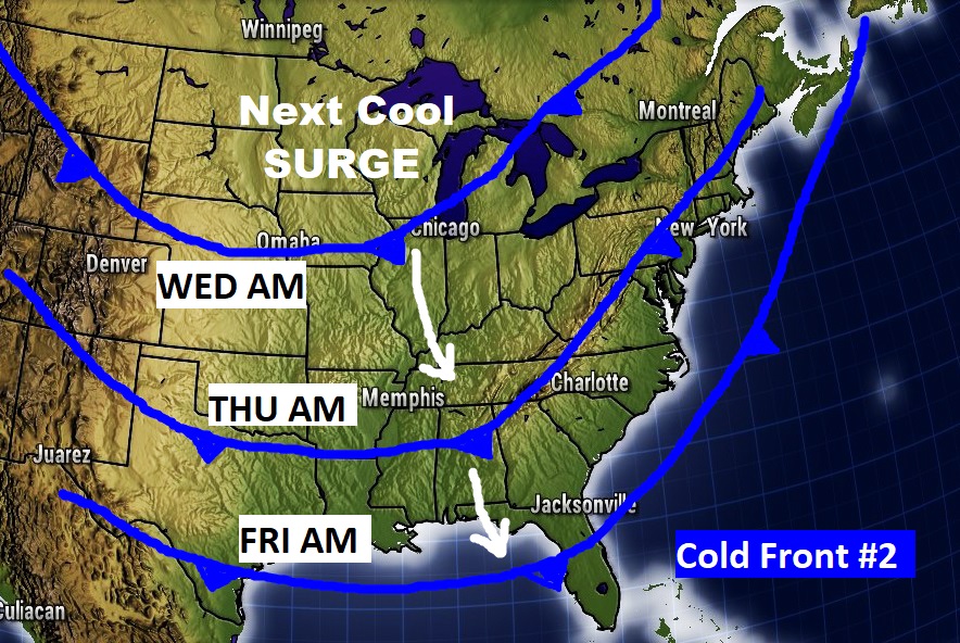
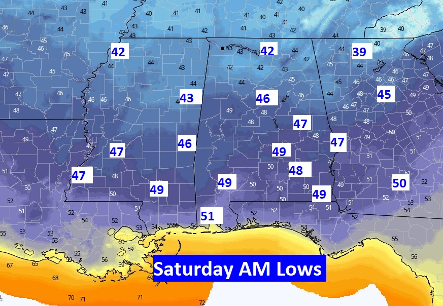
NEXT FEW DAYS: Nice string of days. So, we will actually warm back up to 80 Thursday before cold front number two arrives. Very cool and nice Friday through Sunday. Nice air. Good stuff.
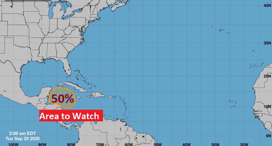
TROPICAL OUTLOOK: During this time of the year, we turn our attention to the western Caribbean and the Gulf. NHC gives that Area to Watch in the Caribbean a 50% chance of development in the next five days.
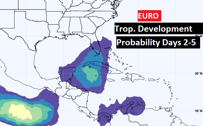
The EURO model also agrees.
- –
I promise, we’ll be back to a regular video schedule first thing tomorrow morning. Bear with me. Have a great day
–Rich
