**4:00pm update:
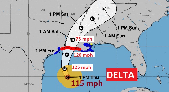
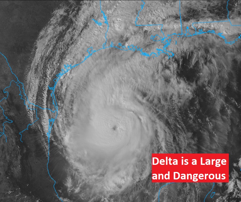
Hurricane Delta strengthens to 115 mph, becomes Major Hurricane Status again. Moving NW at 12, Delta is destined to make landfall late Friday/early Friday evening as a Major Cat 3 Hurricane. Now located 345 miles south of Cameron, LA. Cat 4 Laura made landfall in Cameron 5 weeks ago tomorrow.
*10:00AM UPDATE:
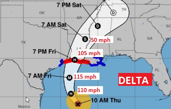
Air Force and NOAA Recon has found Delta is larger and a little stronger now, Cat 2, 105 mph, moving NW at 14. Expected to reach Major Cat 3 status late tonight or FRI AM. Landfall along the Louisiana coast is likely late Friday or Friday evening with 105 mph winds.
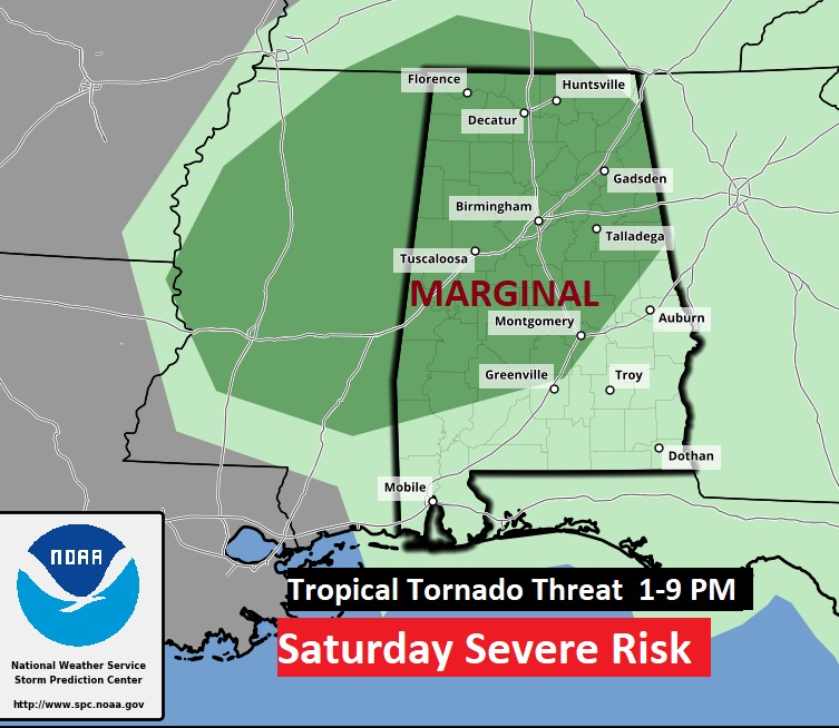
There will be at least a low end threat of spin-up Tropical Tornadoes Saturday afternoon & evening.
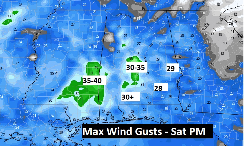
Winds here in central Alabama could gust to near or perhaps a little over 30 mph. mainly Saturday afternoon.
Early Morning Update:
Good morning! More and more it appears that Hurricane Delta is locked in on a track towards the Louisiana coast on Friday. Delta will be large hurricane in the Gulf, and the outer effects of Delta will cover much of the Gulf south. I have the updated track and timing from the National Hurricane Center and expected impacts for Alabama. Meanwhile get ready for another hot October Day.
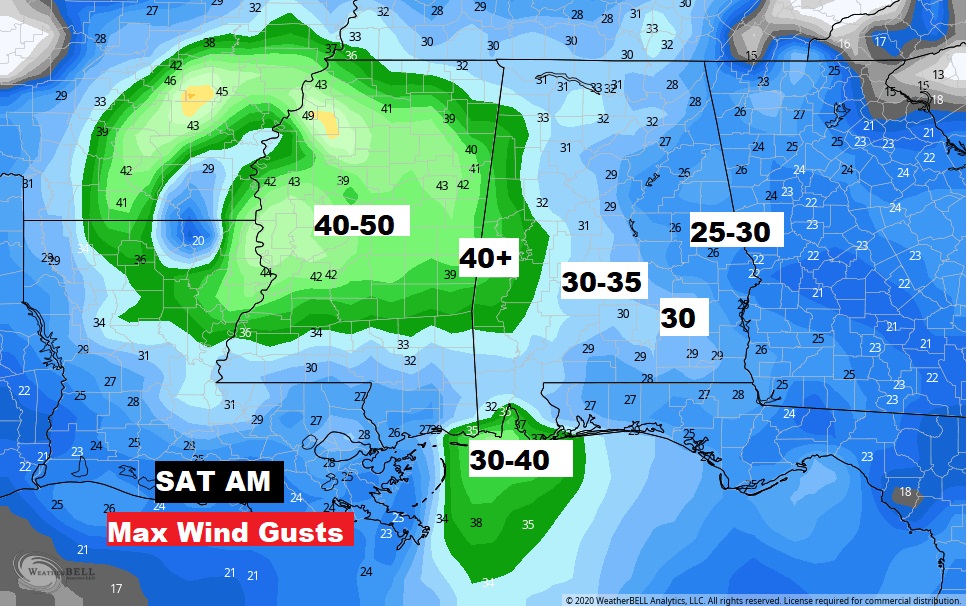
Even here in Alabama, winds could easily gust to 30 to 35 mph especially Saturday, especially morning and mid day.
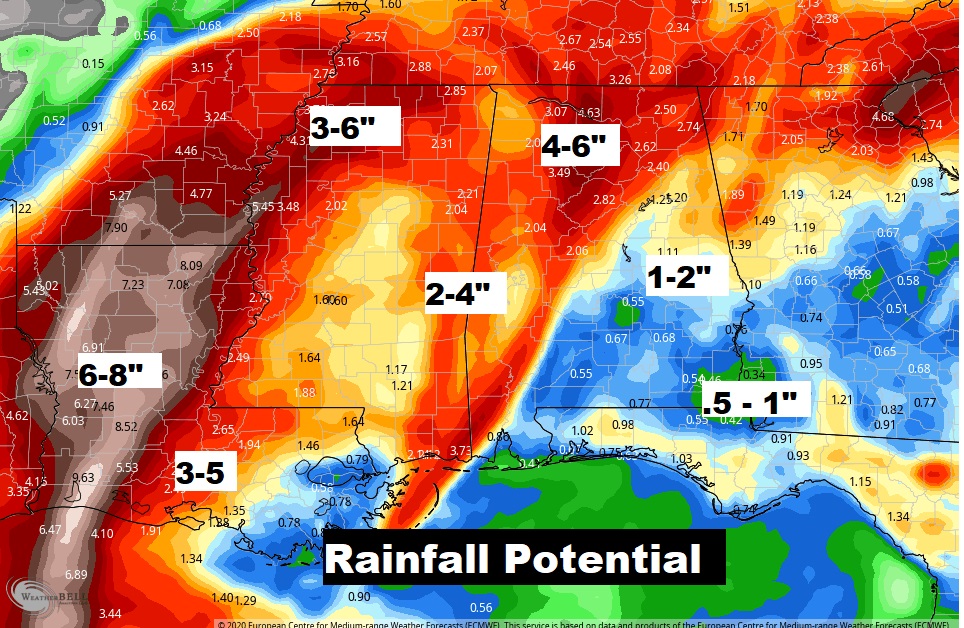
Parts of central Alabama could see 1-2″ of rain with much heavier amounts over north, northwest and west Alabama.
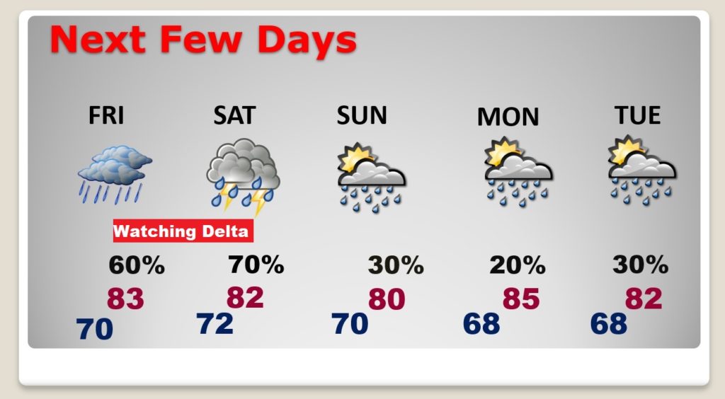
The biggest DELTA effects in Alabama will be Friday night and Saturday. It will continue warm up. Small rain chances continue Sunday through Tuesday.
