
Good morning! Today’s update will be short and sweet, because there’s not much to say.
Saturday was picture postcard perfect. Montgomery had a morning low of 44, and an afternoon high of 74.
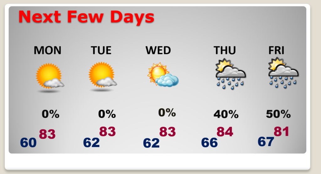
Today will be another great day. Not as cool. In fact, we have a warming tend in our future. The days will be a little warmer and nights will not be as cool.
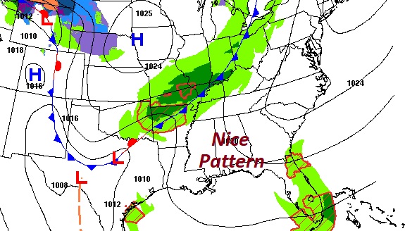
I think we should stay in this dry pattern through about Wednesday. There’s a small chance of showers late in the week as a disturbance approaches.
It’s quiet around the SE US today.
TODAY: Total sunshine. Low humidity. Perfect day. High near 80. East breeze at 5 to 10 mph. Tonight…mostly clear, not as chilly. Low near 60.
NEXT FEW DAYS: Really nice Monday through Wednesday. Warming trend. Back to the low mid 80’s daytime. Lows at night in the 60’s. Small rain chance returns late week. No big deal.
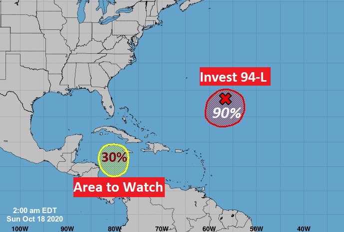
THE TROPICS: There are two areas being monitored. Invest 94-L in the Atlantic is likely to become either a depression or some sort of hi-bred tropical storm. It will not affect the United States. That Area to Watch in the southern Caribbean is not quite as concerning as it once appeared. It could still develop into a depression or storm by next weekend at it moves in the general direction of the Bahamas and the Southeastern United States. The models are a lot less bullish on development of this system as they once were.
—
I’ll have a complete video Monday morning. There may be additional updates today as needed. Stay safe and well. Enjoy your Sunday.
–Rich