Good morning! Again, here’s a brief forecast summary. Thanks for bearing with me as I continue deal with the effects of COVID.
Alabama’s atmosphere continues to modify. We are very warm for October. The afternoons have been hot for this time of the year. Tropical moisture is making comeback. The threat of showers is returning to our forecast. In fact, there were even a few spotty showers yesterday in east and southeast Alabama. Rain chances get a little better today, tomorrow and Saturday.
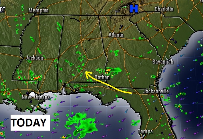
TODAY: Tropical moisture from the Atlantic and Gulf is increasing. There will be a sun/cloud mix. Random, widely scattered showers and storms will pop up here and there. High today 84. Low tonight 67. East wind at 5 to 10 mph.
Here’s a future radar snapshot at mid-afternoon.

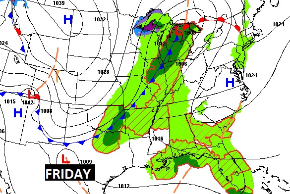
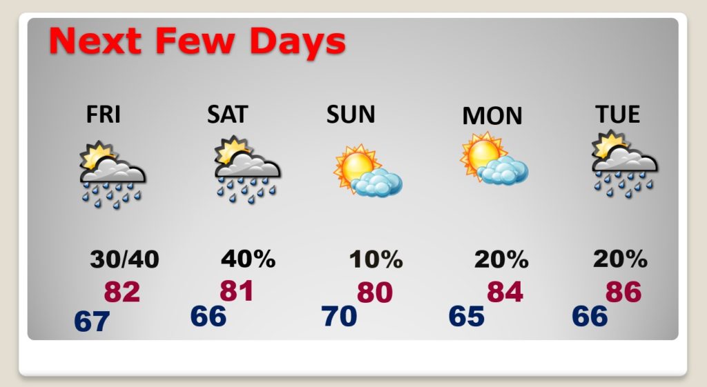
NEXT FEW DAYS: A weak frontal system approaches Alabama. The chance for showers and thunderstorms get a little better Friday, Friday night and Saturday.

The front is weak, and we will not cool down, at all, behind this “cool front”. It reaches the coast Sunday. I have Sunday and Monday mostly dry. I’ll put in a 20% rain chance on Tuesday as the next front approaches. It now appears that this front, also, will be rather weak. The Big Deal Front of next week arrives LATE next week. There could be sone strong storms ahead of it, and sharply cooler air behind it.

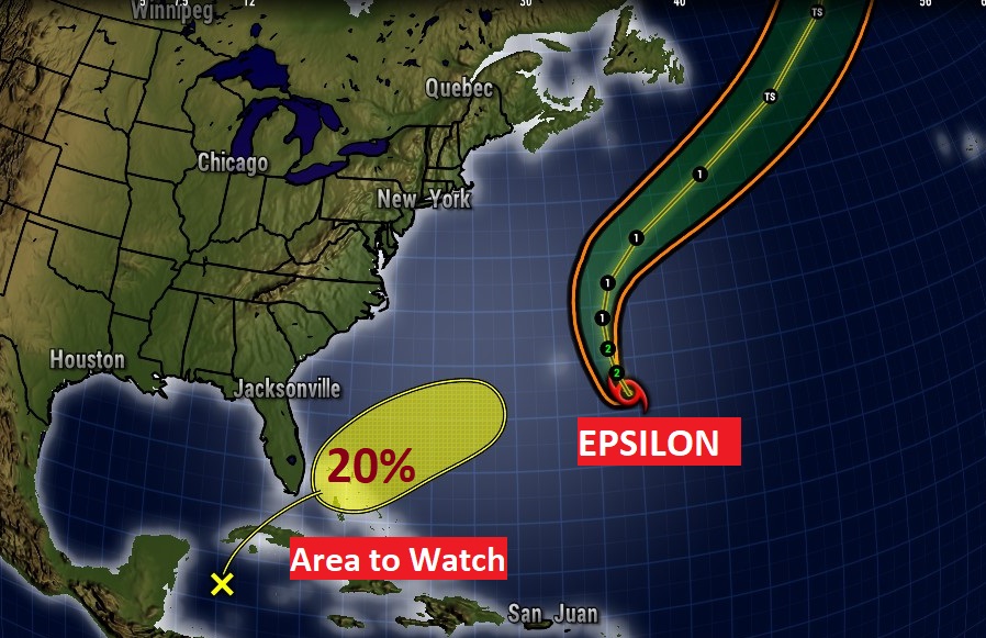
TROPICAL OUTLOOK: All of a sudden that Area to Watch is back on the map. A weak disturbance in the West Caribbean has a low chance of development as it heads northeastward toward the Bahamas. Epsilon is a Major Category 3 hurricane with 115 mph winds in the central Atlantic, moving northward.

- –
I’ll have another Blog Update in the morning. You can hear my forecast every hour across the dial on the 8 Bluewater Broadcasting radio stations. Have a great day. I’m going to try and get some more rest. Again, thanks so much for bearing with me. I have read all of kind messages. Forgive me if I haven’t responded.
–Rich
