
Good morning! Showers and thunderstorms will be in generous supply today and tonight as a weak cool front sweeps through the state. No severe weather is expected.
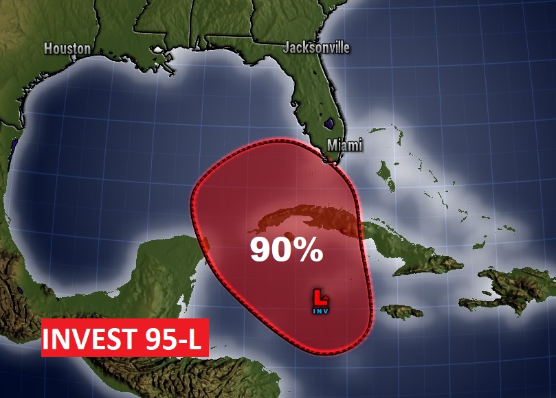
While Sunday and Monday should be dry, we have an interesting week ahead. An important frontal system will cross the Gulf States Wednesday and Thursday. But, complicating the forecast is a developing Tropical System. Invest 95-L could become a depression or a named storm in the Gulf and interact with the strong front. There are many question marks. A few strong to severe storms can’t be ruled out.
Much cooler air arrives Friday.
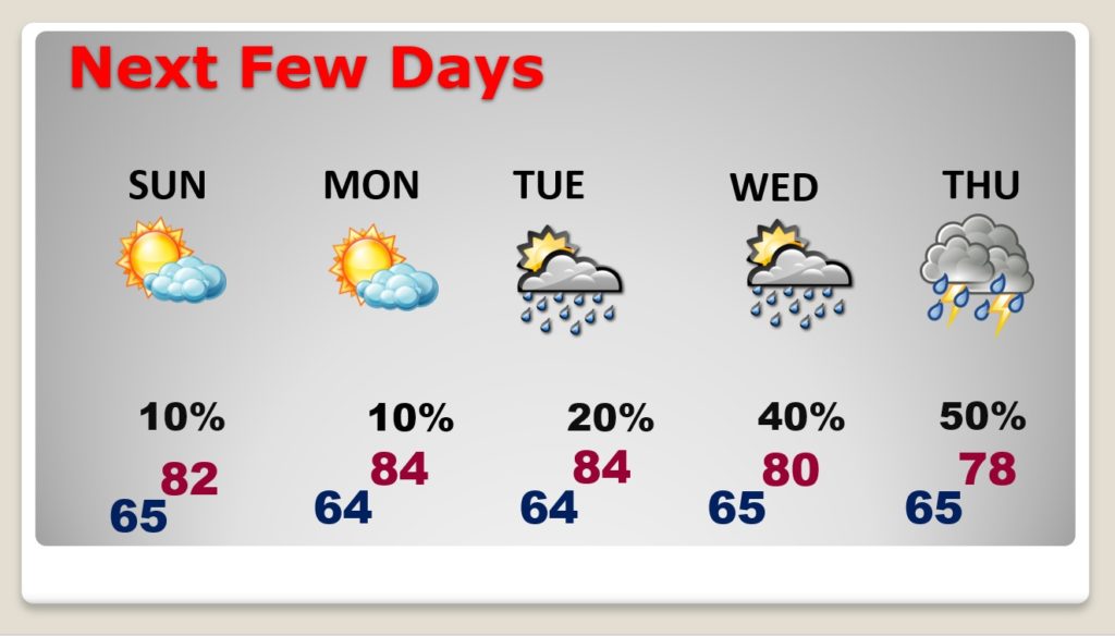
TODAY: Showers and thunderstorms will be in generous supply today. High 82. Low tonight 65. East winds 5 to 10.
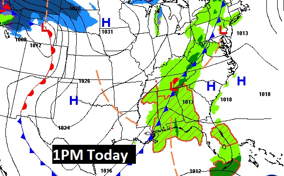
Here’s a Future radar snapshot at about Noon.

NEXT FEW DAYS: Sunday and Monday should be dry. Widely scattered showers Tuesday. Showers and thunderstorms become likely by late Wednesday through Thursday.
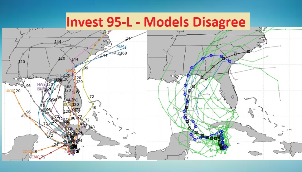
POTENT FRONTAL SYSTEM & INVEST 95-L LATER THIS WEEK: Details of the late week system are very murky. As a strong front sweeps across the Gulf south, it may indeed interact with a future Tropical Depression or Tropical Storm. The future track on Invest 95-L is not known.
Here’s 95-L this morning, in the west Caribbean, with a 90% chance of development before reaching the Gulf.
How will the tropical system interact with the strong front? That remains to be seen.
Some models bring the tropical system to the northern Gulf coast. Other models favor Florida.
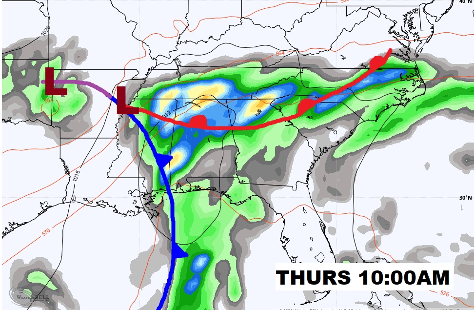
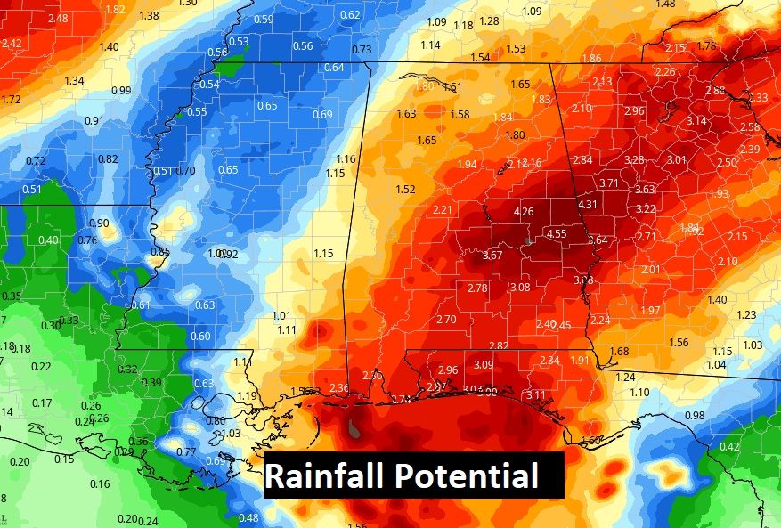
Looks like there could be a few strong to severe storms, and locally heavy rainfall. Look at this rainfall potential map. That’s a lot of rain. Many question marks remain.
Much Cooler air follows the front, perhaps setting the stage for a nice Halloween weekend.
—
Stay safe and well. Enjoy your weekend.
–Rich