Good Morning! Say goodbye to our quiet, tranquil weather pattern. It ends today. We are heading into an active pattern. Storm system number one arrives Wednesday evening. Another significant storm system will effect the state on Iron Bowl weekend. Both storm systems have the potential to produce Severe Weather. Sharply Colder air arrives by the start of next week. By far, the coldest air so far. I’ll sort out the details on this video.
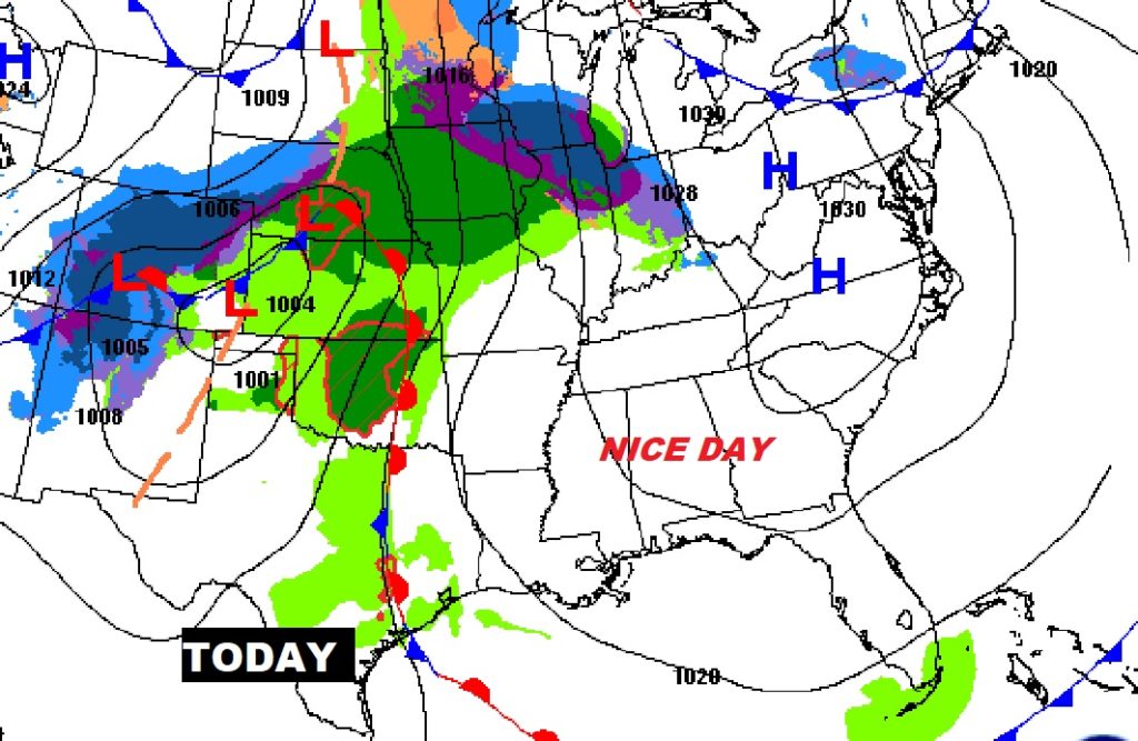
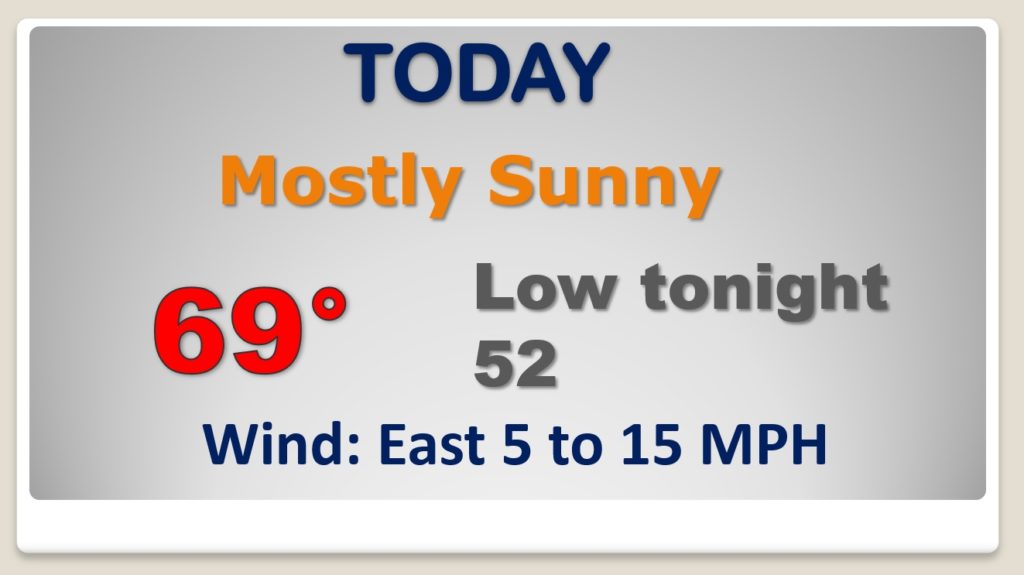
Enjoy the last quiet day today. Nice day after a chilly start.
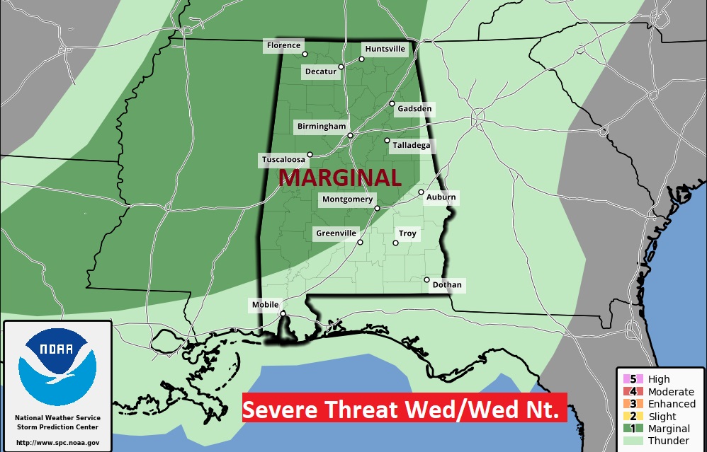
Formidable storm system will effect much of the eastern half of the county on Thanksgiving eve. Showers and thunderstorms are possible here Wednesday afternoon, but there will be a better chance Wednesday evening and night. Some storms could be severe.
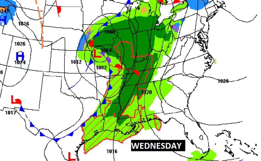
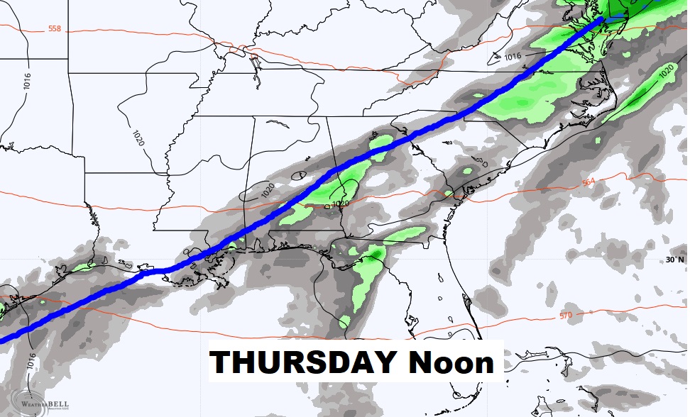
As the front slows up Thursday, we’ll have to leave in at least a small chance of scattered showers through Mid-Day.
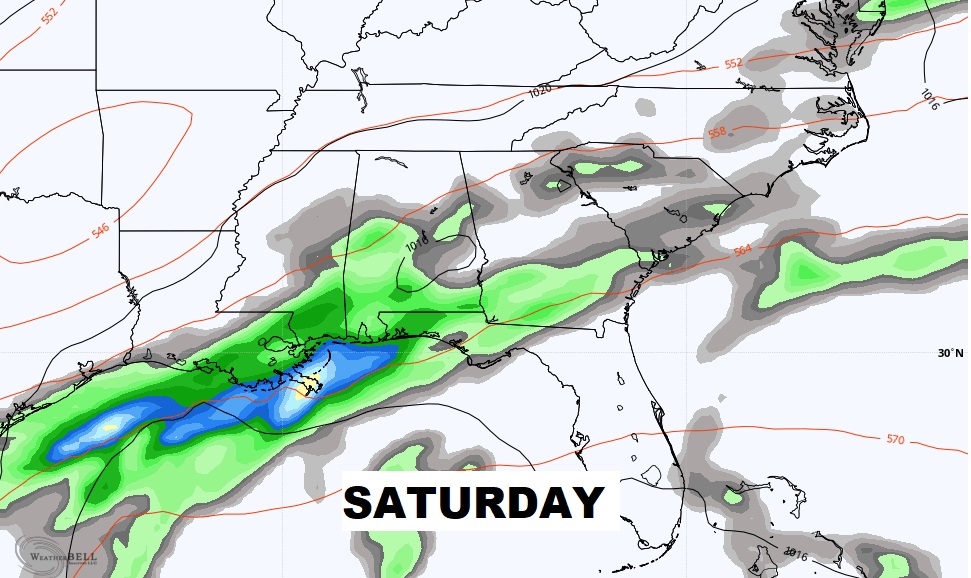
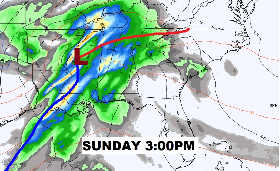
Stormy Wednesday evening and night. Scattered showers Thanksgiving but very mild. The Weekend storm system has many components. First disturbance brings in showers and thunderstorms by late Friday. More showers and thunderstorms scattered on Iron Bowl Saturday. The main event is Sunday, especially late Sunday.
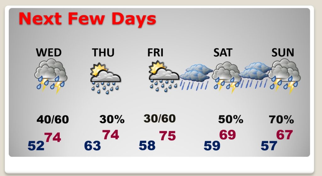
No severe weather expected on Iron Bowl Saturday, but Sunday there appears we could see severe weather is this next robust storm system moves through.
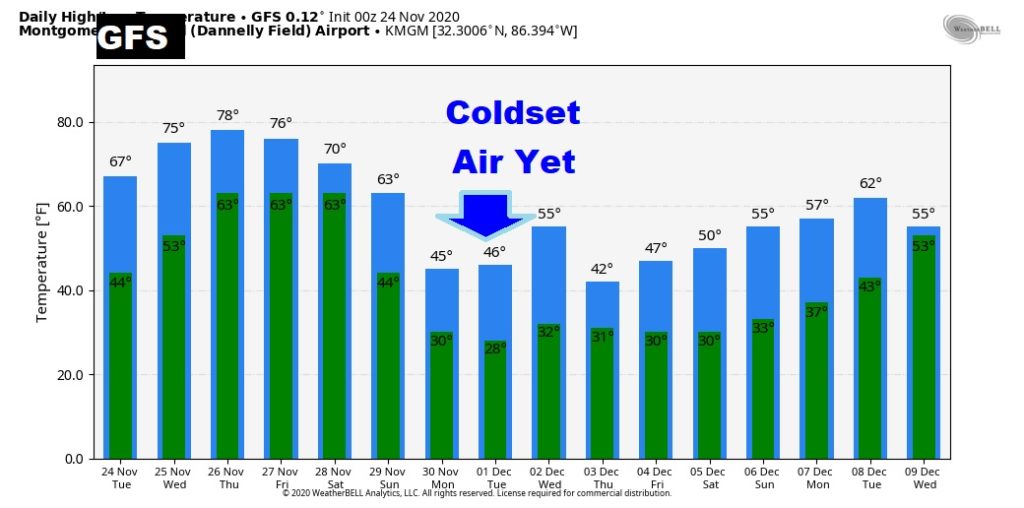
GET READY. The bottom drops out next week. Sharply colder air. Coldest of the season so far, by far.
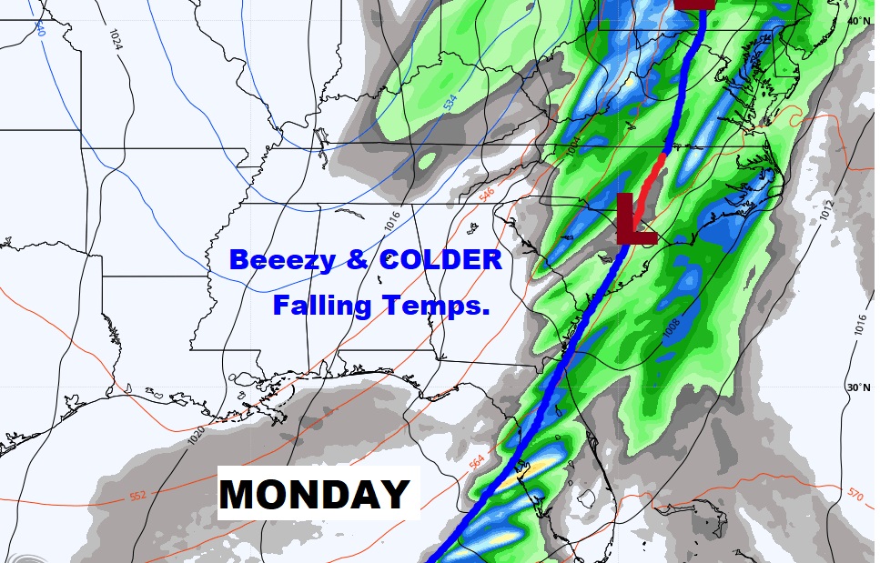
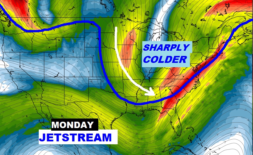
This is just raw model data, don’t focus on specific numbers. BUT, it looks cold next week. First widespread freeze by Monday night.