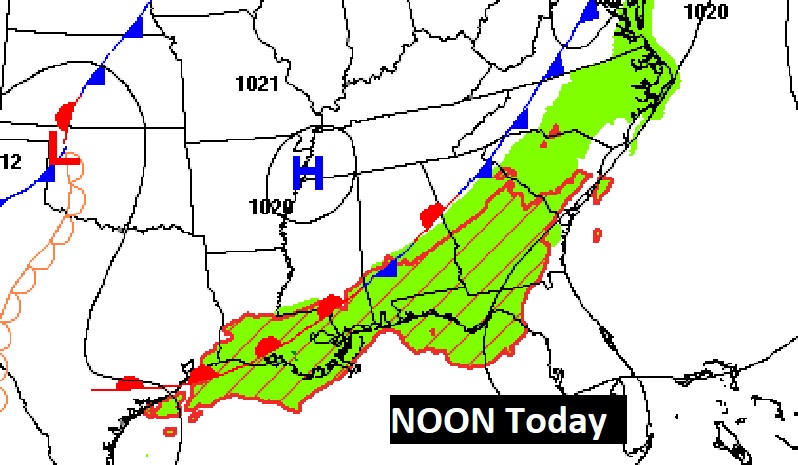
Happy Thanksgiving! During the night and early this morning, many towns have had a nice downpour and thunder & lightning, along a frontal boundary. The front will become stationary later today.
We’ll be in a rather active pattern through Sunday. It will be wet at times. Sunday, a rather robust storm system could bring a severe weather threat.
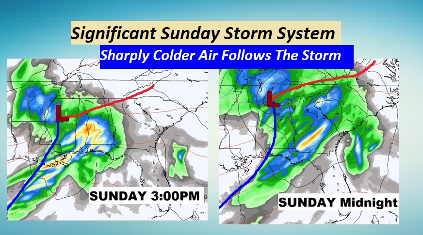
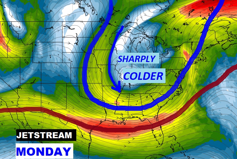
Then, following the Sunday storm system, sharply colder air funnels into Alabama. Winter is coming. Details below.
TODAY: On this Thanksgiving Day, it will be another very mild day with a high of 75. The front which has brought the rain and storms will stall somewhere in south central Alabama this morning. Best rain chance today will be across the southeast third of the state. I’ll hang onto at least a 20% chance risk of isolated showers through tonight. It will be mostly cloudy. Tonight’s low 57. Here’s a Future Radar snapshot at 11AM.
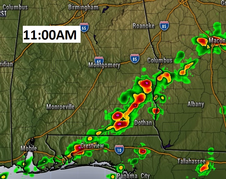
The frontal system stalls in south central Alabama by mid-day.
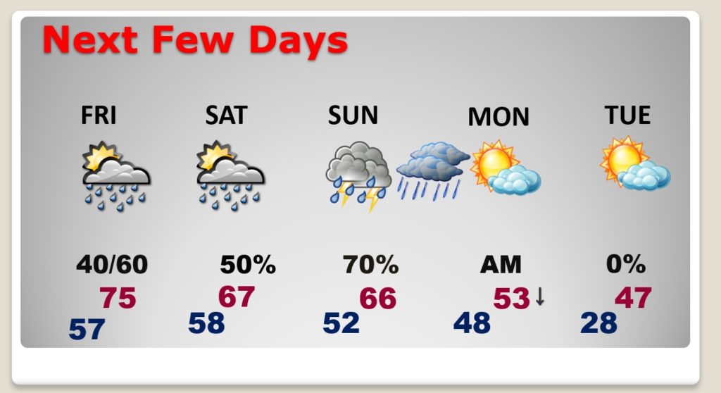
NEXT FEW DAYS: A series of disturbances will bring in more wet weather, at times through the weekend. The most significant rain chance arrives Sunday and Sunday night. Sharply colder air funnels into the state Monday. Winter is coming.
Robust Sunday storm system. Will there be a Severe Weather component? Maybe. Too early to say for sure, but the Storm Prediction Center is hinting at a Severe Threat.
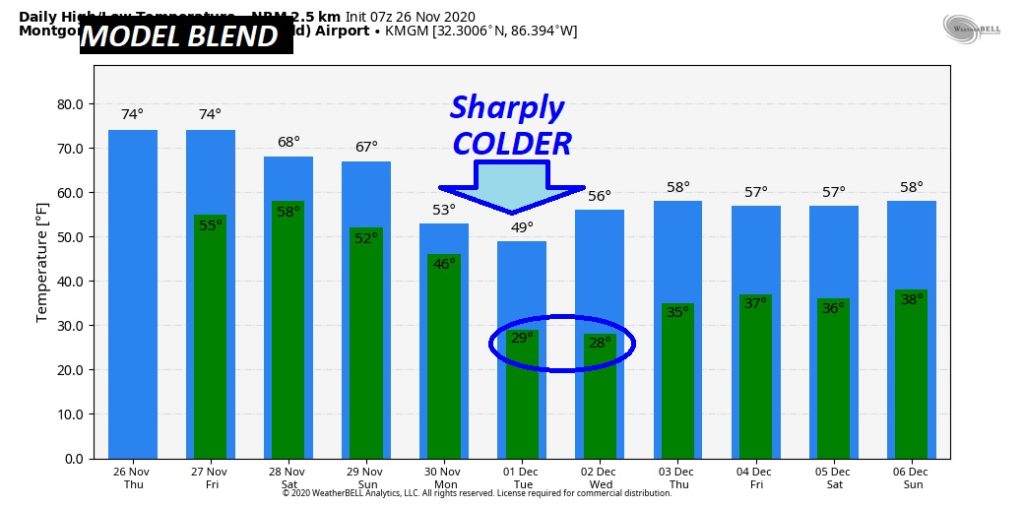
ARE YOU READY FOR WINTER?: Much colder air arrives Monday. We’ll be in the 20’s Monday night and Tuesday night. Tuesday’s high will not make it out of the 40’s..with a stiff breeze making it seem colder. Timing is perfect. Tuesday is the first day of December.
I’m ready to build a fire in my fireplace!
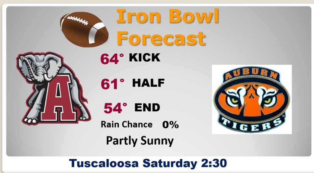
IRON BOWL FOREAST: Looks like a great day for football in Tuscaloosa. No rain expected at this time.
HAPPY THANKSGIVING!

How much rain did you get at your house. Here in East Montgomery I had .73″ overnight, and 1.22 in the last 24 hours.
I will have another Blog Update for you tomorrow, Saturday and Sunday morning. I Hope you and your family have a wonderful Thanksgiving!
–Rich
