
Good Morning! Our active weather pattern continues. Early morning showers will move out. But, the next significant disturbance, in a series will bring in more drenching rains into the area by this evening and tonight.
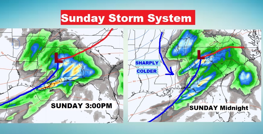
Sunday will be the main event, as a robust storm system affects to the state. Think of it as the “caboose”… the final and strongest disturbance in this series. That system is associated with a strong cold front.
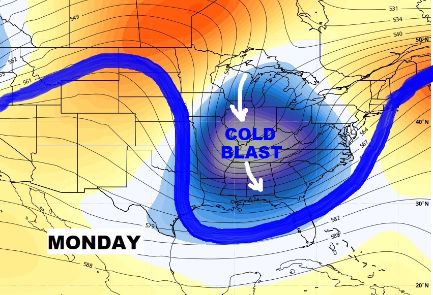
Expect a shocking temperature drop Monday. Get ready for temperatures in the 20’s by Monday night. The first widespread freeze. The coldest morning will be Wednesday morning.
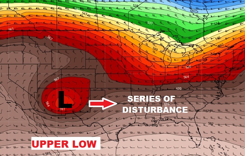
Here’s the set-up this morning. That upper low in the southwest US, will “fire off” a series of disturbances. We’ll be wet at times through Sunday night.
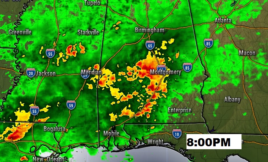
TODAY: Early morning showers are associated with a stalled front in south Alabama. Much of this day will be dry/quiet, as we wait for the next disturbance by evening. High today 73. Showers and storms likely tonight. Looks like a “drencher”. Low tonight 59. Here’s a Future Radar snapshot at 8:00PM tonight.
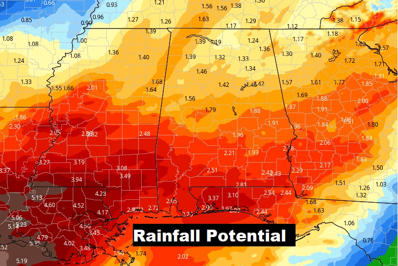
SUNDAY STORM SYSTEM: The final disturbance begins to effect the state in the wee hours late Saturday night into Sunday. This will be a rather robust storm system, associated with a strong cold front. Showers and storms will become likely. Rainfall could be rather heavy.
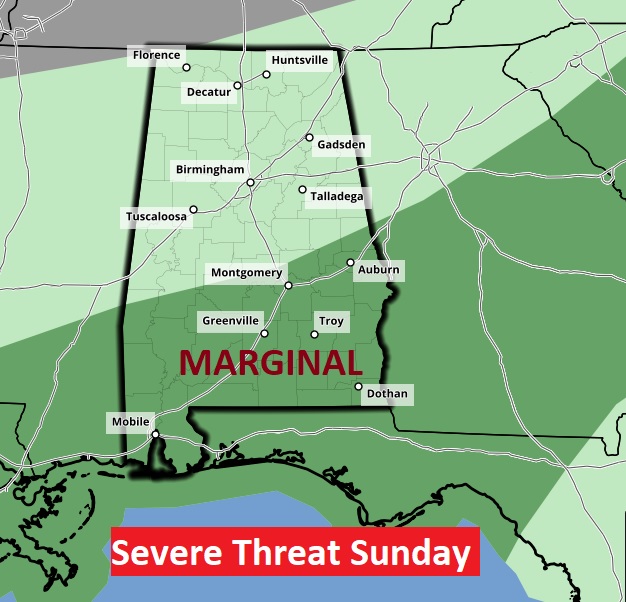
The Storm Prediction Center says there could some severe storms. Right now, a Marginal Risk covers south Alabama.
Additional rainfall potential could total 2”+ in spots before the rain ends by Monday morning.
NEXT FEW DAYS: By far the coldest air of the season will follow the storm. Monday’s high will barely reach 50. Winds will make it seem colder. We’ll be in the 20’s Monday night and perhaps the mid 20’s by Wednesday Dawn. Tuesday’s high will only be in the 40’s. Winter is coming. Get ready.
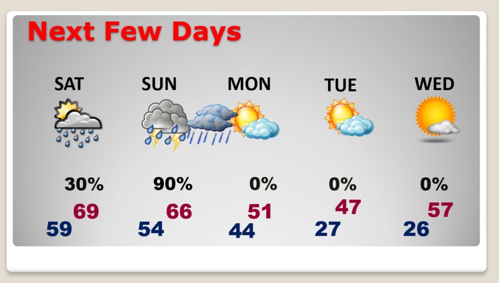
SHARPLY COLDER – TASTE OF THE ARCTIC: Much colder air arrives Monday. We’ll be in the 20’s Monday night and Tuesday night. Tuesday’s high will not make it out of the 40’s..with a stiff breeze making it seem colder. Timing is perfect. Tuesday is the first day of December.

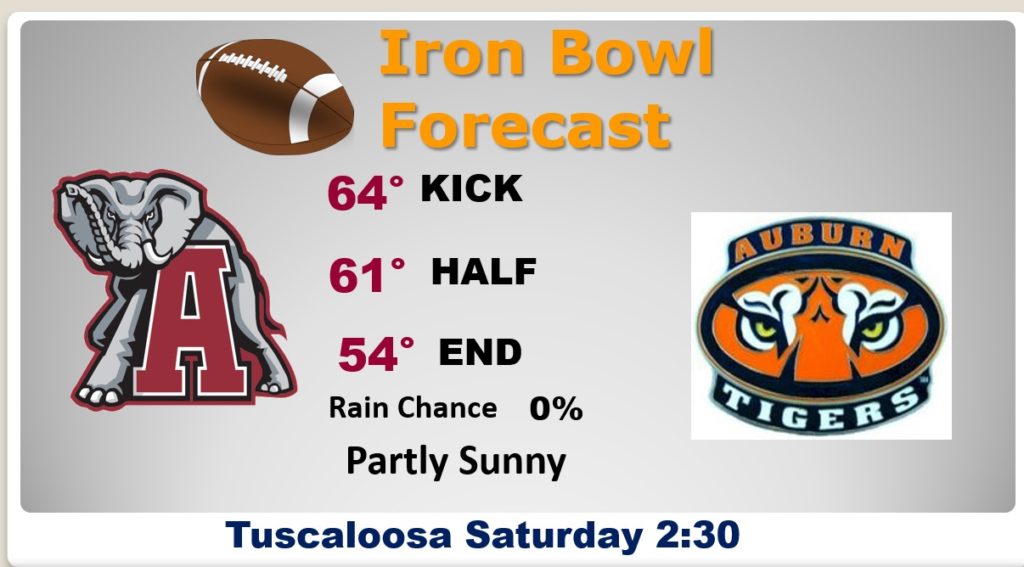
IRON BOWL FOREAST: Looks like a great day for football in Tuscaloosa. Partly sunny. High in the mid 60’s. North wind at 5 to 10 mph.
- –
I will have another Blog Update for you tomorrow, and Sunday morning. I Hope you and your family have a wonderful Black Friday and Iron Bowl weekend!
–Rich