Good Morning!
STORM SYSTEM TODAY: An approaching low pressure system will track eastward across the Gulf states today.
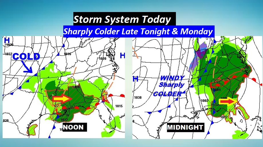
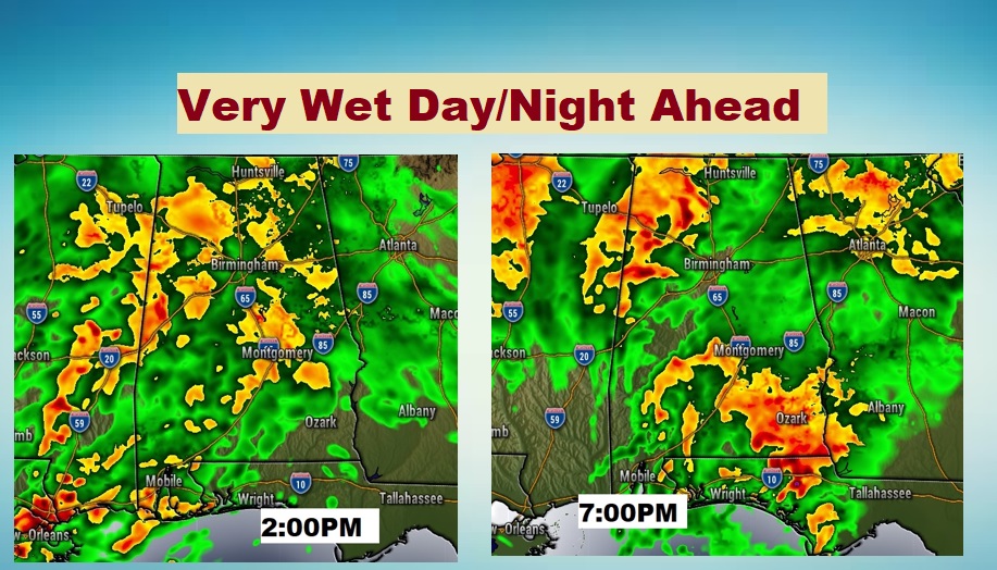
Showers and storms will become likely. Rainfall could be rather heavy at times. It will become windy. High today 66. Upper 40’s overnight, then falling. Here’s a couple of Future Radar snapshots.
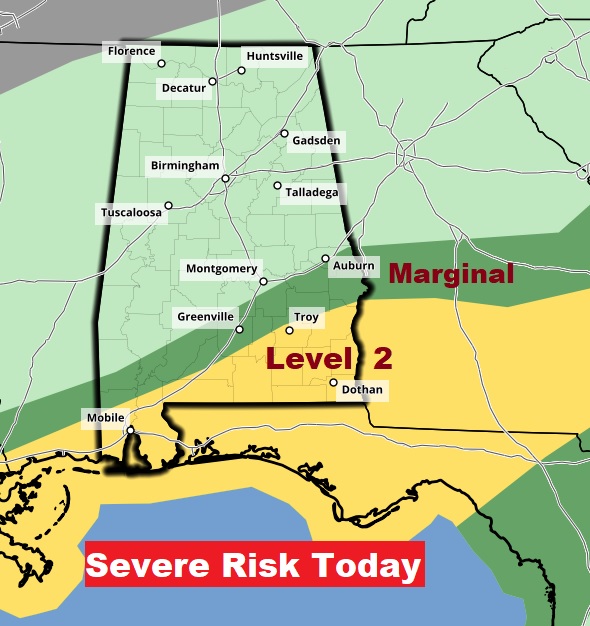
Slight increase in coverage area on today’s Severe Risk from SPC. Larger Level 2 ‘Slight’ risk now covers most of Southeast Alabama. A couple of isolated tornadoes ca’t be ruled out
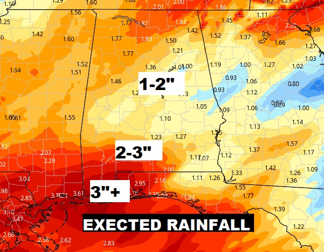
Additional rainfall potential could easily total 1-2” for many before the rain ends by Later tonight.
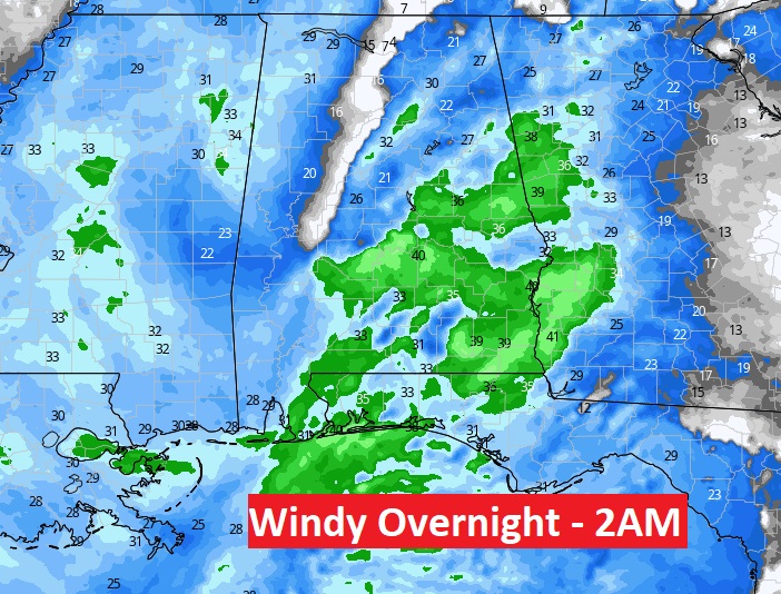
DRASTIC TEMPERATURE PLUNGE: Overnight, a strong Cold Front sweeps through the state. As the front moves through, winds will become quite gusty. Maximum wind gusts could reach 35-40 mph with the frontal passage.
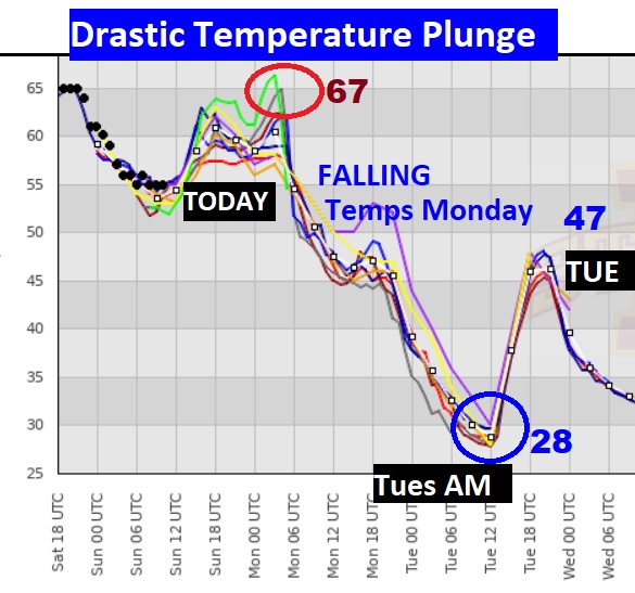
There will be no traditional high temperature Monday. Look for falling temperatures, reaching near 43 by late Monday afternoon, and into the upper 20’s on Monday night. It’ll be the first widespread freeze. Tuesday’s high will only be in the 40’s. The graph below speaks volumes on the dramatic drop.
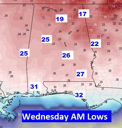
The Coldest morning will be Wednesday. Here’s a look at Wednesday AM at Dawn.
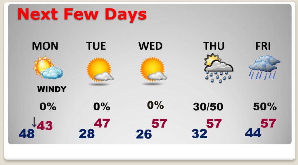
NEXT FEW DAYS: Winter is coming…at least for 2-3 days. This will be a shock to the system. Highs return to the 50’s by Wednesday. The risk of rain is back in the forecast by the end of the week.
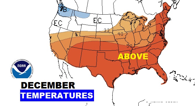
LONG TERM: The fact that we are about to have cold blast doesn’t mean we’re in for a cold winter. In fact, the forecast for December show above to much above normal temperatures, according to the Climate Prediction Center. Looks like a La Nina winter….warmer than normal and drier than normal.
- –
I will have a complete video update for you in the morning. Enjoy your Sunday. Stay Weather Aware.
–Rich
