
Good Morning! It’s a cold, sub-freezing Saturday morning, but temperatures are will start to moderate today through Wednesday, as the cold air retreats.
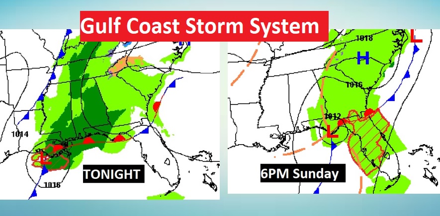
We have yet another Gulf Coast storm system on the way. Rain will overspread the area tonight and Sunday. Rainfall amounts will be light, and because the Low will track along the coast, all the strong thunderstorms will be confined to the Gulf of Mexico.
Christmas Week looks very interesting to say the least. We’ll be dealing with a stronger storm system, followed by dramatically colder air just in time for Christmas Eve and Christmas Day. Some parts of the state will see snow flurries on the back end of the storm. Not a big deal. Just a novelty. Details of the Christmas Week drama below.
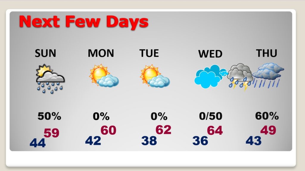
TODAY through SUNDAY: Good bit of sunshine today, but clouds will increase during the day. Near normal temperatures. High 58.
Cloudy tonight. Rain will overspread the area. No heavy rain is expected. Low 44.
Here’s the set-up. Low pressure along the Gulf Coast will track eastward.
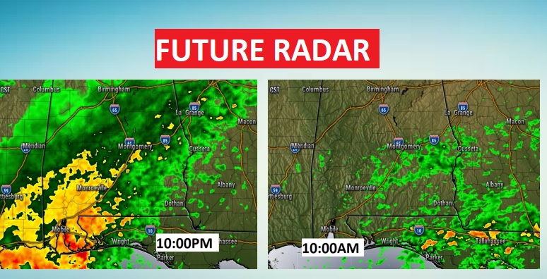
Future Radar snapshots give you an idea of the rain coverage tonight and late Sunday morning. Spotty rain on Sunday, will taper off and move out during the afternoon. High 59.
NEXT FEW DAYS: Monday and Tuesday will be very nice. Warming trend. Low to mid 60’s Monday through Wednesday. Rain moves in Wednesday night in through mid-day Thursday. Then, windy and dramatically colder.
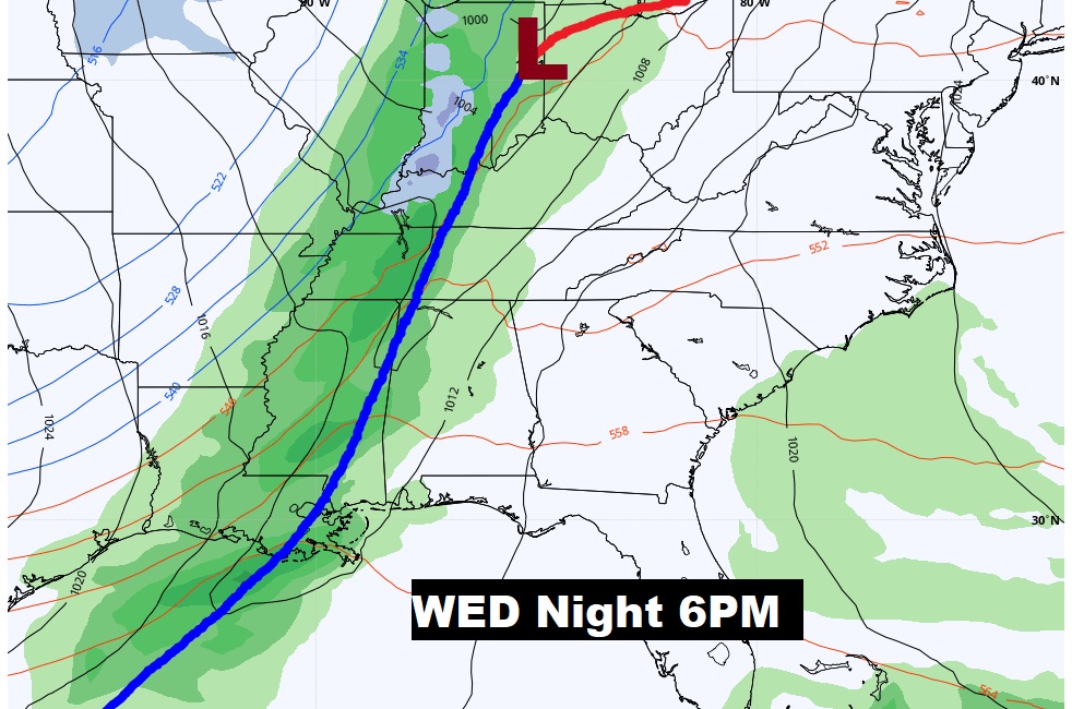
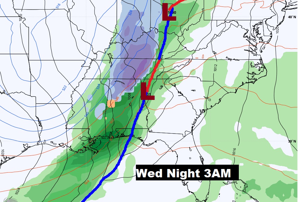
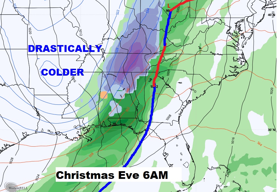
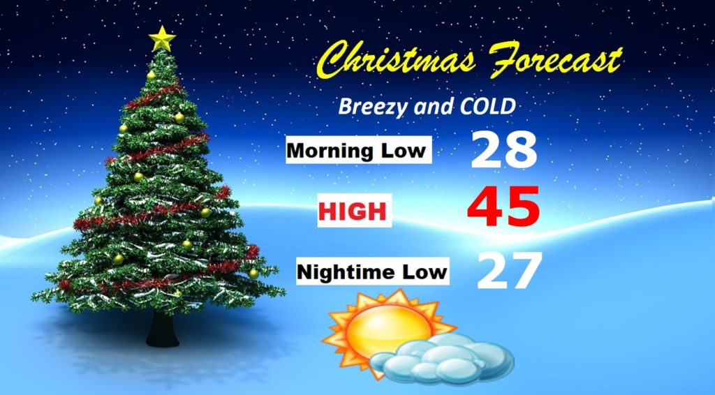
CHRISTMAS WEEK DRAMA: The storm system is on a faster timetable, now, based on the latest models. Showers and perhaps some thunderstorms move in ahead of the front Wednesday night. So far, there are no indications of Severe Weather, but every storm system this time of the year is suspect. The cold front cuts through the area by Christmas Eve morning. There’s rain behind the front, tapering off and ending by early afternoon. Any flakes of snow on the very back end of this system will be very minor for us. No big deal. It turns windy and dramatically colder Christmas eve, from the afternoon and through Thursday night. Upper 20’s but Christmas morning, followed by a raw day, with highs barley into the mid 40’s. Here’s the map set-up Wednesday night through Thursday.
It looks like a breezy and cold Christmas Day, but the sun will be out.
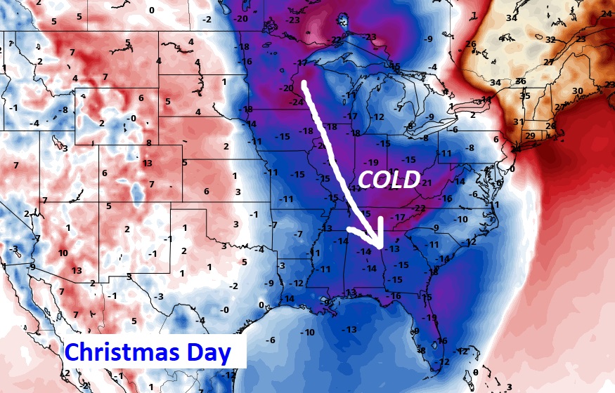
Very Cold Arctic Air will dominate much of the eastern half of the nation.
LONGER RANGE: Looks like another storm system, next weekend, around December 27th, and another one near New Years Eve…so the active pattern will continue.
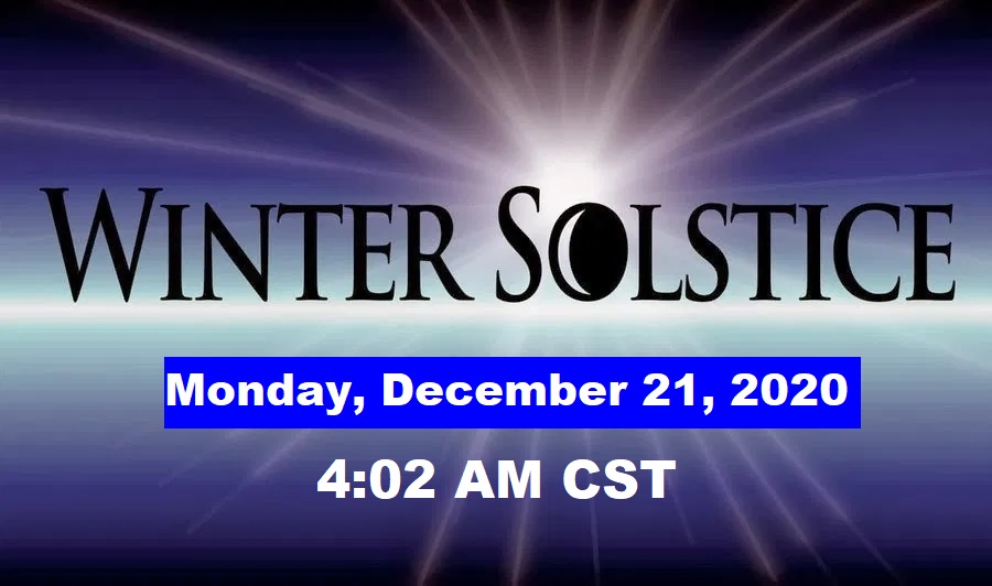
WINTER BEGINS MONDAY: Sunday is the last official day of Fall. The Winter solstice is Monday.
I hope you enjoy the weekend, as Christmas Week begins. I’ll have another Blog update early tomorrow morning. Stay safe and warm.
–Rich