Welcome to Winter! The WINTER SOLSTICE happened officially at 4:02AM. After some patchy dense fog in spots this morning, we have some decent weather ahead today, Tuesday and daytime Wednesday. But get ready. Showers and thunderstorms move in Wednesday night. Cold front moves through by Thursday morning, and dramatically colder will funnel in, just in time for Santa’s arrival. The Arctic Express is coming for Christmas. I’ll fill you in on the chilly details, including an updated timeline.
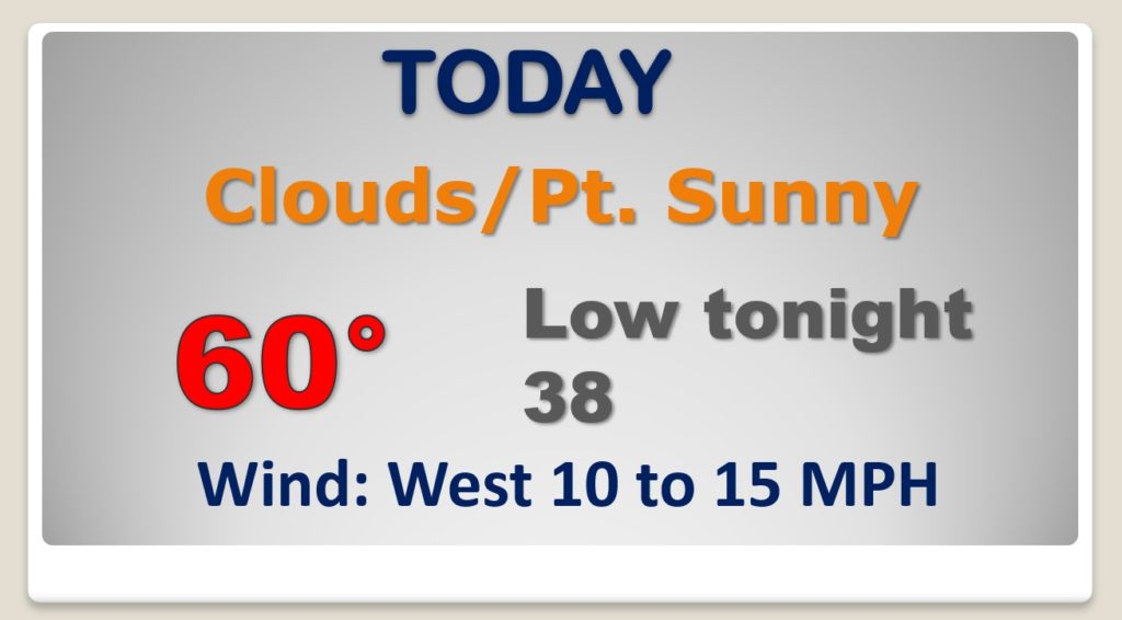
Patchy fog in spots this morning, otherwise this first day of Winter will be Dry , quiet and mild.
We are enjoying a warming trend for the first 3 days of this Christmas Week. But, do you see that Arctic Air in northern Canada? That has out name on it. The Christmas Arctic Express is coming.
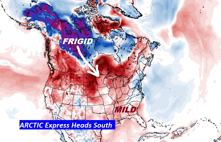
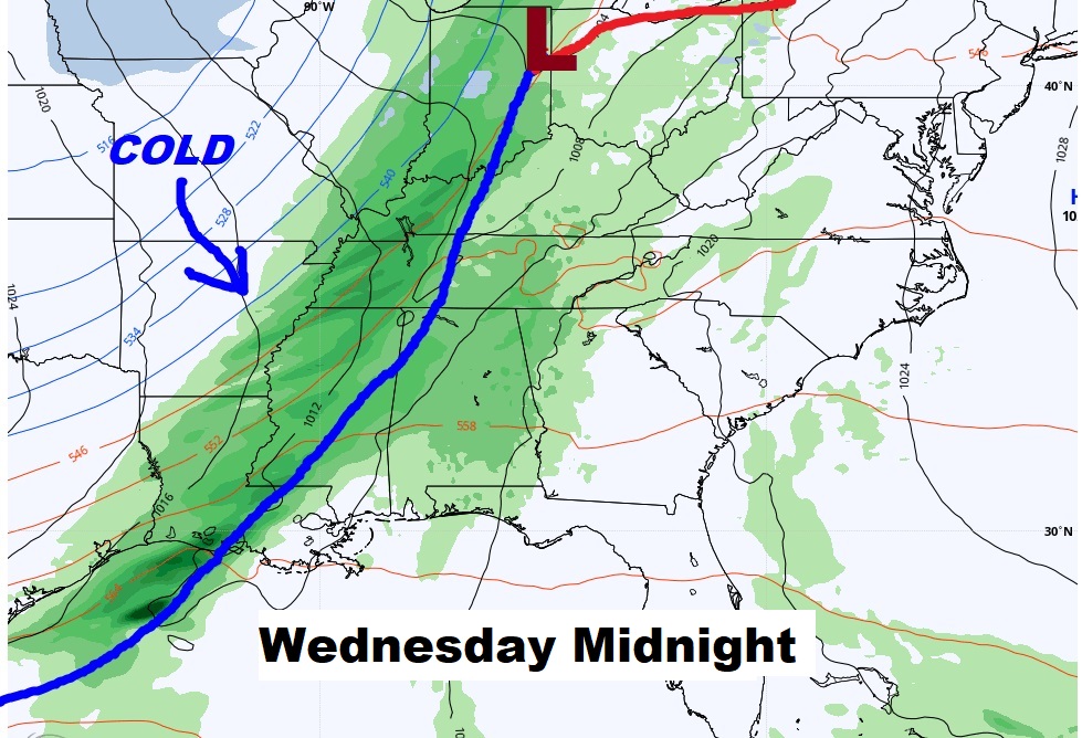
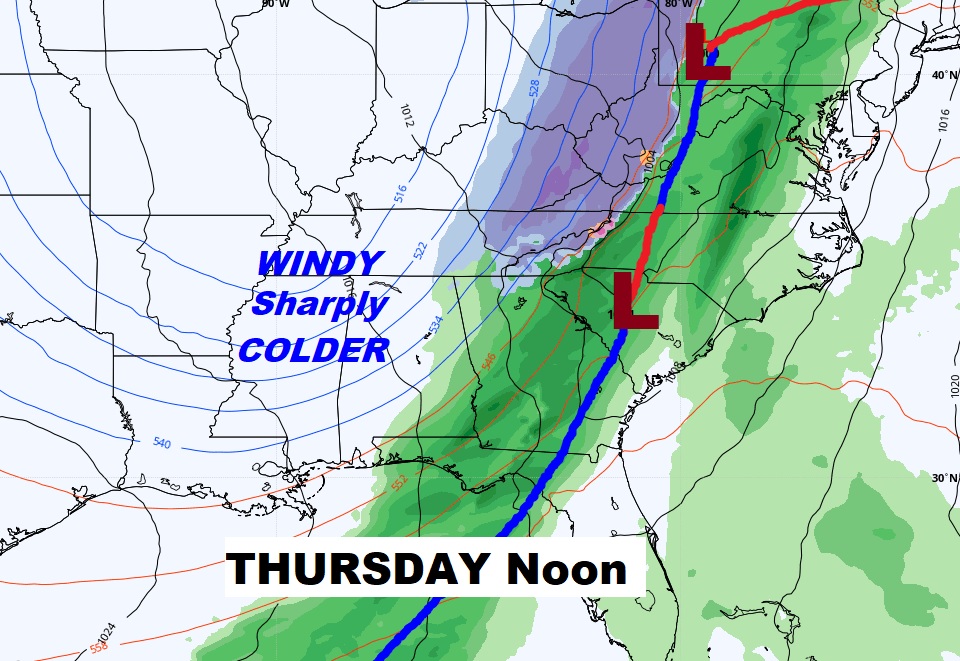
Warming trend through Wednesday. Showers & storms Wednesday night and Thursday morning. Rain exits the state by early afternoon Thursday. Then, windy and sharply colder, as arctic air funnels in for Christmas Eve and Christmas Day.
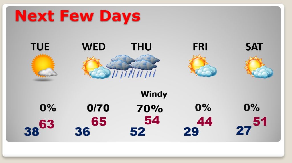
Showers & storms Wednesday night and Thursday morning. Rain exits the state by early afternoon Thursday. I don’t expect any severe weather. It turns windy and drastically colder behind the arctic front.
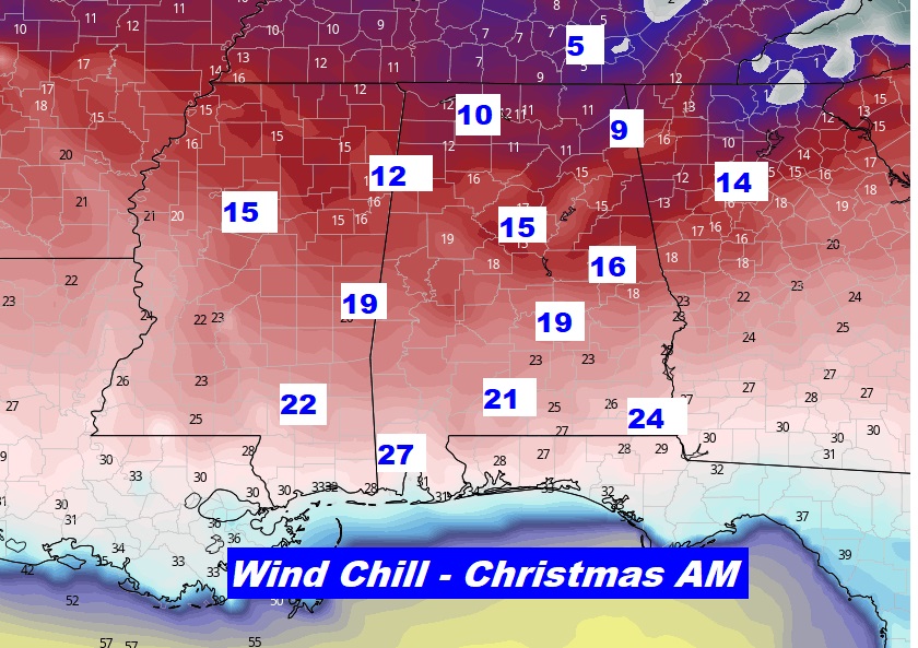
Arctic Air will dominate the entire eastern and southeast US on this Christmas Day. Even Florida will be sharply colder.
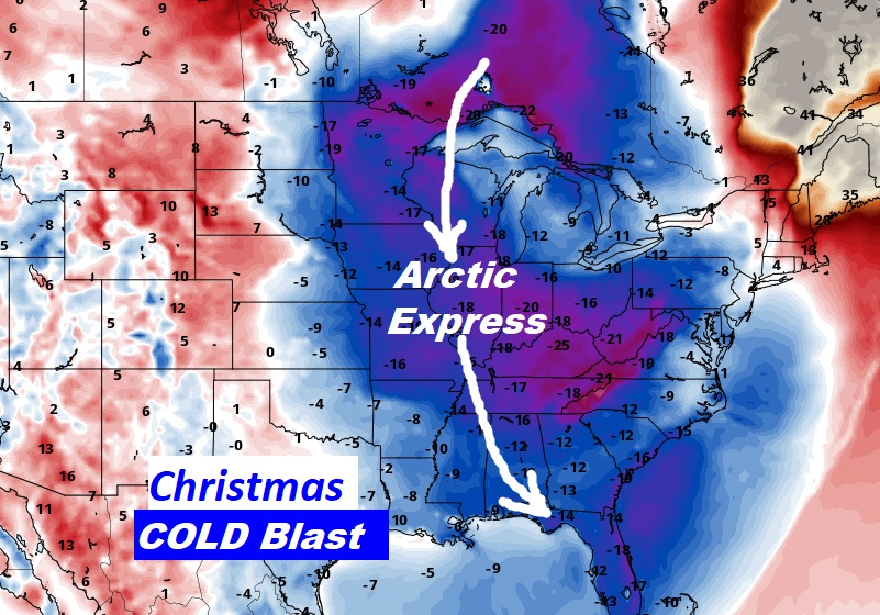
COLD Christmas Day. A far cry from last year’s high of 74!
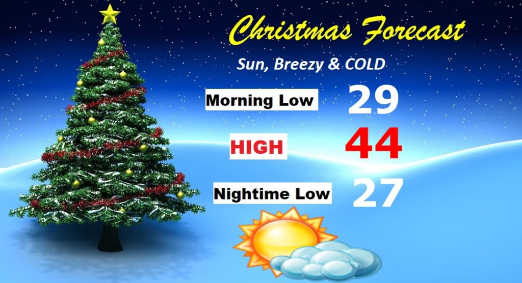
How about some potential wind chills in the teens Christmas morning into central Alabama.