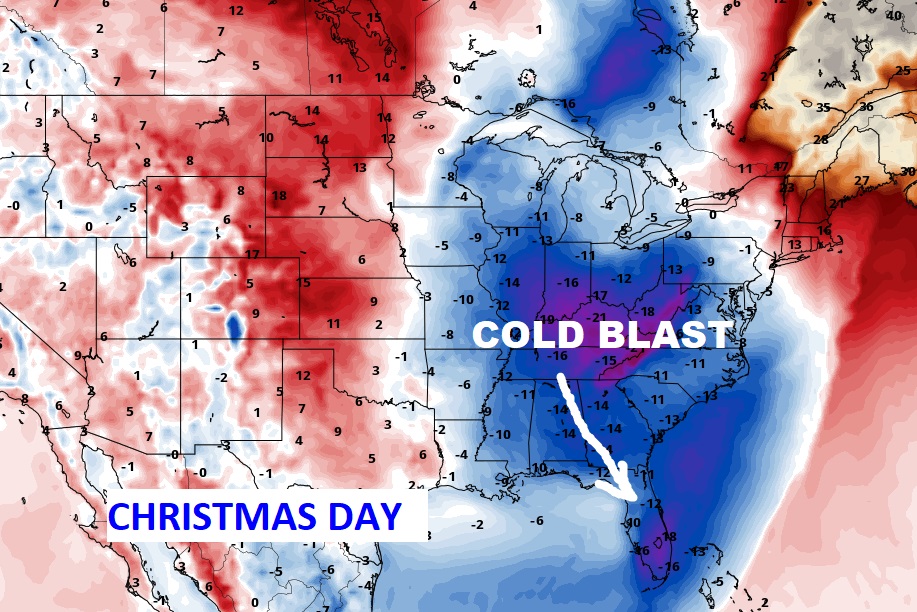
Good Morning! Enjoy another quiet, mild day today. But, get ready. Radical changes are fast approaching. An Arctic Cold Front will spread showers and thunderstorms into the state tonight and tomorrow morning. Behind the cold front, it turns windy and drastically colder. Falling temperatures on Christmas Eve and Thursday night. By Christmas morning, we will be in the Deep Freeze with Lows in the 20’s. Christmas Night will be even colder. On this video, I will dissect the details and we’ll look ahead to the weekend.
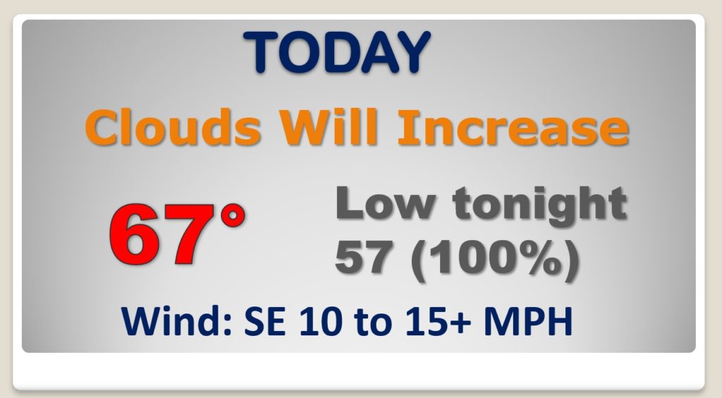
Enjoy another quiet, almost spring-like day today. Storms arrive tonight.
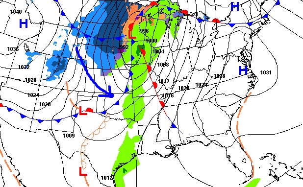
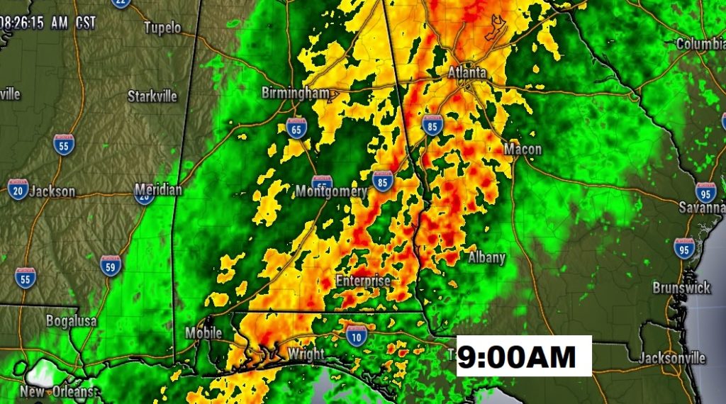
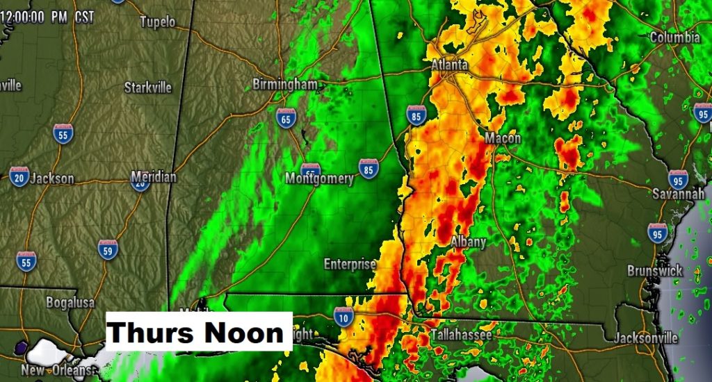
The squall-line enters the state around Midnight and crosses the state in the wee hours of the morning. The back edge of rain reaches the I-65 corridor by Noon, if not earlier.
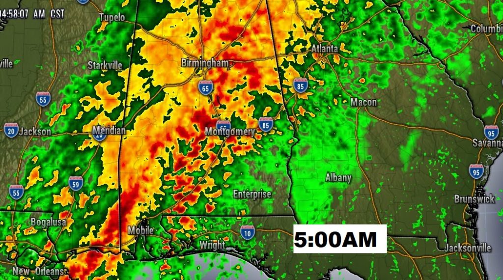
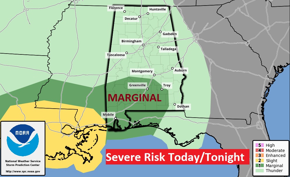
SPC has a Marginal Severe Weather Risk covering much of south Alabama in the overnight hours. A couple spin up tornadoes can’t be ruled out.
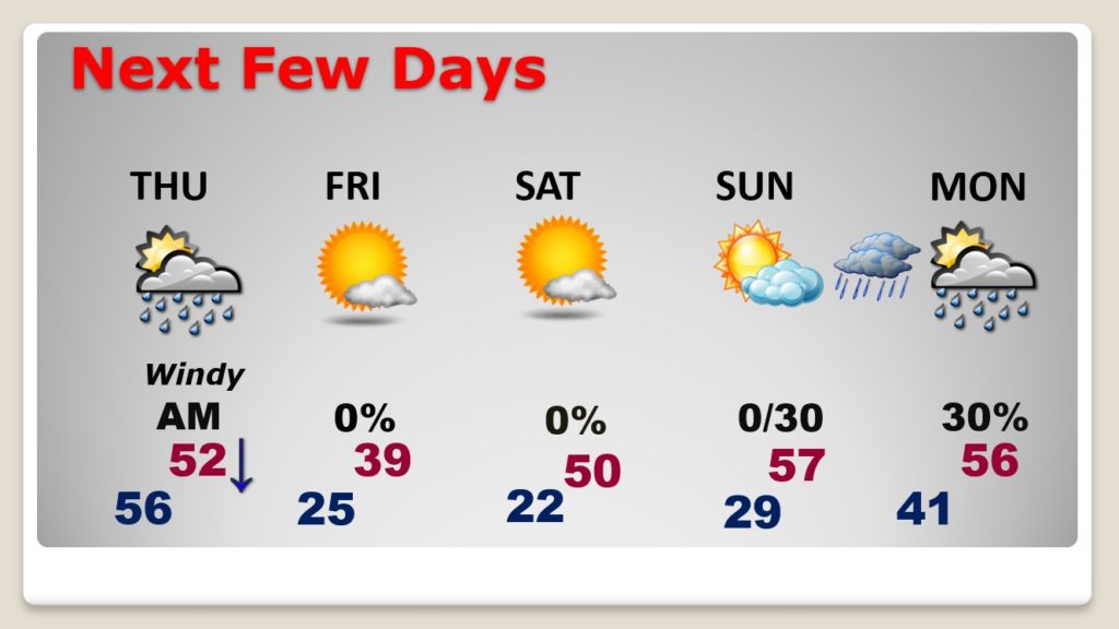
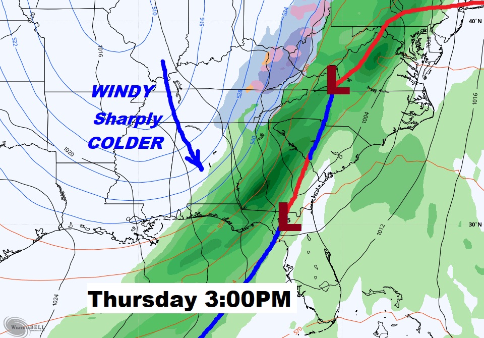
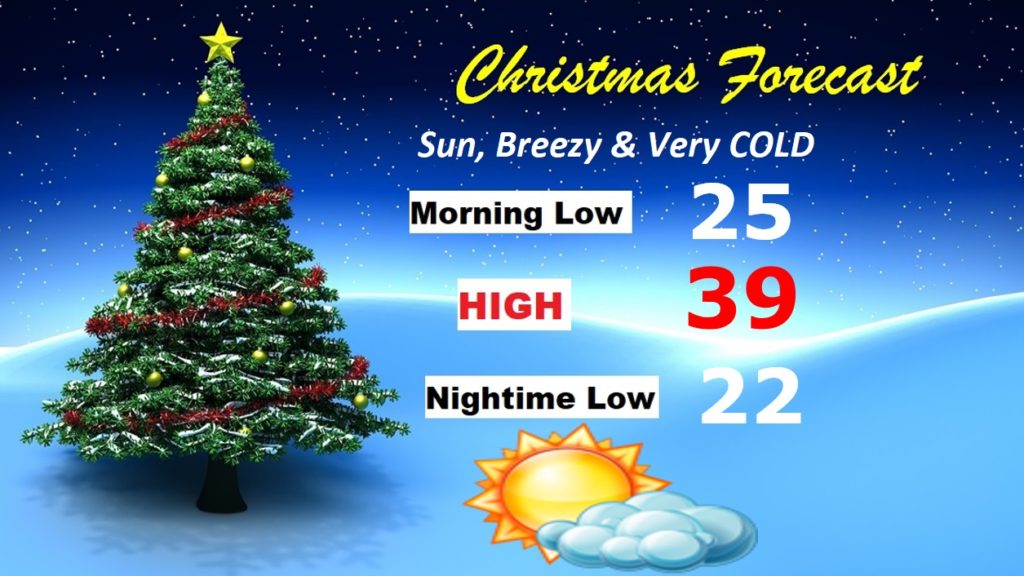
Christmas Eve will be windy and drastically colder with Falling Temperatures. Arctic Cold on Christmas Day.
Wind chill in the teens Christmas morning.
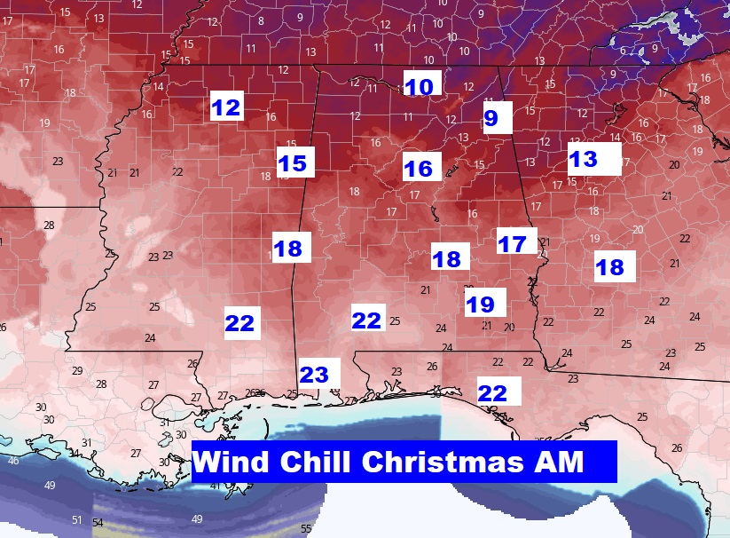
I have revised the expected lows and high downward for Christmas.
After Christmas, the weekend will be not quite as cold. Upper 50’s possible by Sunday. Maybe some showers Monday.