
Good Morning!
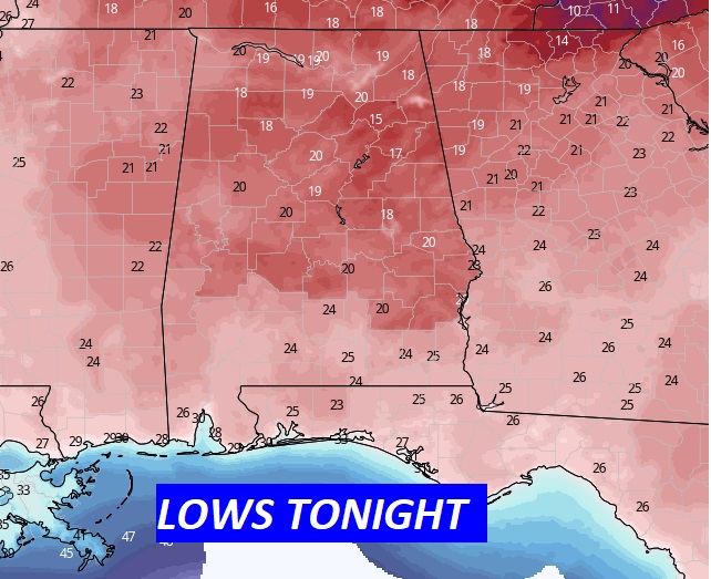
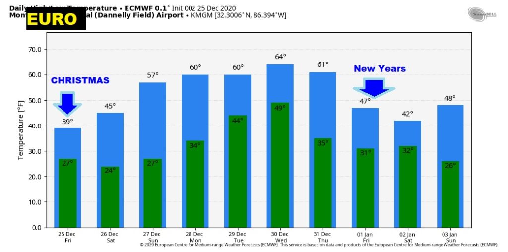
TODAY…CHRISTMAS DAY: Very Cold. Sunshine. Windy at times. Northwest wind at 10 to 20 mph. High today 39°. Last year 74°) Tonight..coldest night of the season so far. Low 20.
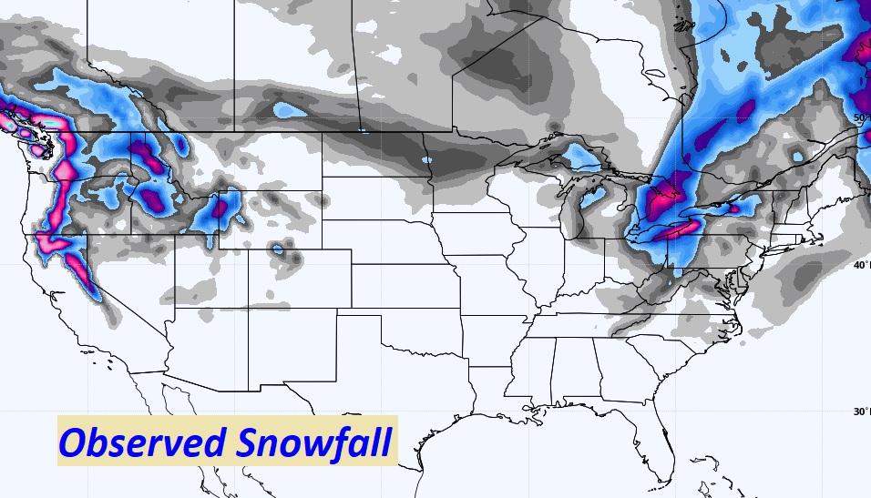
Closest snow on the ground to us on this Christmas morning is in the Smoky Mountains on eastern Tennessee.
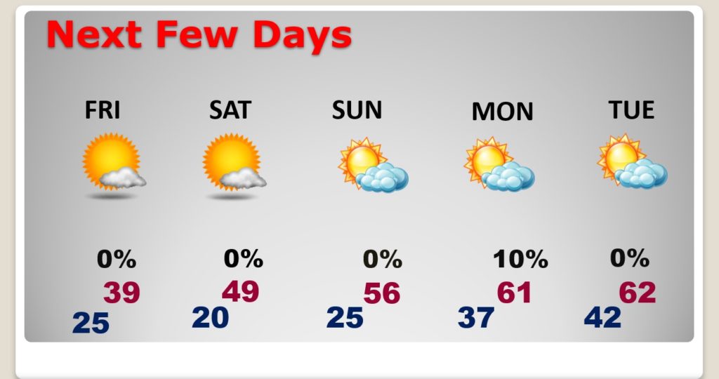
NEXT FEW DAYS: Very cold through Saturday morning. Upper 40’s Saturday. Still Cold. 20’s again Sunday morning. Nice recovery Sunday afternoon and Monday. Warming trend continues Wednesday as the next storm system begins to affect the area. Showers and thunderstorms.
Will the Wednesday storm system bring a severe weather threat? Too early to say.
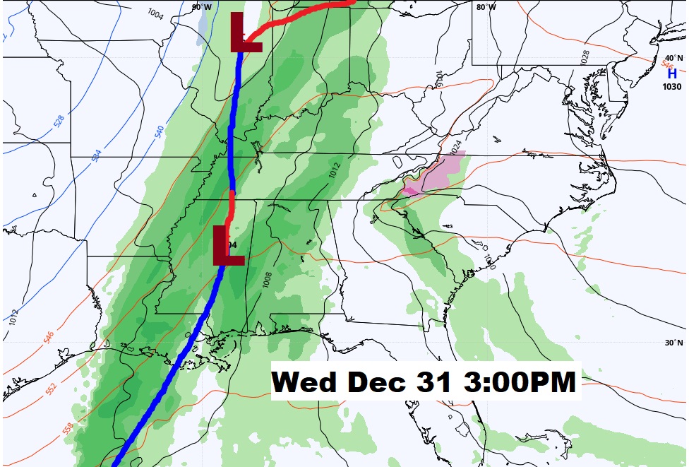
The EURO model suggests another Temperature Crash as the New Year begins.
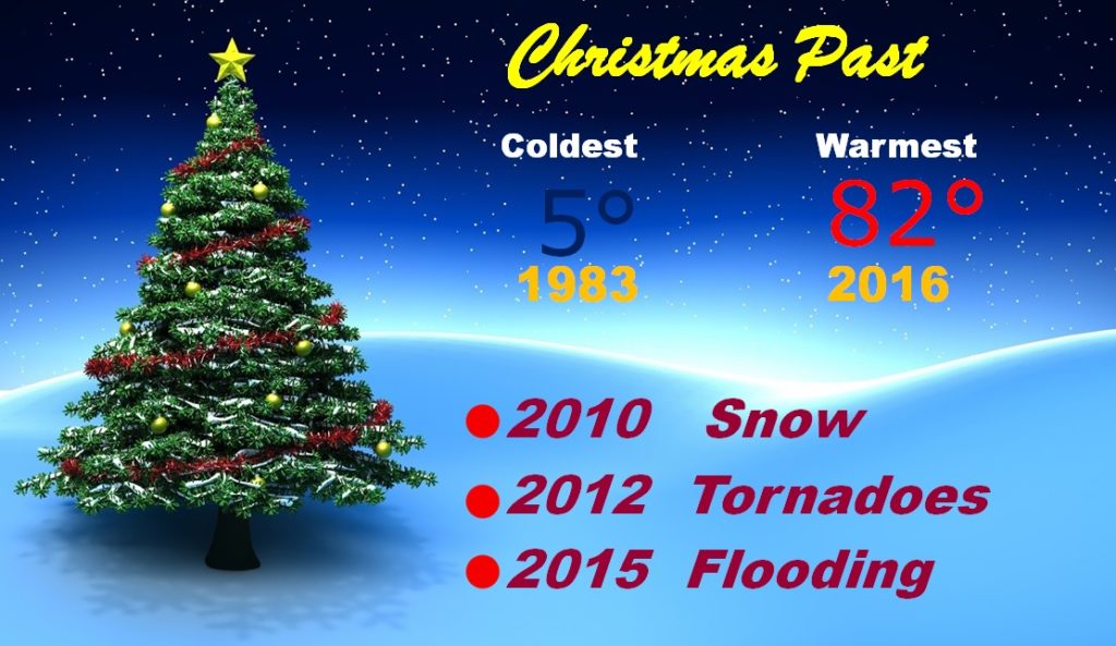
CHRISTMAS PAST: We’ve had some pretty interesting Christmas weather extremes in the 43 years I have covered the weather for you. The 2012 tornado marathon was epic. More than a dozen tornadoes. A little bit of snow in the area on 2010. (There has been No official Montgomery WHITE Christmas in history)
There’ll be another Blog Update tomorrow Morning. MERRY CHRISTMAS!

–Rich