
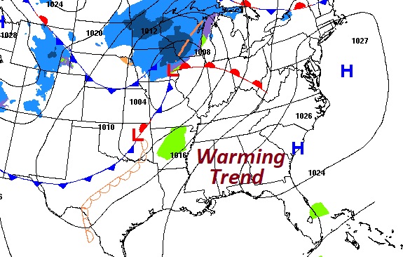
Good Morning! After another very cold start, there is good news ahead. A nice warming trend begins this afternoon and continues into Mid-week.
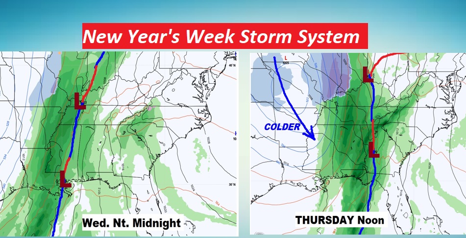
The biggest news in the week ahead, involves another storm system which will bring showers and thunderstorms to the state, before yet another big temperature plunge. (not quite as severe as the Christmas plunge)
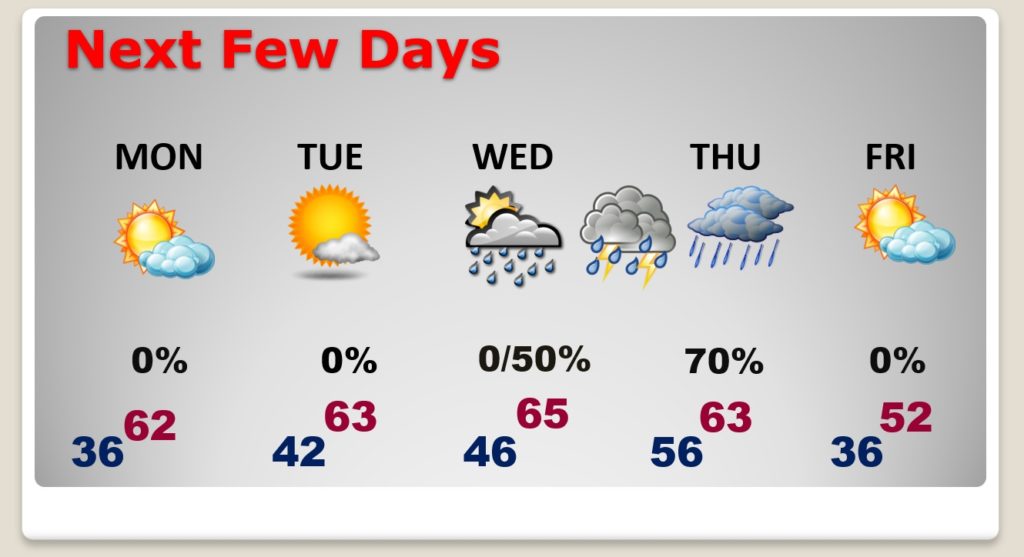
TODAY: It should be a great day today. Lots of sunshine. Great afternoon temperature recovery, after a cold start. High near 60. Not quite as cold tonight. Chilly, though…Clear sikies. .low 36.
NEXT FEW DAYS: Nice warming trend continues Monday through Wednesday. Highs in the 60’s. Showers and thunderstorms arrive Wednesday night into Thursday. Sharply colder again behind the storm system.
NEW YEARS WEEK STORM SYSTEM: Showers and thunderstorms arrive Wednesday evening/night into Thursday. Sharply colder again behind the storm system. It’s not no known yet, whether this will be severe weather producer or not. ‘Tis the season. Stay tuned for more.
Have a GREAT Sunday! I’ll have a complete video update in the morning.
–Rich