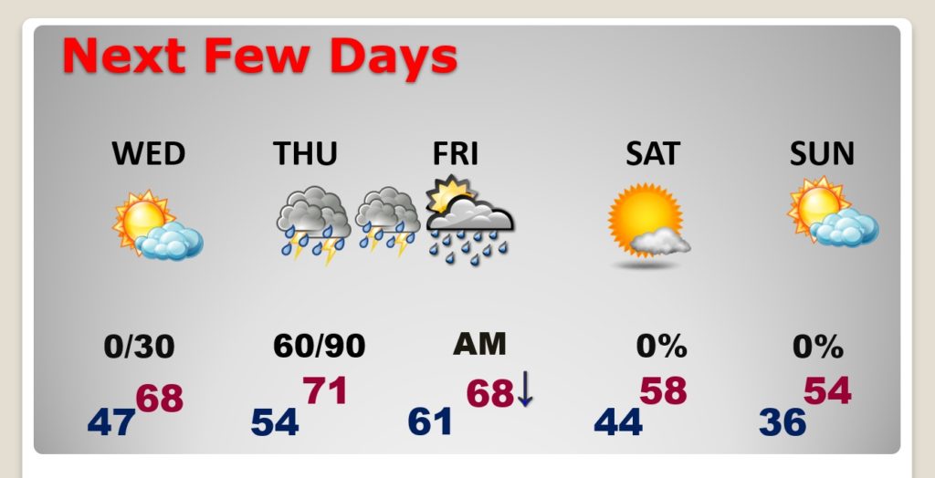
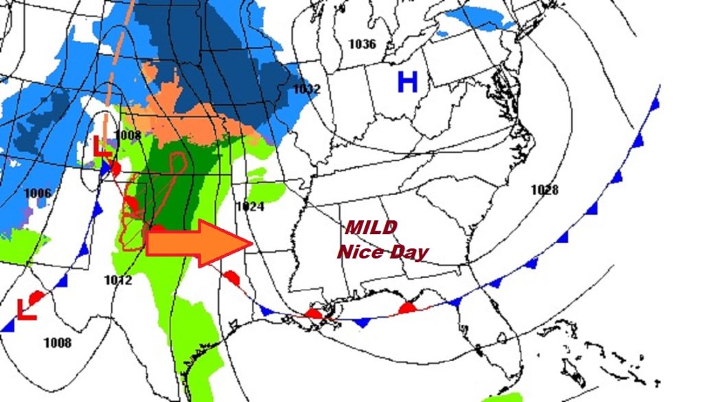
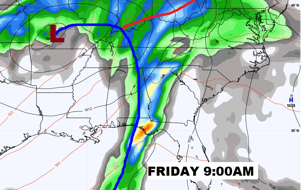
Good Morning! Dense Fog Advisory this morning. The news is very good in the short term. The warming trend continues. Today and Wednesday will be tranquil and mild…very nice for late December. But, a formidable storm system will arrive before 2020 ends on Thursday night. Severe weather is also possible. The timeline has changed. I’ll bring you up to date on the details and we’ll look ahead to the weekend.
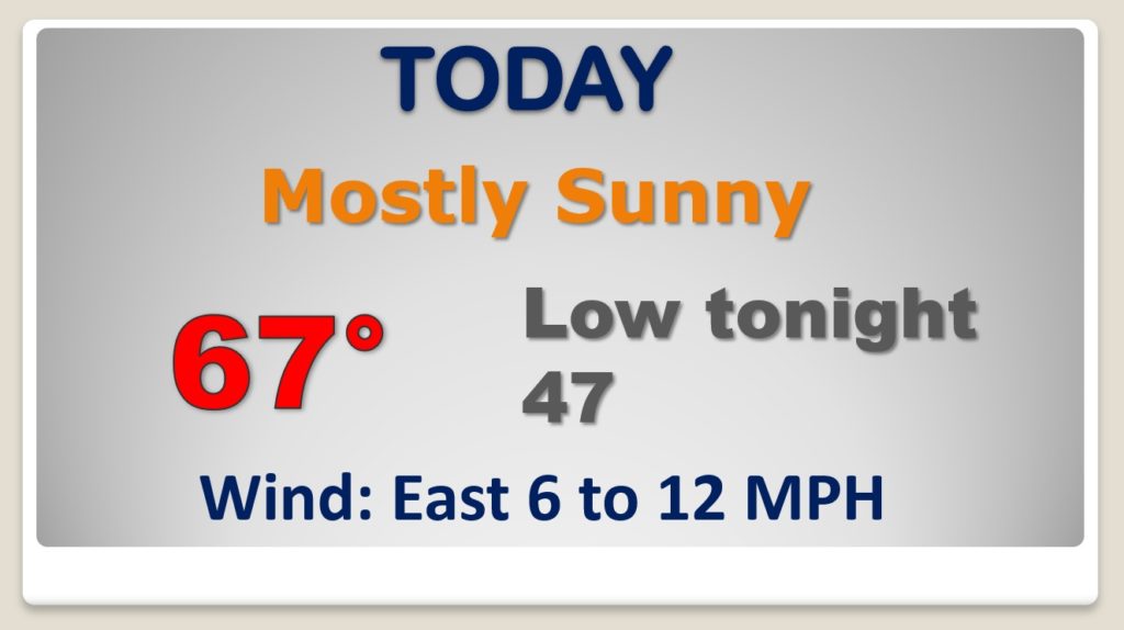
After the morning fog issues…NICE day today! Mild for December. Great day…
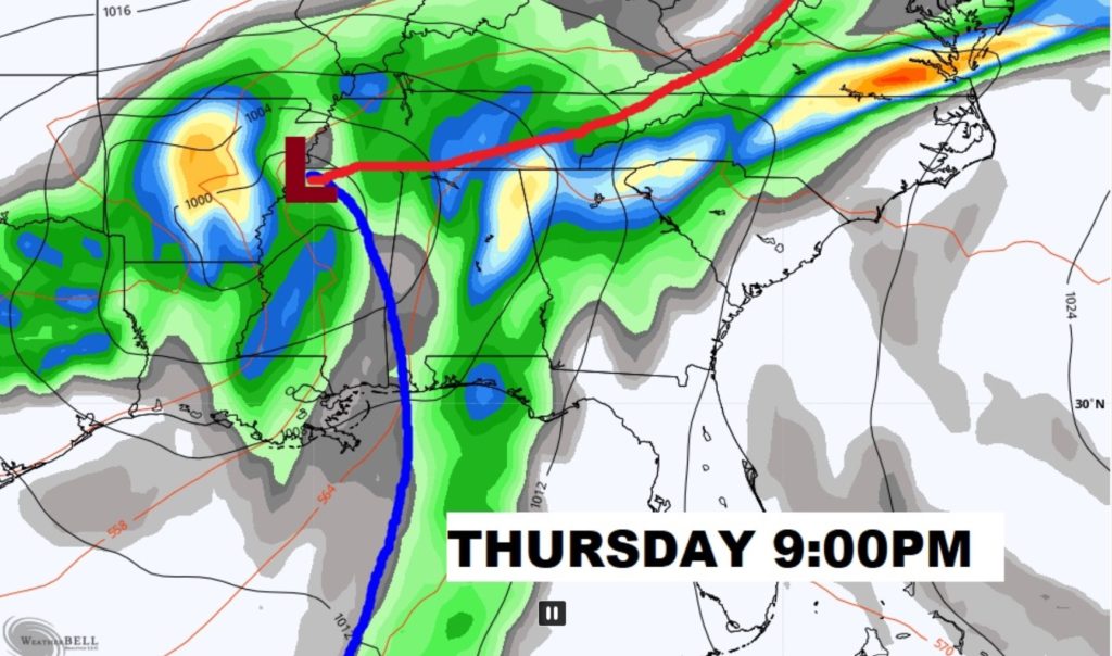
New Years Eve storm system will brings showers and storms to the state by Thursday evening / Thursday night. Stormy end to 2020. Severe weather threat. The time line now extends until Friday morning.
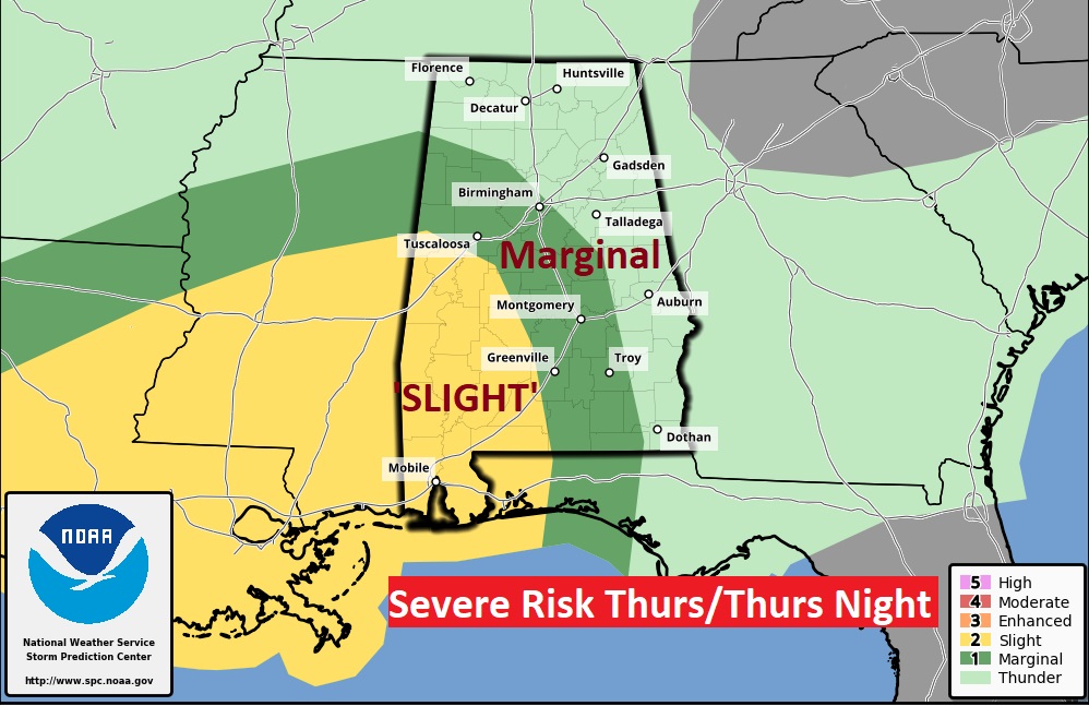
The adjusted severe weather outlook through Friday morning at 6AM shows the threat expanding eastward to a Tallassee Troy line by Dawn. Level 2 slight risk west of a Selma/Greenville line. Tornadoes can’t be ruled out.
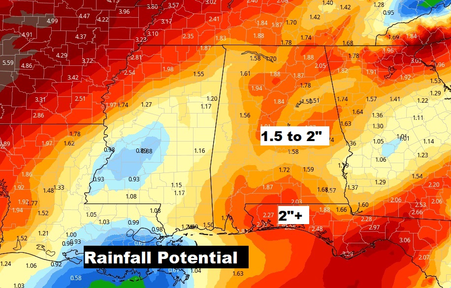
Could be up to to 2″of rain in spots.
The air that follows the storm system is NOT Arctic air this time. The weekend will be cooler, but not cold.
