Good Morning from the Alabama coast!
TODAY: Sun and cloud mix. Very mild, again. High 71. Partly cloudy and not as cool tonight. Low 55. Can’t rule out a stray shower overnight.
NEW YEARS EVE STORM SYSTEM: A potent storm system moving northeast out of Texas. Showers and storms will be scattered across the area Thursday afternoon, and evening. The main event will be later. The timing is awful. The main band of showers and storms will move through state in the overnight hours of New Years Eve through the early hours of New Years morning.
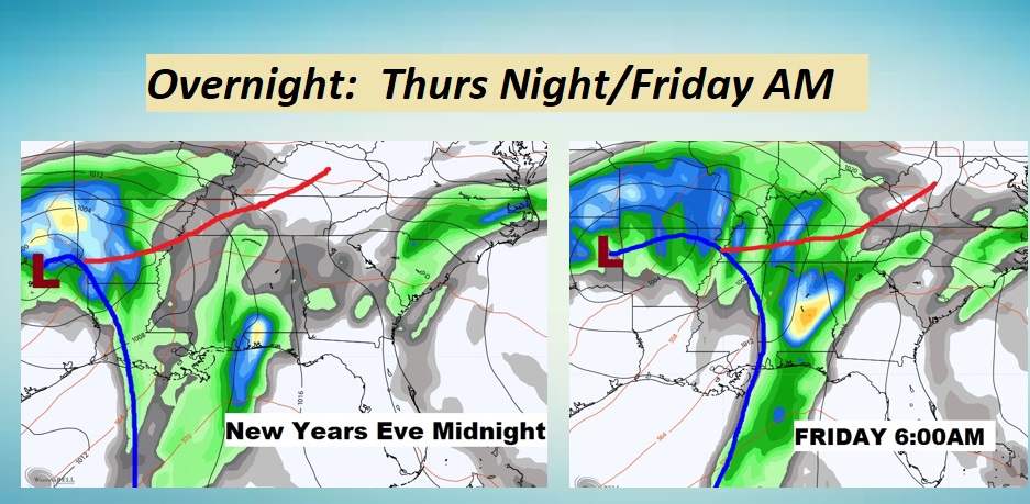
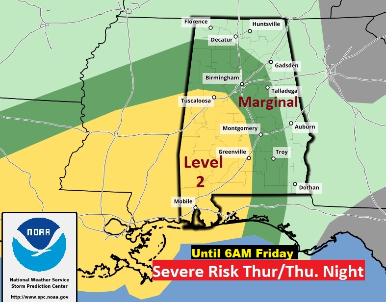
Some of the storms will be strong to severe. Damaging wind gusts and a few tornadoes are possible. The primary window for severe weather will be about 10PM in the western counties until about 9AM Friday in east and southeast Alabama. Happy New Year. Here’s the updated outlook from the Storm Prediction Center. This outlook ends at 6AM Friday.
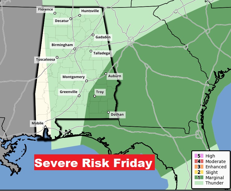
Here’s the SPC Severe Risk after 6AM Friday…covering southeast Alabama.
FUTURE RADAR: This is the NAM Model loop from Midnight to 8AM. The first 8 hours of the year 2021.
Many towns will get a good soaking. Heaviest rainfall will be in south and southeast Alabama.
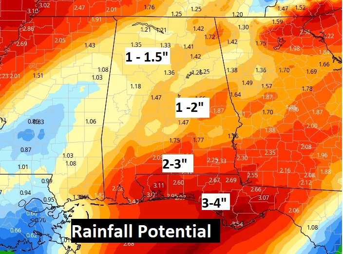
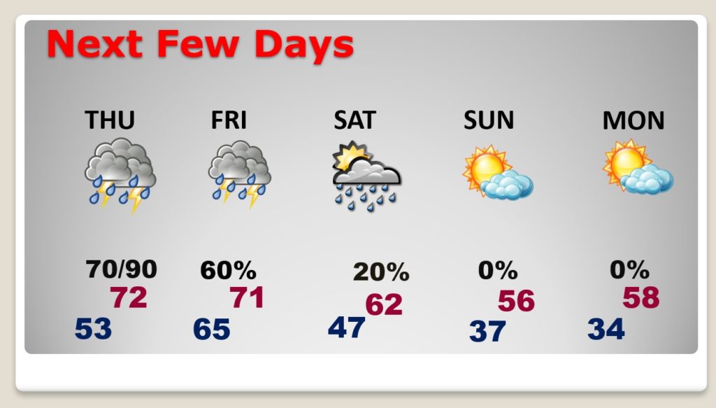
NEXT FEW DAYS: After the rain moves out by mid-day Friday, the rest of New Years Day will be dry and mild. I’ll leave in a tiny rain chance Saturday as a little disturbance brushes by the area. It will be mild Saturday, but a little cooler Sunday. Coldest night will be Sunday night.
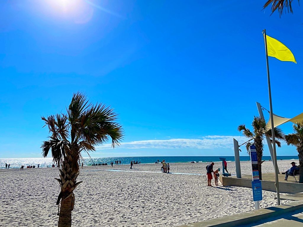
There’ll be another Blog Update tomorrow Morning. Enjoy today’s nice weather. Chase and I are going to enjoy another nice day on the Alabama coast.
–Rich
