
Good Morning!
Here’s the map setup on Monday morning at 6AM. The exact placement of the Low pressure system is key to the forecast.
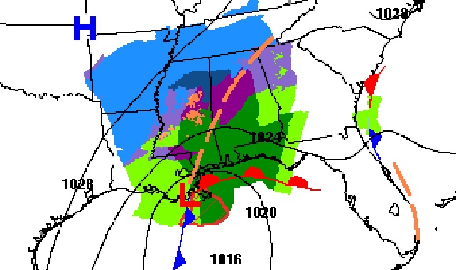
TODAY: Becoming mostly cloudy, again. Still cold for January. High 47. (Normal high 57). Not as much wind. NE wind 5 to 10 mph. Mostly cloudy tonight. Low 36 in Montgomery. Colder to the northwest of the city (34 to 36), and warmer southeast of the city (38-40). Chance of some light rain after about 3AM. Possible winter mix northwest of a Selma to Alex City line. (See below for more)
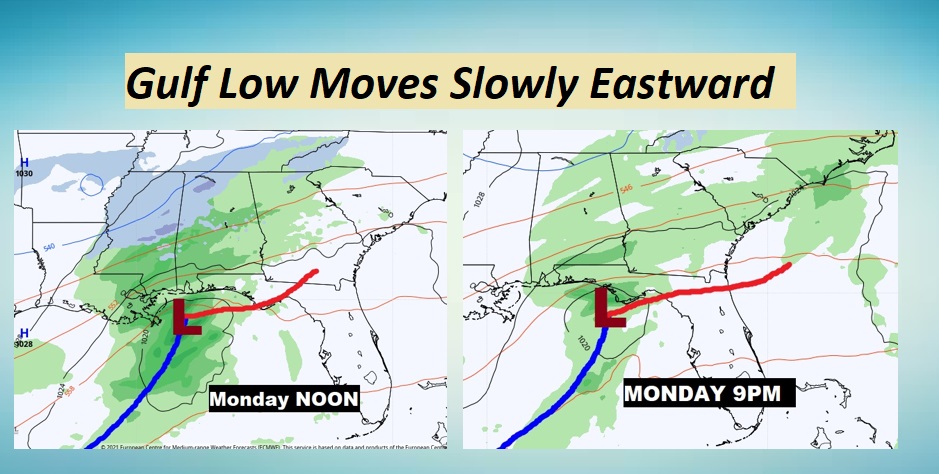
MONDAY STORM SYSTEM: For almost all of us, the Monday storm system will be just a cold rain.
However, in the pre-dawn hours of Monday morning, there could briefly be a mix of perhaps, rain and sleet in parts of west central and central Alabama.
Precipitation could reach the I-65 corridor by about2AM, and overspread the eastern counties by 5AM. There could be briefly a Winter Mix of rain and sleet (ice pellets) generally along and northwest of a Selma to Alex City line. That would includes parts of Autauga and Elmore counties. But, NO travel impacts are expected, and the by about mid-morning, the threat of any Winter Mix will end as the precipitation becomes all rain.
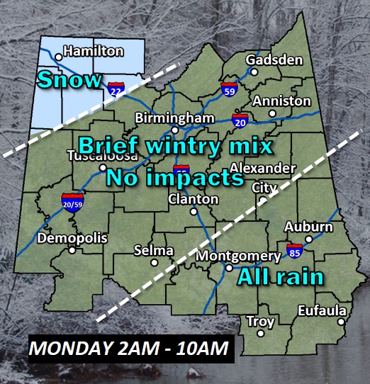
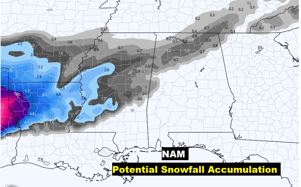
In the colder air of northwest Alabama there could be a minor snow accumulation. However, our friends west of Alabama…in parts of Louisiana and Mississippi could see a more significant accumulation from this system.
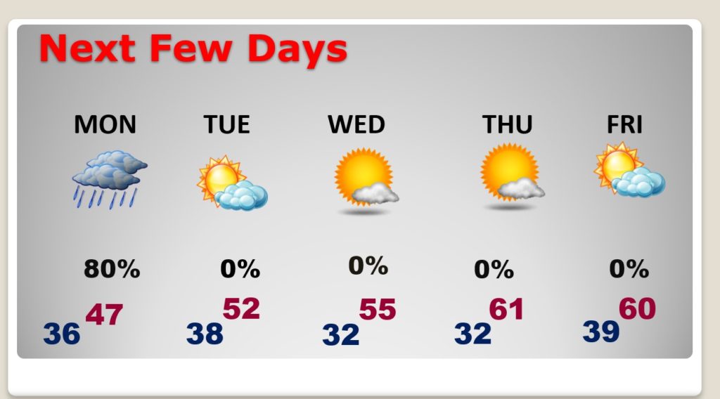
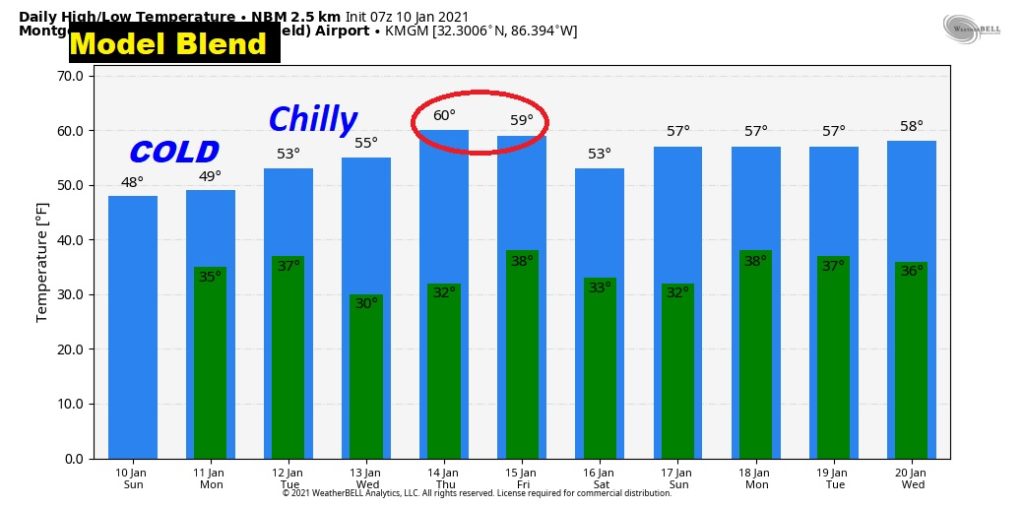
NEXT FEW DAYS: Cold rain Monday and Monday night. Chilly Tuesday and Wednesday. Warmest day of the week will be Thursday and Friday. After Monday we should be dry
Have a GREAT Sunday! I’ll have a complete video update in the morning. We’ll look ahead to later in the month to see what surprises might be lurking for the rest of January.

–Rich