
Good Morning! It has been a Brisk & Chilly Weekend. Many towns are in the 20’s early this morning. Today will be another below normal temperature day and we’re headed for a freeze tonight.
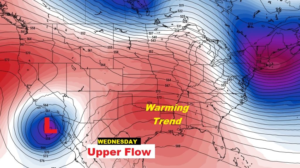
But, the news gets better this week. A building ridge of high pressure in the upper atmosphere will lead to a significant warming trend.
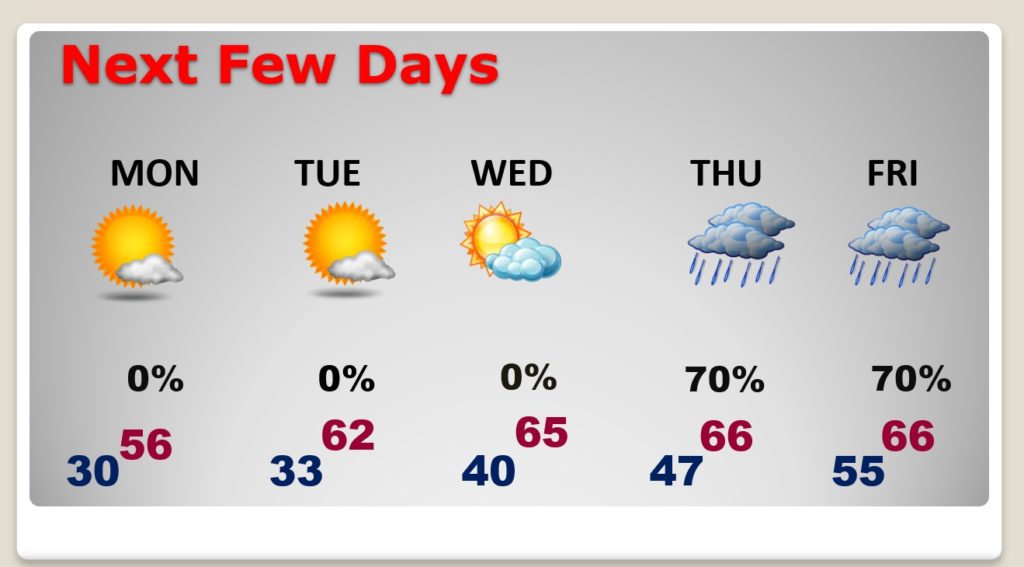
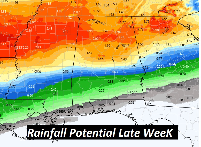
Late in the week, rain will become likely on Thursday and Friday especially.
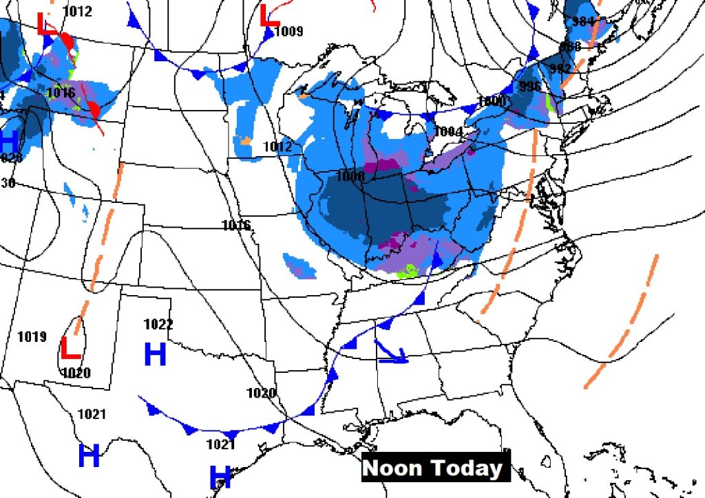
TODAY: Clouds will drift across the state this morning and early afternoon as one more front sweeps through. Sunshine later. High in the mid 50’s. Winds will be a little gusty again….west at 10 to 18 mph. Mostly clear and cold tonight. Low 32.
NEXT FEW DAYS: The MLK holiday will be nice. Sunshine. Mid 50’s. Warming trend begins this week. Low 60’s Tuesday. Mid 60’s Wednesday through Friday. Rain is likely Thursday & Friday.
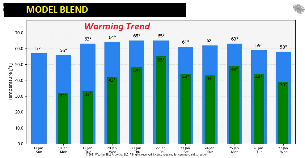
The 10 day “model blend” Temperature trend.
Rainfall amounts will vary quite a bit from north to south this week. Wet in north Alabama. Not as wet in south Alabama.
SNOW ANNIVERSARY 2018: Who could forget what happened here 3 years ago today? Four inches of snow on top of ice and wind chills just above zero! Remember?
A clip from my morning weather video that morning.
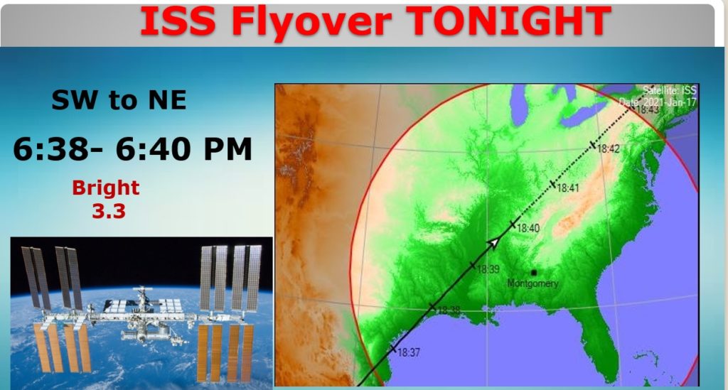
SPACE STATION VISIBLE TONIGHT AND MONDAY: The ISS will be visible this evening around 6:40, across the western and into the northern sky. It will fade out as it loses the light of the sun.
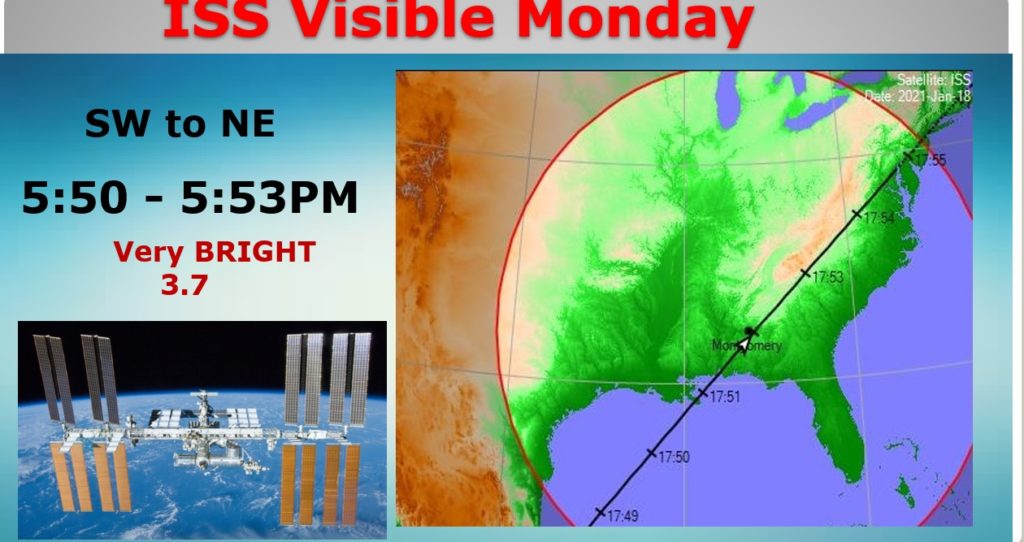
The flyover tomorrow night will be even better. Straight overhead. 5:50 to 5:53. Very bright. Enjoy.
Have a GREAT Sunday! I’ll have a complete video update in the morning.
–Rich