
Good Morning! The weekend weather news is pretty good. Temperatures will be mild for January. (Normal high 58, Low 36) Today and Sunday we’ll be in the low 60’s.
Today should be the best day of the weekend, with a good but of sun. Clouds roll in for tonight and Sunday. There will be a small rain chance starting Sunday afternoon. The better chance of showers and thunderstorms will hold off until Monday and Monday night.
TODAY: Patchy dense fog early. Otherwise, expect a mostly sunny day. High in the lower 60’s. (Wind NE 6 to 12 mph) Increasing clouds tonight. Not as cold. Low 45.
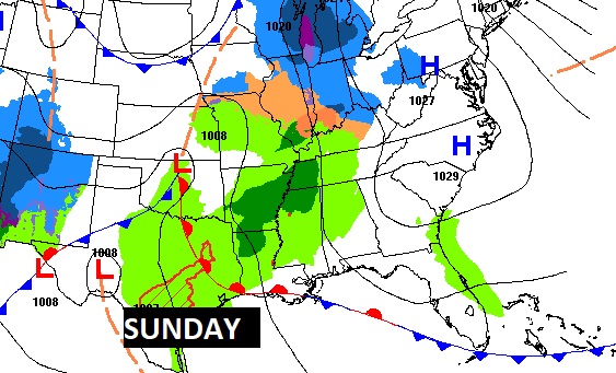
SUNDAY: Mostly cloudy and mild. Widely scattered showers possible. High in the lower 60’s.
The Map shows a northward moving warm front on Sunday.
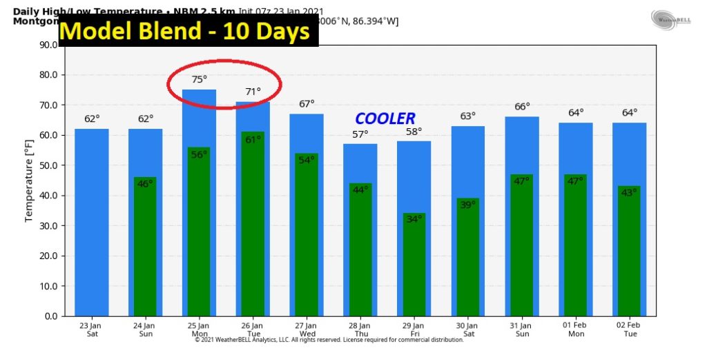
NEXT FEW DAYS: Showers and maybe some thunderstorms become likely by Monday afternoon and Monday night. Warm day…high in the mid 70’s. (more below) Another storm system brings in another round of showers by Wednesday.
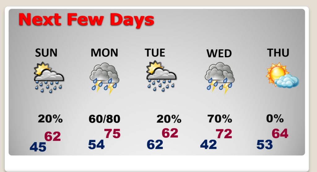
Mild for the next 5 days. (above normal) Then, back to below normal temperatures late next week, Thursday & Friday. Milder next weekend.
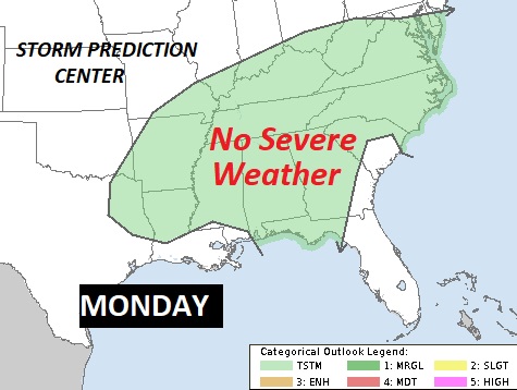
MONDAY STORM SYSTEM: The main event with this storm system rolls through the state Monday night. There probably will be some thunderstorms, but the parameters for any possible severe weather are lacking. The best upper level dynamics will be far northwest of Alabama.
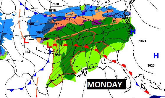
Right now, the Storm Prediction Center has not introduced any severe weather threat. We’ll continue to watch for changes.
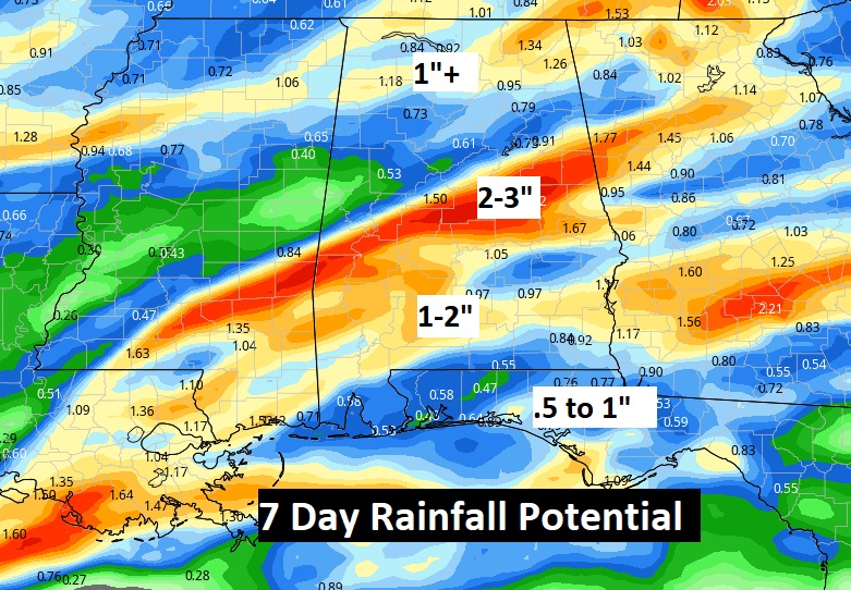
ACTIVE WET PATTERN AHEAD: The Monday and Wednesday storm systems could produce locally heavy rainfall amounts in the week ahead. Perhaps 2”+ in spots.
I’ll have another Blog update early tomorrow morning. Enjoy what should be a great Saturday.
–Rich