Good Morning!
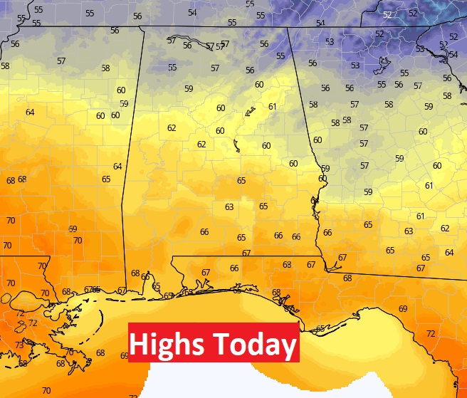
TODAY: Increasing clouds. Very mild again. High in the mid 60’s. (We had a high of 65 yesterday) We should be dry during the day today. Widely scattered showers possible tonight. Mild. Low 56.
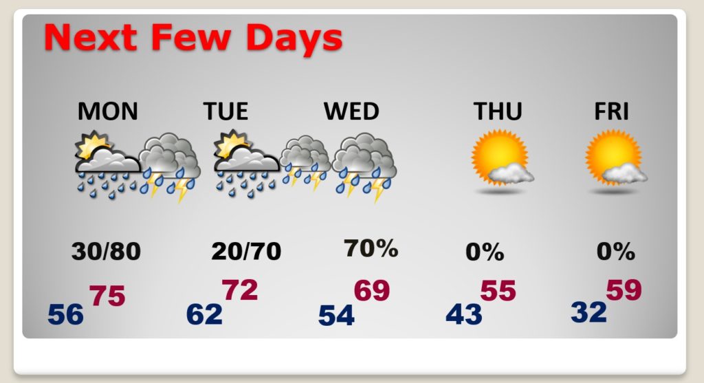
NEXT FEW DAYS: Very warm Monday. Spotty showers possible during the day. Showers and maybe some thunderstorms become likely by Monday night. Warm day…high in the mid 70’s. Another storm system brings in another round of showers by Tuesday Night/Wednesday. Much cooler late week.
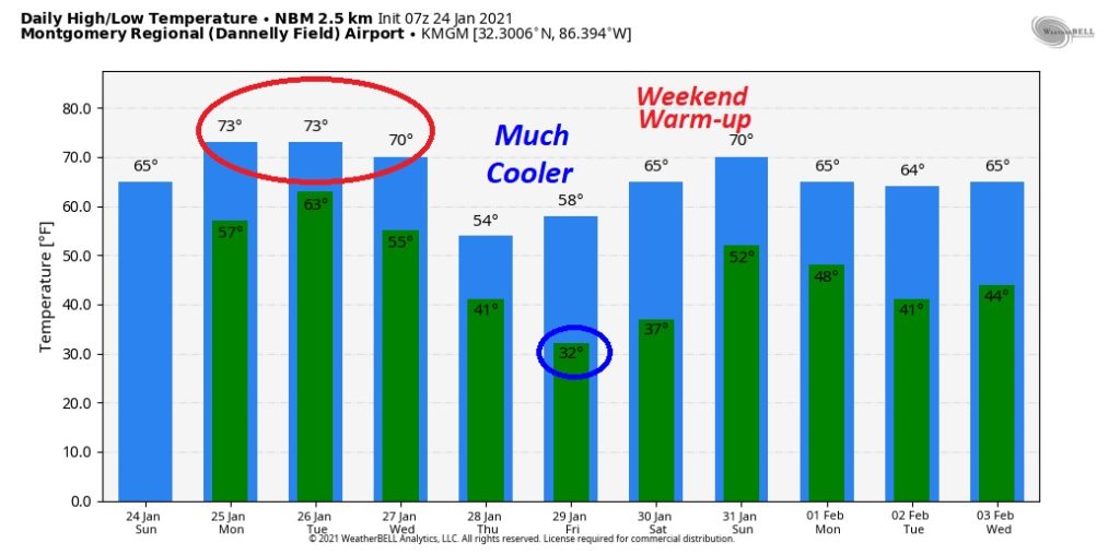
Here’s the 10 day model trend. Very mild through Wednesday. Much cooler Thursday & Friday. Another warm-up next weekend.
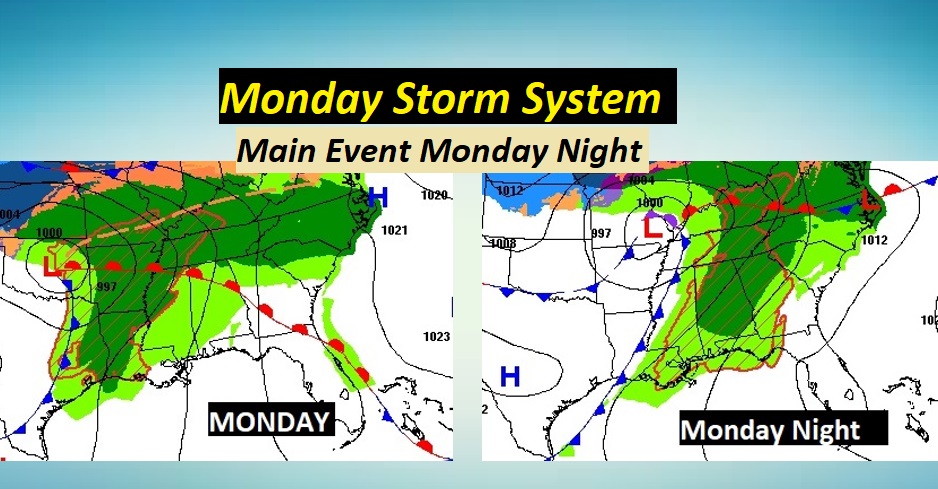
MONDAY STORM SYSTEM: The main event with this storm system rolls through the state Monday night. There probably will be some thunderstorms, but the parameters for any possible severe weather appear to be lacking. The best upper level dynamics will be far northwest of Alabama.
Right now, the Storm Prediction Center has not introduced any severe weather threat. We’ll continue to watch for changes. Check with me on my video in the morning for any changes.
ACTIVE WET PATTERN AHEAD: There will only be a brief break between storm systems. More rain and maybe thunderstorms arrive Tuesday night into Wednesday. The two storm systems could produce locally heavy rainfall amounts in the week ahead. Perhaps 2”+ in spots.
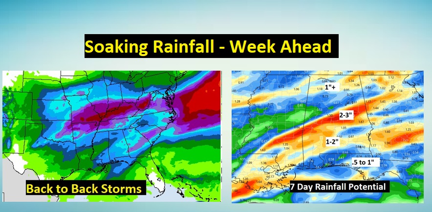
.
Have a GREAT Sunday! I’ll have a complete video update in the morning.
–Rich
