Good Morning! It’s another chilly start in the 30’s this morning. But, the morning chill will fade and we’ll be into the 60’s this afternoon and close to 70 on Sunday.
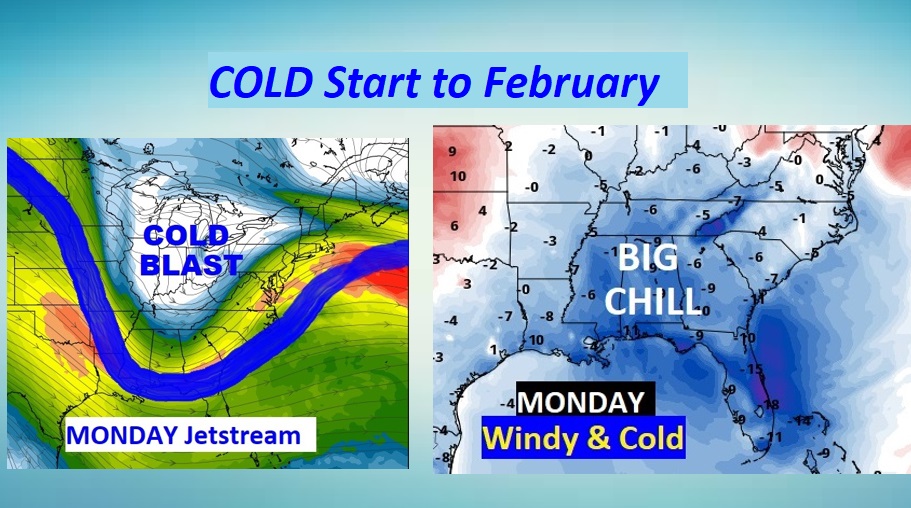
Another storm system will bring in showers late tonight and Sunday morning, but no severe weather is expected. Behind the storm system, here comes another quick shot of very cold air.
You’ll need to dress in layers Monday as the new month of February begins. There will be another, perhaps more potent storm system at the end of next week.
TODAY: The morning chill will fade. Southeast winds 5 to 15 mph will transport warmer air into the state. High today 64. (Normal high 58). Look for a sun cloud mix, with increasing clouds late. Showers become likely late tonight, but mostly after Midnight. Mild. Low 55.
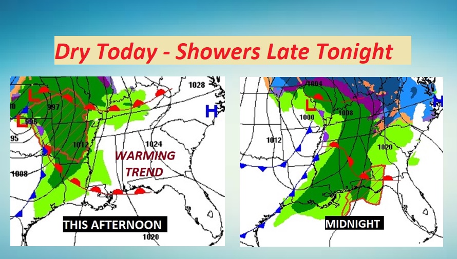
SUNDAY: Risk of showers mainly in the morning. A cold front will swing through the state. Showers should exit east Alabama shortly after lunch. High 71. The colder air will be noticeable by evening. Windy and colder Sunday night. Low 41. Wind chill will be a factor.
COLD MONDAY: Welcome to February. Monday will be brisk and blustery. Highs in the 40’s. North and northwest winds gusting as high as 25 mph will make it seem colder.
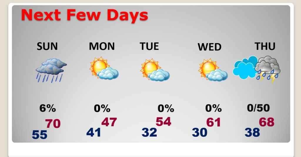
NEXT FEW DAYS: Rain ends by mid-day Sunday. The weekend mild air will be replaced by another quick shot of very chilly air Sunday night and Monday. Expect freezing temps Tuesday and Wednesday, followed by a late week storm system.
The temperature rollercoaster will continue. Here’s a glance at the next ten days on the model blend.
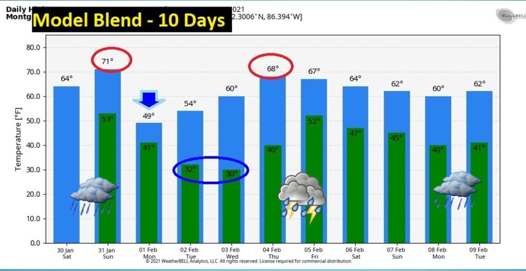
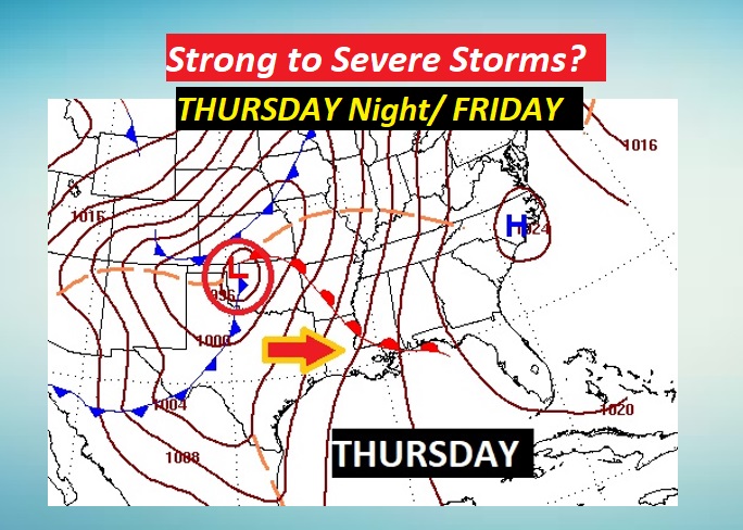
LATE WEEK STORM SYSTEM: Storm system begins to affect the area Thursday night into Friday. This one looks a little stronger. Could we see any strong to severe storms? Too early to say. Stay tuned.
I’ll have another Blog update early tomorrow morning. Enjoy what should be a nice Saturday.
–Rich
