
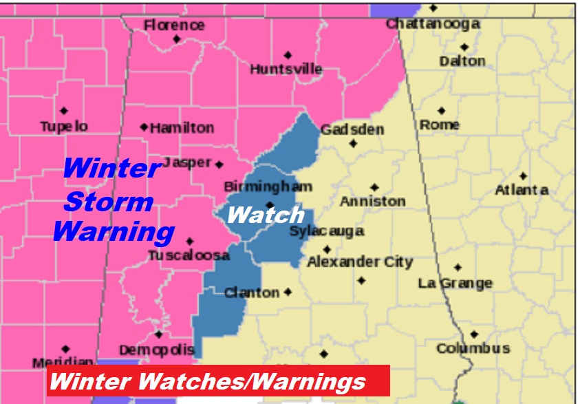
Good Morning! Parts of western and northwestern Alabama are poised for a brush with a Winter Storm. Several west and northwest Alabama counties are under a Winter Storm Warning for possible ice accumulation which could cause significant travel problems. For most of the state, east of a Birmingham, Marion line this will just be a rain event. But, it’ll be a close call.
On this blog update, I’ll tell you about our encounter with colder air behind the storm system. Plus, a look ahead at another potent system arriving Wednesday night into Thursday, and the temperature plunge that follows.
TODAY: Slight chance of rain or drizzle mainly before Noon. Otherwise, a cloudy, dismal day. High near 50. North wind 5 to 10. Slight chance of rain late tonight. Low 45.
ALABAMA WINTER WEATHER ALERTS: Two impulses, one tonight and another on Monday will affect the state with potential winter weather. Much of west and northwest Alabama are under a winter storm warning for a mixture of precipitation, which could lead to an accumulation of ice. A winter storm watch extends as far east at Birmingham and Marion.
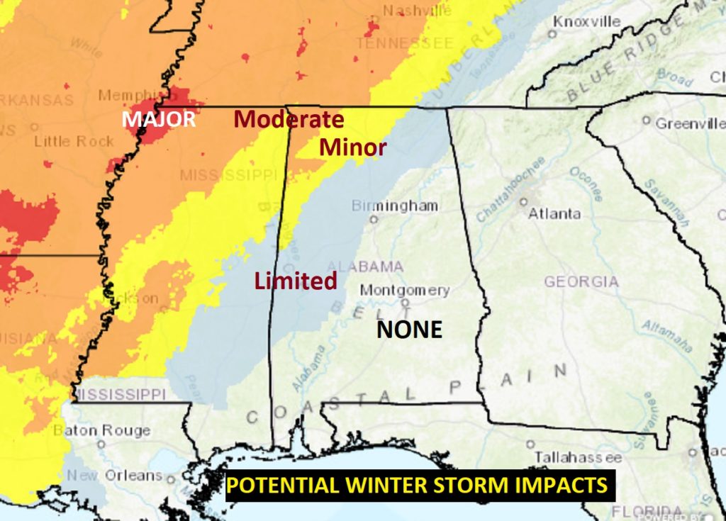
This map shows the expected impacts. Limited impact in blue. Minor in yellow. The moderate impacts are mainly in extreme northwest Alabama.
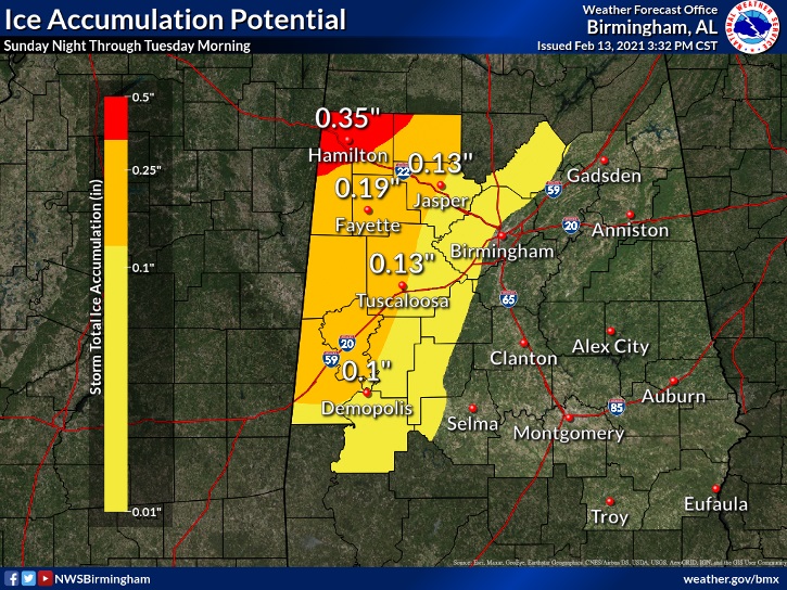
A tenth of an inch or more of ice accumulation is enough to cause significant travel problems. (See map below) That 100+ car pile-up in Texas the other day on I-35 occurred with only .05” of ice on the road.
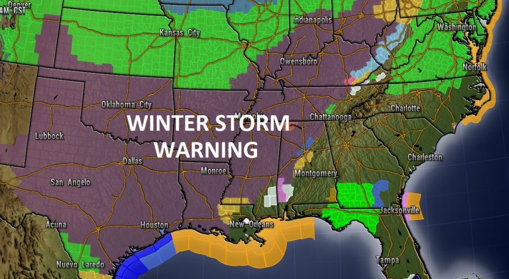
This is a Massive Winter Storm. Take a look at this map. I have never seen a Winter Storm Warning area so large. It extends from Texas to Ohio.
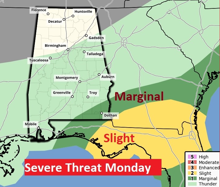
MONDAY: (for central and south Alabama) Small risk of showers in the morning. Best chance of showers and thunderstorms will be in the afternoon & evening hours. High 56. Low 45.
A few stronger storms are possible in southeast Alabama where a Marginal Sever Weather risk has been issued.
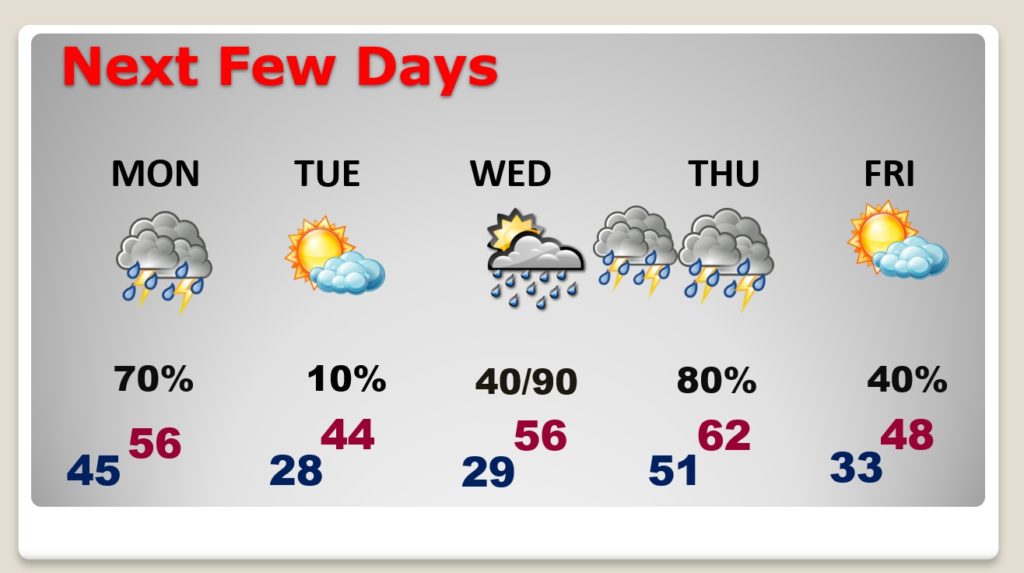
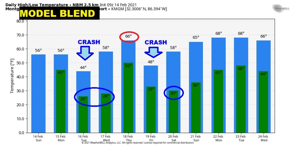
NEXT FEW DAYS: After the Monday storm system, it turns windy and cold Monday night and Tuesday. Tuesday high only in the 40’s, and sub-freezing Tuesday night. Another storm system will bring in a round of rain and thunderstorms Wednesday night into Thursday. It will turn sharply windy & colder behind the storm on Friday.
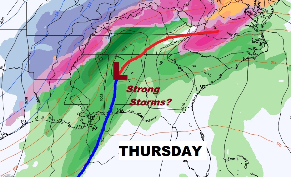
LATE WEEK STORM SYSTEM: Another storm system Wednesday night into Thursday could bring a round of strong to severe storms for much of central and southeast Alabama, especially along and south of I-85 and east of I-65. More on that on my video tomorrow morning
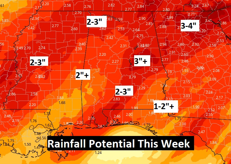
WET TIMES AHEAD: Here’s potential rainfall for the week ahead. Drenching rains. What a week, huh?
LOTS OF UPS AND DOWNS: This map shows how the cold air rushes into Alabama Monday night into Tuesday. The…retreats mid-week, followed by another cold air surge by Friday.
I hope you have a nice Valentine’s Day, despite the weather. I’ll have a complete video update in the morning.
–Rich