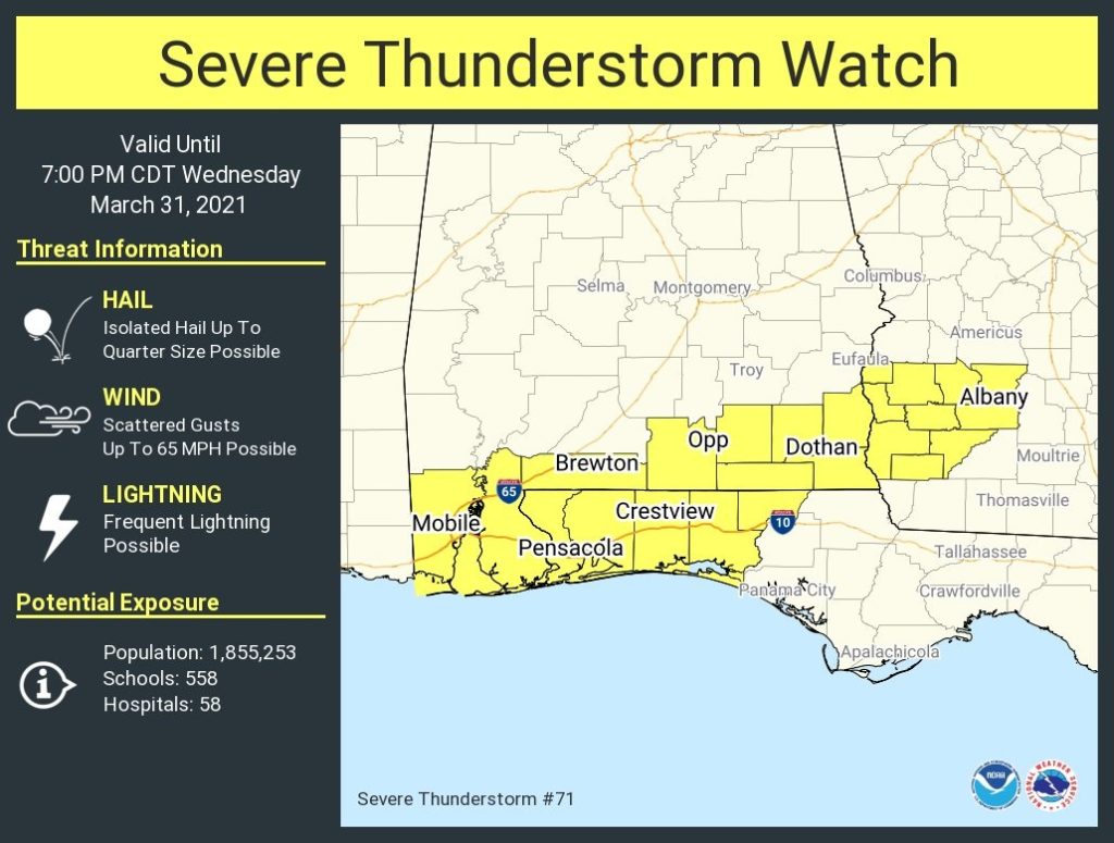
New Severe thunderstorm watch for south Alabama until 7PM
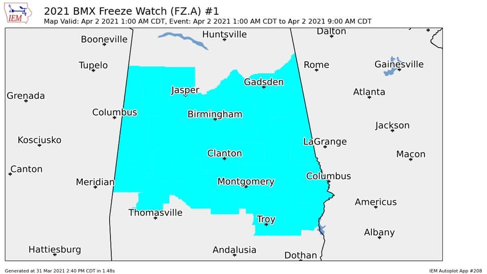
FREEZE WATCH issued for Thursday Night
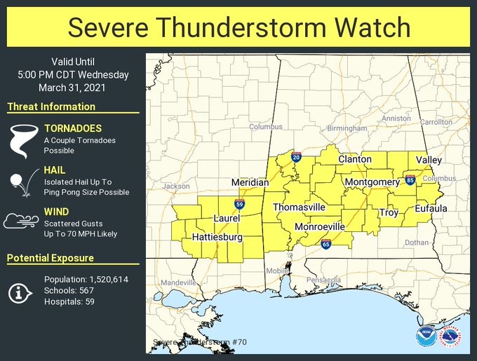
11:10AM:
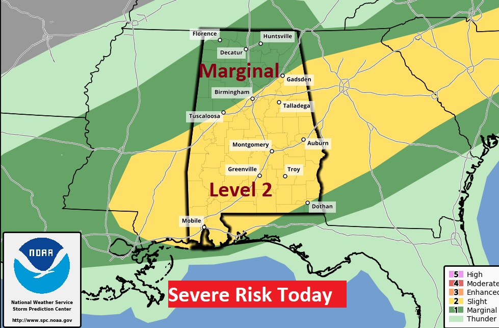
As expected, a Severe Thunderstorm Watch is in effect until 5PM for much of central & south Alabama. Damaging wind gusts up to 70 mph is possible, along with hail up to ping pong size. A couple of tornadoes can’t be ruled out. A line of strong thunderstorms will move southward across the area ahead of a strong cold front. Some storms will reach severe limits. Be weather aware. Our weather app will instantly alert you to a warning for your location.
EARLY MORNING UPDATE:
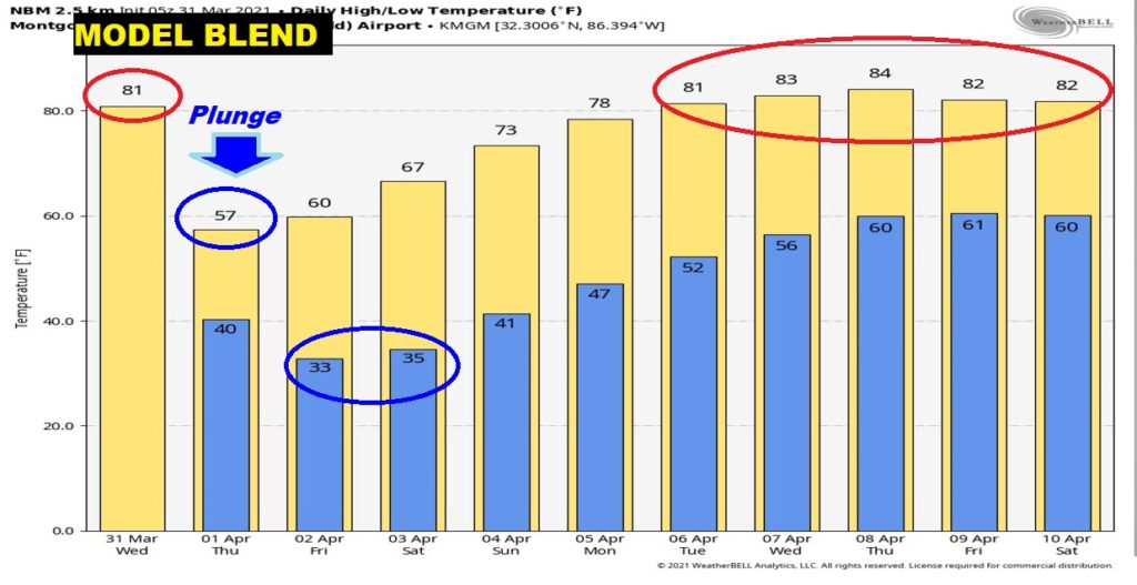
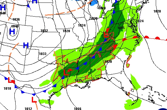
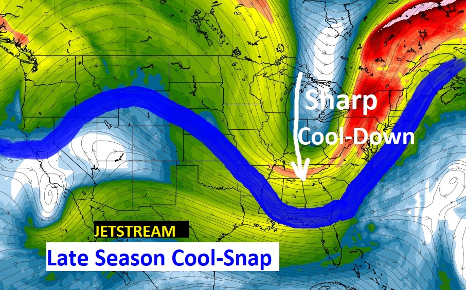
Good Morning! Get ready for big changes. A strong cold front sweeps through the state today. A line of strong/severe storms will precede the front. It will turn sharply colder behind the front. Get ready for a significant late season cool snap. Attention Alabama growers: Frost is a strong likelihood Friday and maybe even Saturday morning. On this video, I’ll tell you about a nearly perfect Easter Sunday Forecast.
Strong Cold front sweeps through the state today. A line of strong/severe storms will precede the front. Level 2 Severe Weather Risk. It will turn sharply colder behind the front.
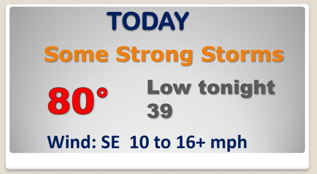
Level 2 Severe Weather Risk. Damaging wind gusts 60+mph is the main risk. Hail possible. Couple of tornadoes can’t be ruled out. Watches and warnings are a good bet.
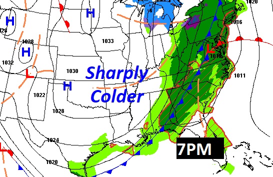
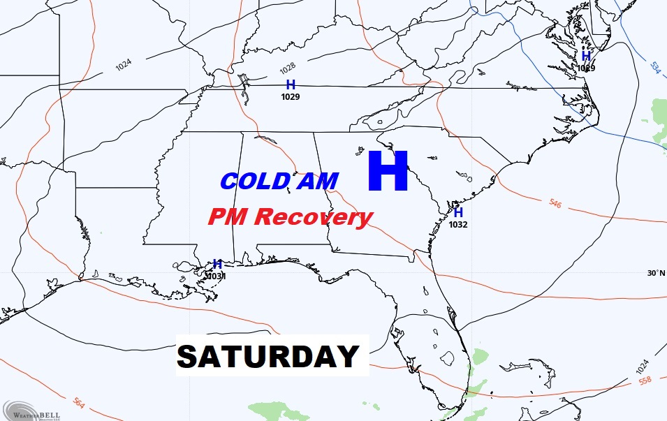
SHARPLY Colder tonight and only in the 50’s on a windy Thursday. Late season cold-snap shocker.
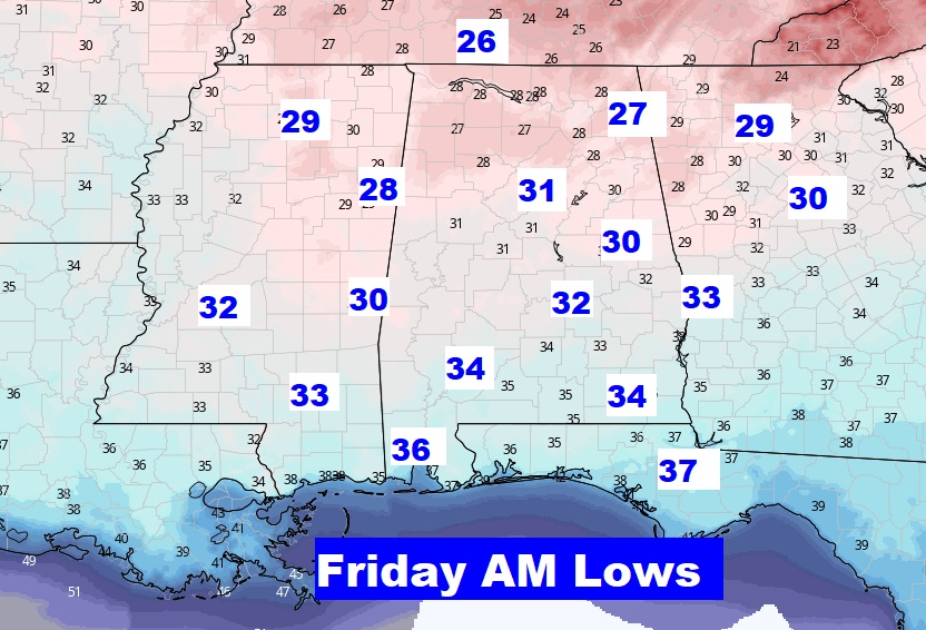
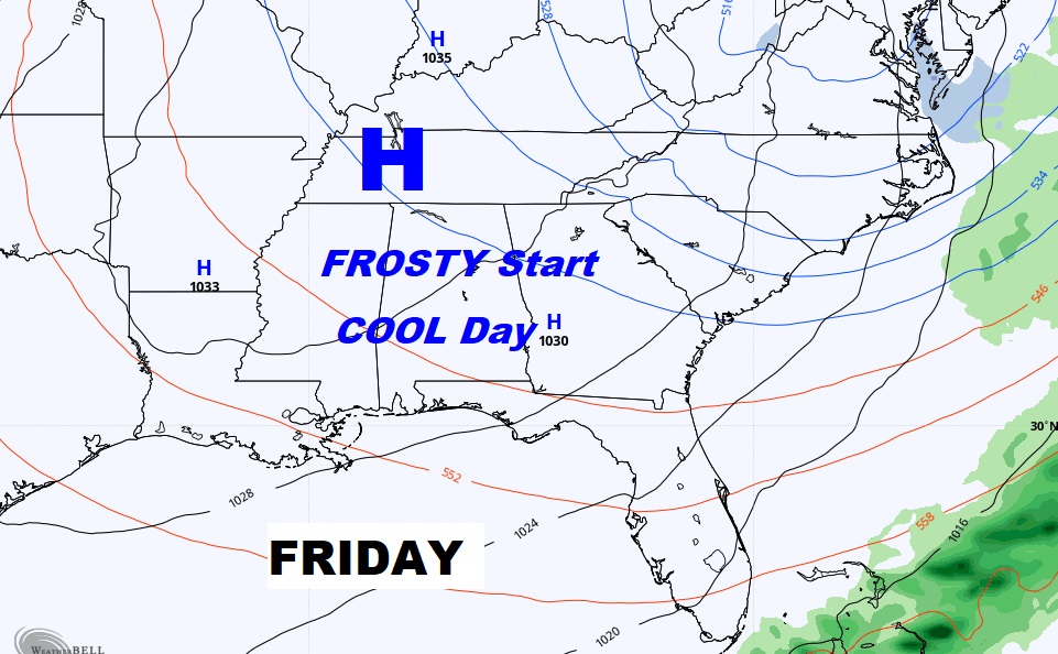
Frost likely Friday & Saturday morning. Near freezing perhaps in Montgomery Friday morning. The record is 30 from 1881.
Beautiful Easter weekend. Nearly perfect Easter Sunday.


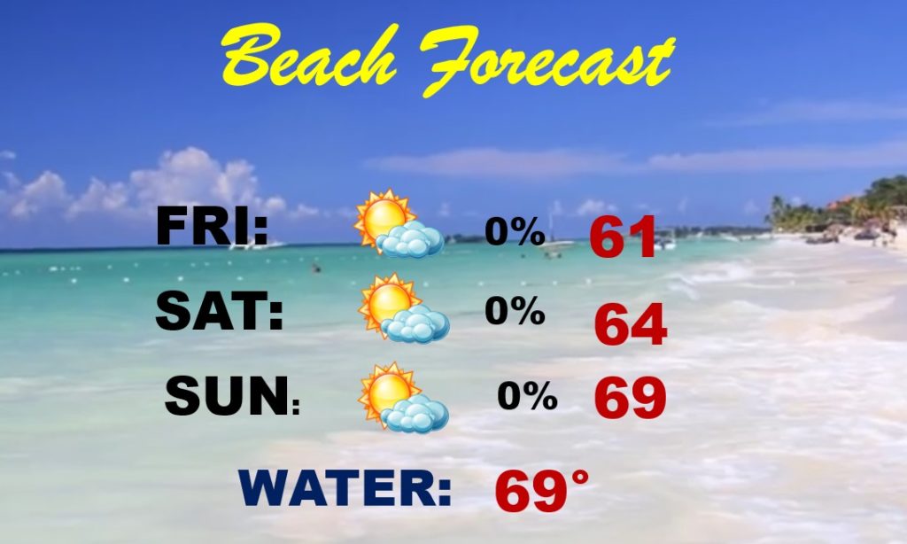
Too cool for the Beach this weekend with lows in the 40’s and highs in the 60’s, but at least the sun is out.
After this Cool-snap, big warming next week. We’re back in the 80’s