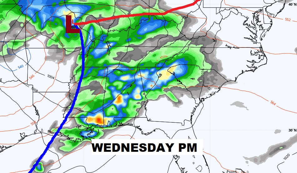
Good Morning! Our incredible string of very warm, storm-free days continues through the weekend. Enjoy it now, because our quiet weather pattern is about come to a screeching halt.
It’s still Winter for six more days. Spring officially begins next Saturday. But, this weekend will feel more like May, with highs in the 80’s.
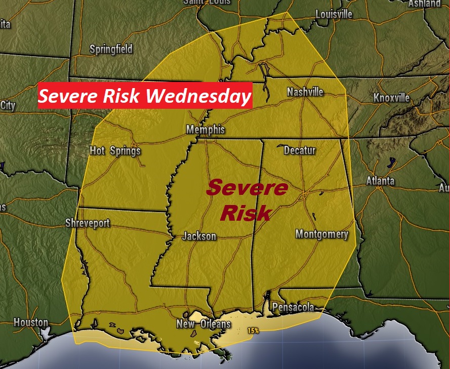
Showers and perhaps a few stronger thunderstorms arrive Monday with storm system number one. The second storm system Wednesday could produce Severe Weather, including the risk of tornadoes.
TODAY: Patchy AM fog in spots. Otherwise, a good but of sunshine, mixed with some high clouds again today. High 83. (Normal high 69) Partly cloudy tonight. Low 55. (Normal 45)
SUNDAY: There will be some extra clouds around. We’ll call it partly sunny. High in the mid 80’s. Chance of showers after midnight Sunday night.
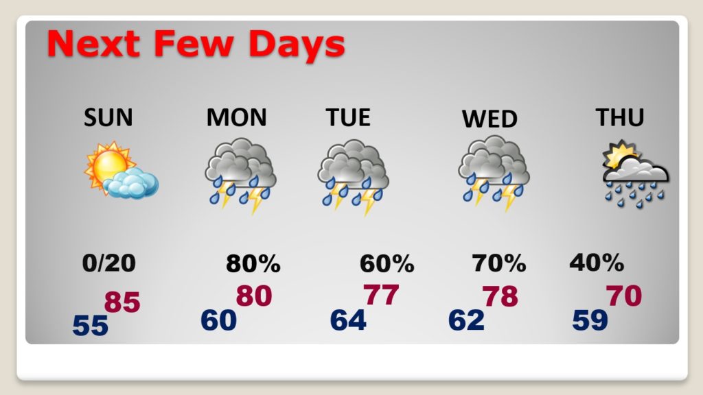
NEXT FEW DAYS: The quite pattern will remain through the weekend. But, get ready. Soon the party will be over. We are about to get into a much wetter, much more active pattern next week, particularly Monday through Wednesday night. Two storm systems will affect the state. A few stronger storms (possibly severe) are not out of the question Monday, but the main severe weather threat will be on Wednesday. (see below)
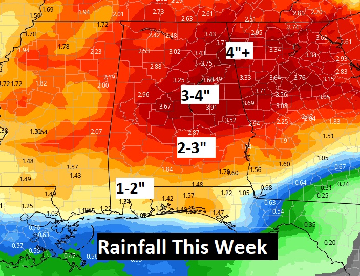
Rainfall this week could be excessive. We need the rain. Sunday will be the 12th dry day. Very rare in March.
SEVERE WEATHER RISK THIS WEEK: Although a few strong storms are possible on Monday, by far the stronger severe risk will be on Wednesday (St. Patrick’s Day), and particularly from Wednesday afternoon through Wednesday evening, and into Wednesday night. It’s rare when the Storm Prediction Center issues a Severe Risk five days out. All modes of severe weather will be on the table including tornadoes. We’ll continue to monitor this developing threat as we get closer to Wednesday.
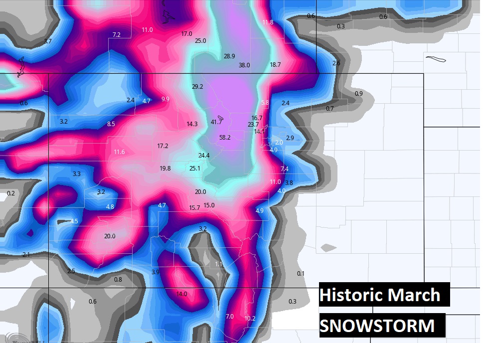
MASSIVE STORM SYSTEM OUT WEST: There’s a very interesting contrast going on in the United States this weekend. The set-up is classic. While May-like Warmth continues across the South, much of the intermountain West, especially Colorado, is bracing for one of the biggest March snowstorms in weather history.
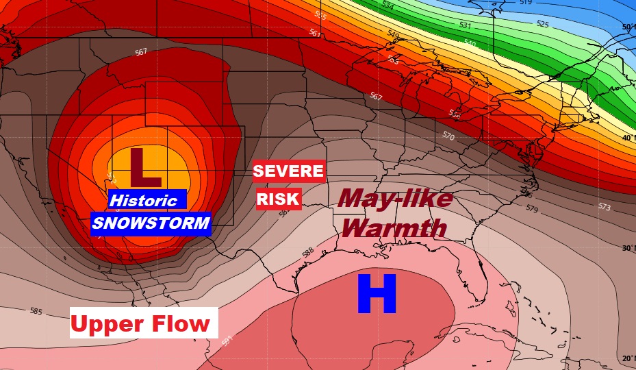
In Colorado, they will be measuring snowfall in feet. Up to five feet in spots.
.
SPRING FORWARD: You’ve been reminded a million times already…. Here’s one more reminder about the time change tonight.

I hope you have a chance to enjoy this beautiful Weekend. I’ll have a complete video update tomorrow morning.
–Rich

