Good Morning! Welcome to Central Daylight time. Our tranquil weather pattern ends today. Get ready for a new reality in the week ahead.
Showers and storms return to the state tomorrow through Wednesday. Locally heavy rainfall totals are possible. Wednesday, St. Patrick’s Day, is shaping up to be a Severe Weather Day. In fact, the Storm Prediction Center has a big chuck of the state in an ENHANCED Severe Weather Risk, including the risk of tornadoes.
Much cooler air arrives at the end of the week.
TODAY: Periods of sun & clouds. Still much above normal. High today 84. Looks like we may tease the record high of 85 from 1989. (Yesterday’s high 83, Normal high 69) South wind 4 to 8. Mostly cloudy tonight. Widely scattered showers late tonight. Low 60.
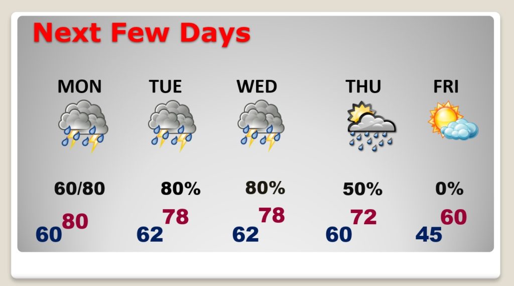
NEXT FEW DAYS: Showers and thunderstorms are likely Monday through Wednesday. Severe Weather Threat Wednesday. (more below). Risk of leftover showers Thursday. Much cooler by Friday. Lows in the 40’s, highs in the lower 60’s.
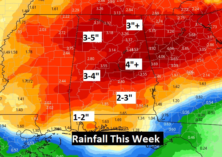
We need rain and it appears we may get a heaping heling this week. Rainfall totals could be excessive.
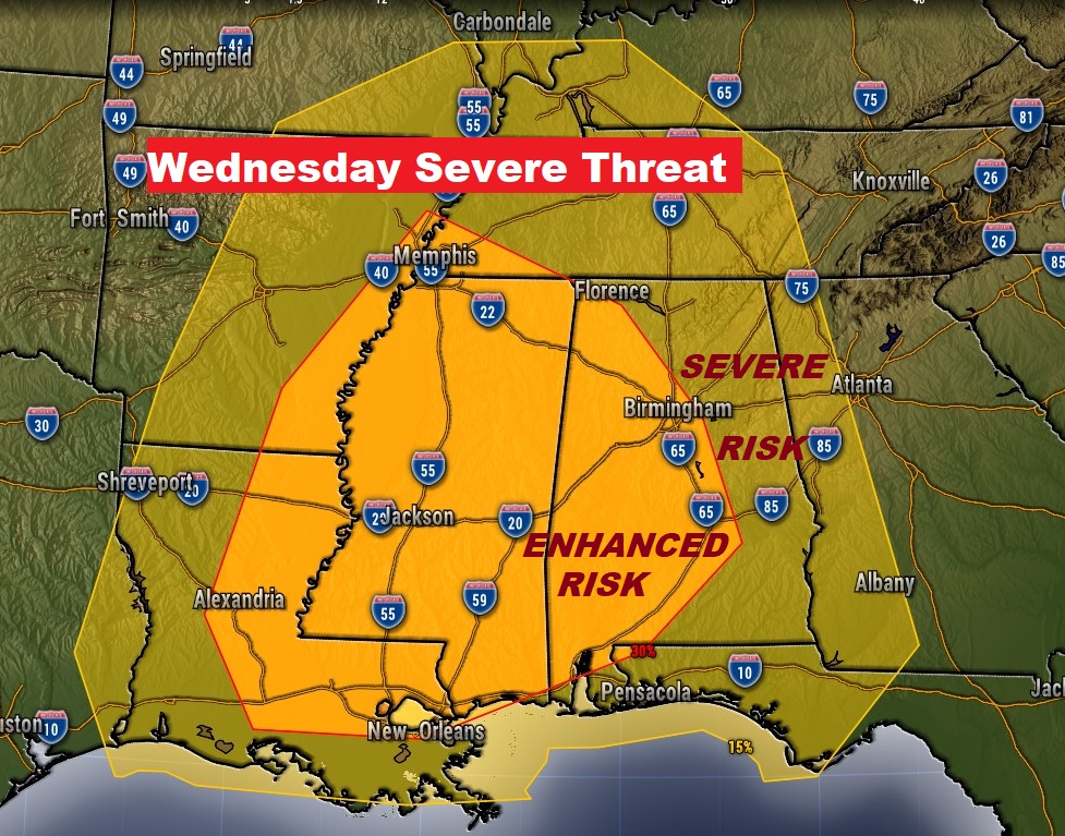
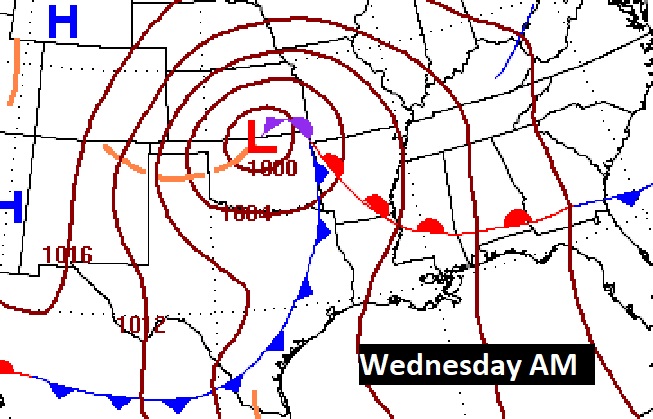
WEDSNESDAY SEVERE WEATHER THREAT: Many parameters are coming together for what appears to be a potentially significant severe weather risk for much of the state. It always gets our attention when the Storm Prediction Center issues a 15% severe risk beyond Day 3. But, in this case, SPC has an Enhanced Risk (30%) covering much of the western half of the state. It is in this area where the Tornado Risk will be the highest, particularly Wednesday afternoon and evening.
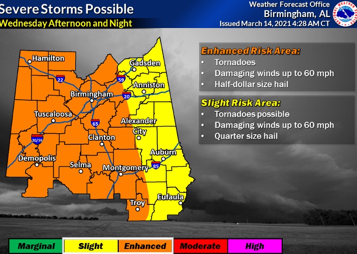
Here’s another map from the local NWS Office in Birmingham. It shows the enhanced risk as far east as a Alex City/Troy Enterprise line Wednesday afternoon & night. In the Enhanced risk area, it lists the threat for Tornadoes, Damaging winds 60+ mph and half dollar size hail.
Wednesday morning, severe weather will be ongoing across parts of Arkansas, Louisiana and Mississippi. The threat across Alabama will increase by afternoon as a warm front moves northward.
AFTER THE STORM: Much cooler Friday and Saturday. Looks like storm-free first weekend of Spring. Spring begins Saturday morning at 4:37 AM. Looks like there could be another significant severe weather threat before this month is over.
I hope you have a chance to enjoy this beautiful Sunday. I’ll have a complete video update tomorrow morning. I’ll update you on the Wednesday Severe threat.
–Rich
