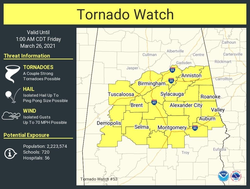
7:45PM:
New Tornado Watch issued by the Storm Prediction Center for much of central Alabama. until 1AM. A couple of strong tornadoes are possible. Wind gusts to 70 mph. Ping pong size hail.
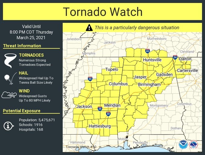
11:30AM:
A PDS tornado watch has been issued. Particularly dangerous situation. It includes a large section of Mississippi, the northwest half of Alabama, parts of GA & TN until 8PM tonight. Damaging winds to 80 mph, Tennis ball size hail, are also possible. It extends as far east at Dallas county in Central Alabama. All of us are in some risk for severe weather this afternoon, this evening & tonight. Several strong, long-tracked tornadoes are possible. Stay weather aware.
EARLY MORINING UPDATE:
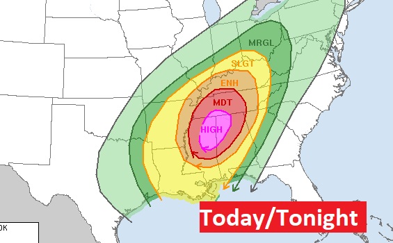
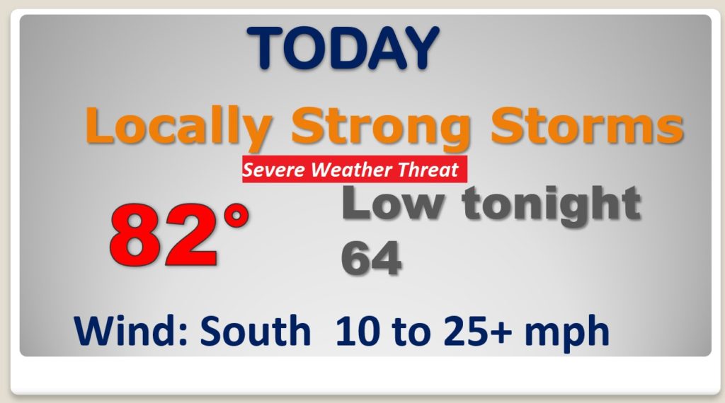
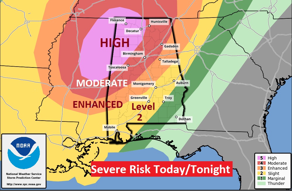
Unfortunately, here we go again. Only 8 days ago, our state had a historic tornado outbreak. More than 2 dozen tornadoes. Today, again, part of our state is in a rare HIGH RISK. ALL of us are in some risk level for severe thunderstorms and tornadoes today and tonight. On this video, I’ll bring you up to speed on the latest time line and threat levels. We’ll look ahead to the weekend and beyond.
It’s still only March and we are poised for yet another significant tornado risk in Alabama today and tonight.
AMAZING to see HIGH RISK on the map again. But, ALL of us need to be concerned, and watchful. ALL of us have a tornado risk, even in the Level 1 areas of southeast Alabama. In northwest Alabama, violent, long-track tornadoes are probable. Life-threatening set-up in Alabama today.
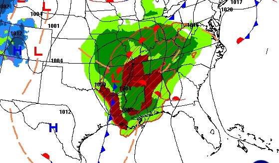
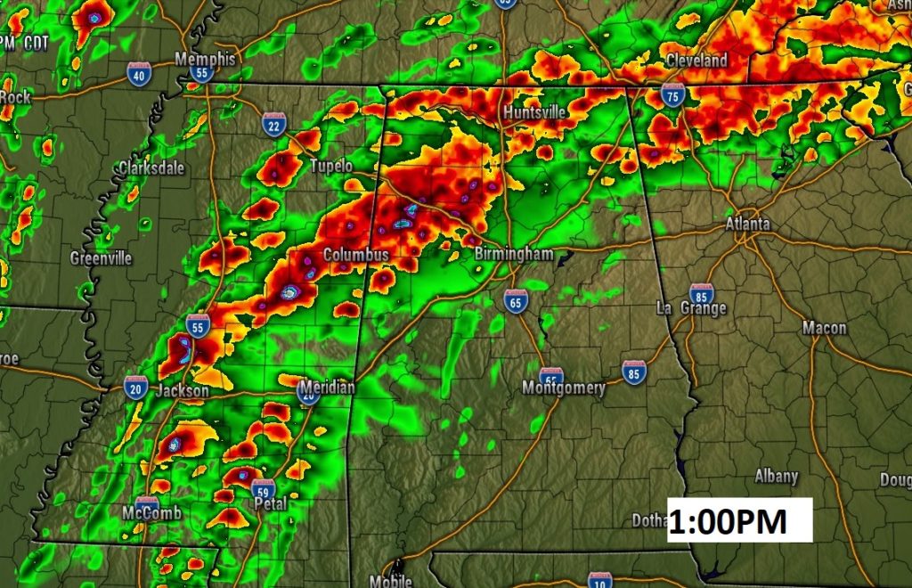
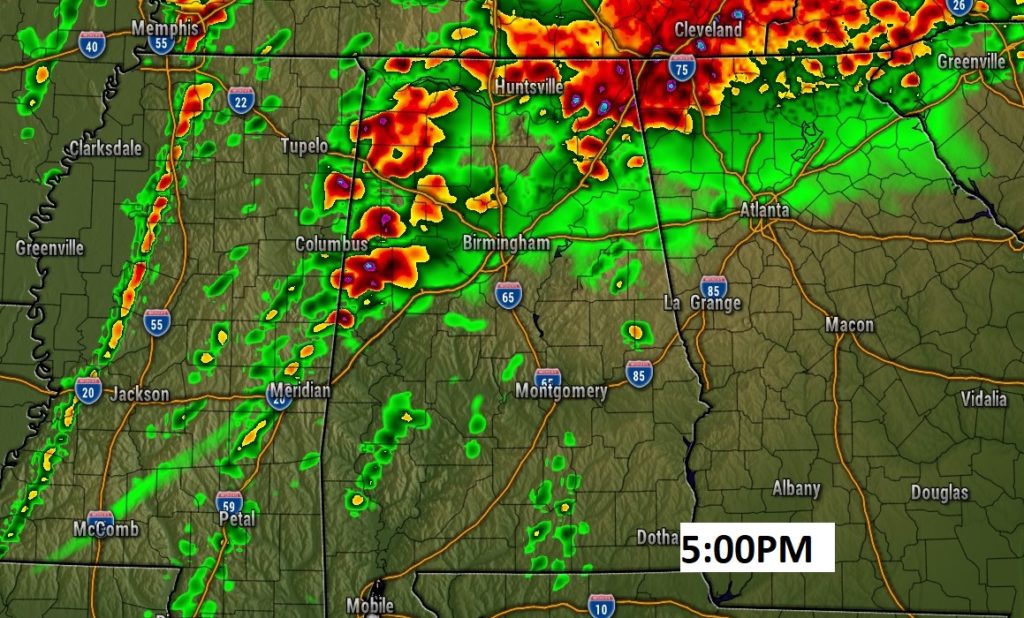
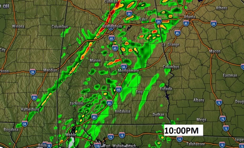
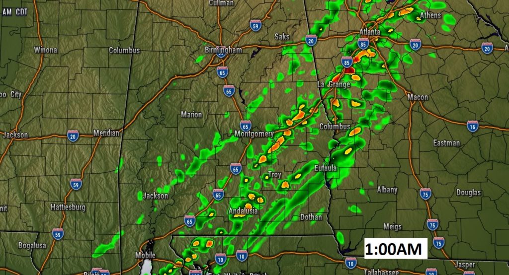
A few Future Radar Snapshots, showing the evolution of the tornadic supercells today and tonight.
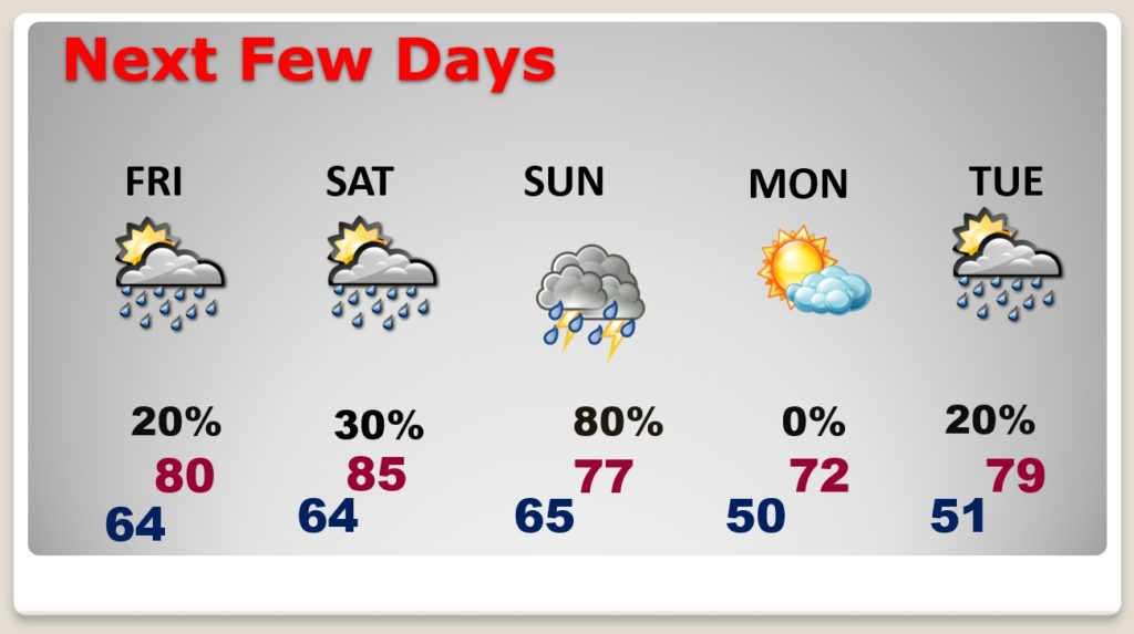
Risk of rain in the forecast through the weekend, especially Sunday. Monday looks dry. More rain possible Tuesday.
