Good Morning! Could we be close to a record this morning, around Dawn? It sure is possible. The Montgomery record is 33 (from 1987 and 1993). We’ll be in the neighborhood, as our late season cool-snap continues. Today will still be way below normal, but not quite as cool as yesterday and certainly not nearly as breezy.
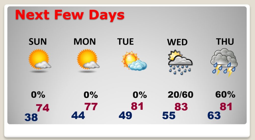
Easter Sunday looks picture-postcard PERFECT. Nice warming trend Monday and Tuesday. Risk of showers and storms returns Wednesday and Thursday. Any severe weather this week? Scroll down.
TODAY: Near record-low at Dawn. Risk of frost. Perhaps a freeze. Total sunshine today. High 67. East wind 6 to 11. Clear and cold tonight. Low 38.
EASTER SUNDAY: Just about perfect. After the morning chill wears off…nice afternoon warming. High 74. (that’s the normal high) East wind at 4 to 8 mph. Last Easter there were 29 tornadoes in the state, and 159 tornadoes across the south.

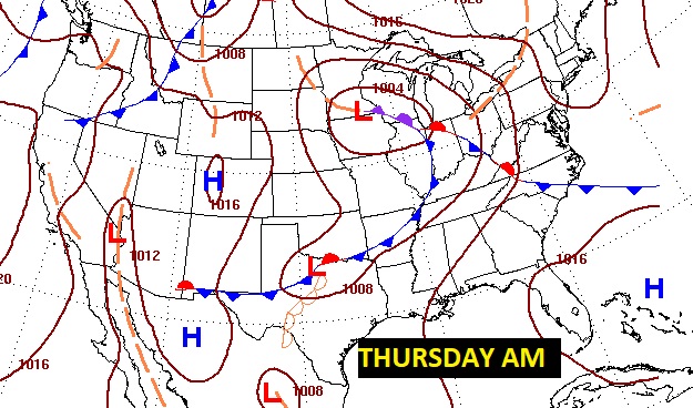
NEXT FEW DAYS: Easter Sunday looks nearly perfect. Chilly start. Nice Day. Warming trend Monday and Tuesday. Risk of showers and thunderstorms by Wednesday afternoon. Better chance Wednesday night and Thursday. (see below on severe weather potential)

SEVERE THREAT NEXT WEEK?: Details are not clear on the storm system that will effect the state by Wednesday night/Thursday. Could there be a severe weather potential? Maybe. But confidence in the forecast is very low this far out. Stay tuned.

MARCH TORNADO COUNT: So far April has been tranquil. Meanwhile, the March tornado count has increased yet again. There were 3 more tornadoes surveyed in the state from that Wednesday storm system (March 31st.) There were 25 tornadoes on March 17th, and 11 more tornadoes on March 25th. That brings the March Alabama tornado total to 39. The number of STRONG tornadoes (EF-2 or higher) is a staggering ten. (Including 4 EF-3’s!) An awful tornado month.
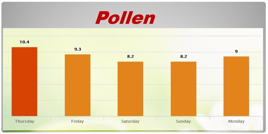
POLLEN: The pollen count will be in the medium to high range for the next few days.

.
There will be another blog update in the morning. Have a nice Easter weekend!
–Rich
