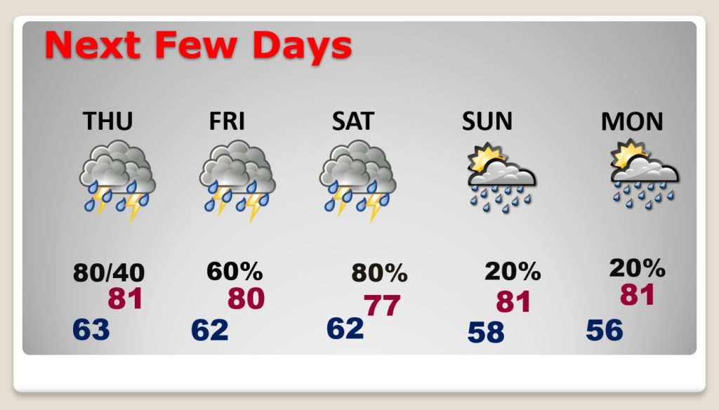
Good Morning! Our extended string of storm-free days is ending. We are about to get into a west and active pattern for a few days. A series of storm systems will bring in rounds of showers & storms through the area from late tonight through Saturday. Some storms will be strong, possibly severe early tomorrow and Friday, and perhaps Saturday. Rainfall amounts could be excessive. I’ll walk you through the details through the weekend for here and the Gulf Coast Beaches.
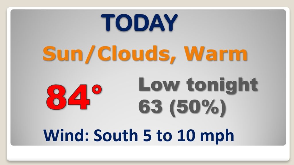
Enjoy another tranquil day. Big weather changes area ahead. Today will be warm and dry. Risk of thunderstorms by late tonight.
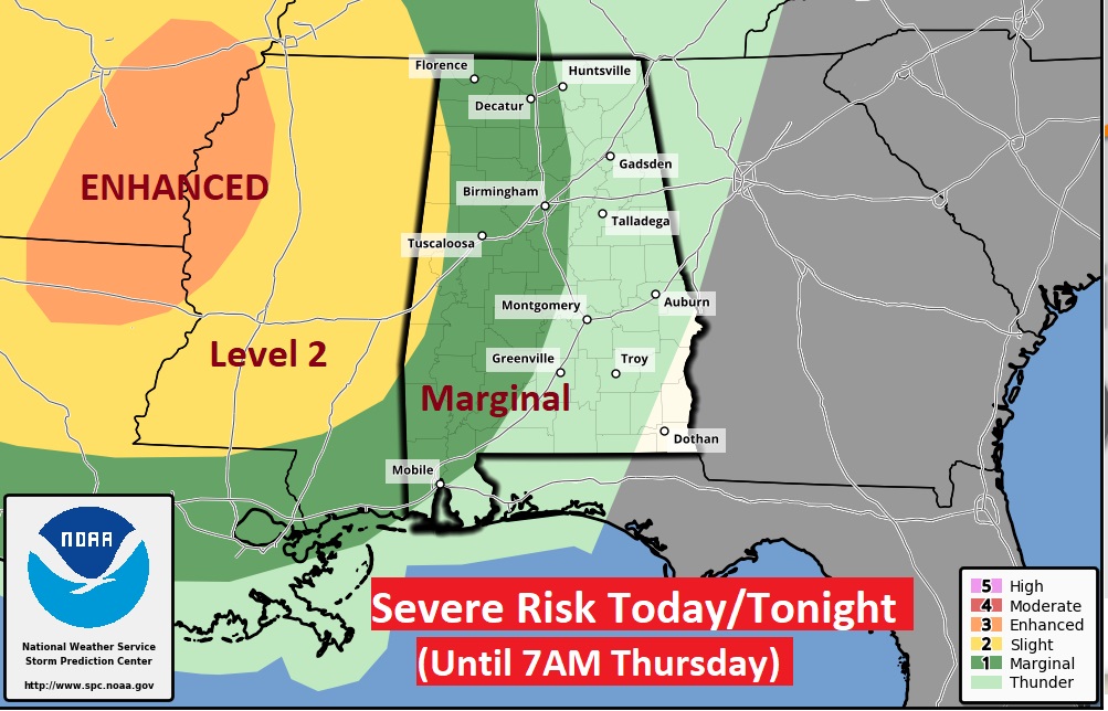
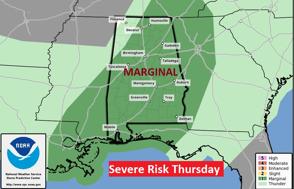
Strong to severe storms enter the state late tonight. Marginal Severe Risk from SPC through 7AM Thursday on the Day one outlook and Marginal Severe Risk area wide Thursday. Damaging wind gusts are the main risk.
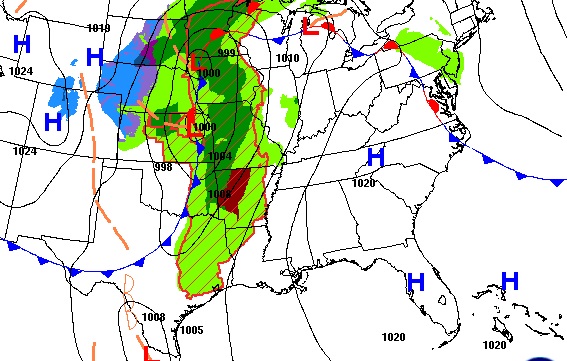
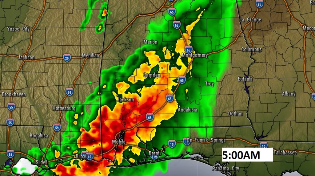
Here’s one Hi-res model showing the storms moving into central Alabama before Dawn tomorrow morning. Some other models are a little slower.
After today…a very west and active weather pattern through Saturday.
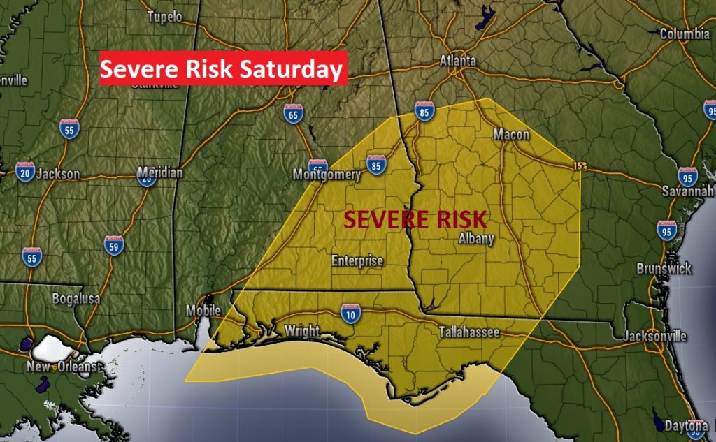
Another concerning system approaches Saturday. Could this system have a severe weather potential? Quite possibly.
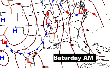
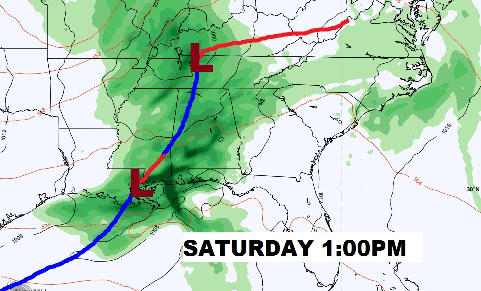
Right now the Storm Prediction Center says the greatest risk of Severe Storms and possible tornadoes will be east of I-65 and generally south of the I-85/U.S 80 corridor. This certainly could be adjusted as we get closer to Saturday.
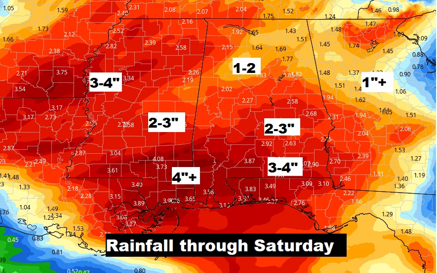
Rainfall amounts through Saturday could be excessive in spots. Flooding could be an issue.