Good Morning! A series of storm systems will affect us the next 3-4 days. There is a severe weather risk each day through Saturday. Today’s main threat will be early in the day. Tomorrow, strong to severe storms could bring damaging wind gusts. Another severe threat begins early Saturday, and will include a tornado threat, as well. Rainfall amounts next 3 days could be excessive in spots. On this video I’ll walk you through the details.
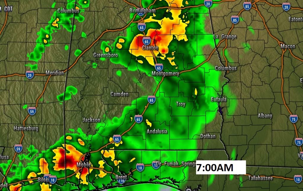
Today’s severe threat will be primarily early in the day with a weakening line of storms heading southeastward. Damaging wind gusts are possible.
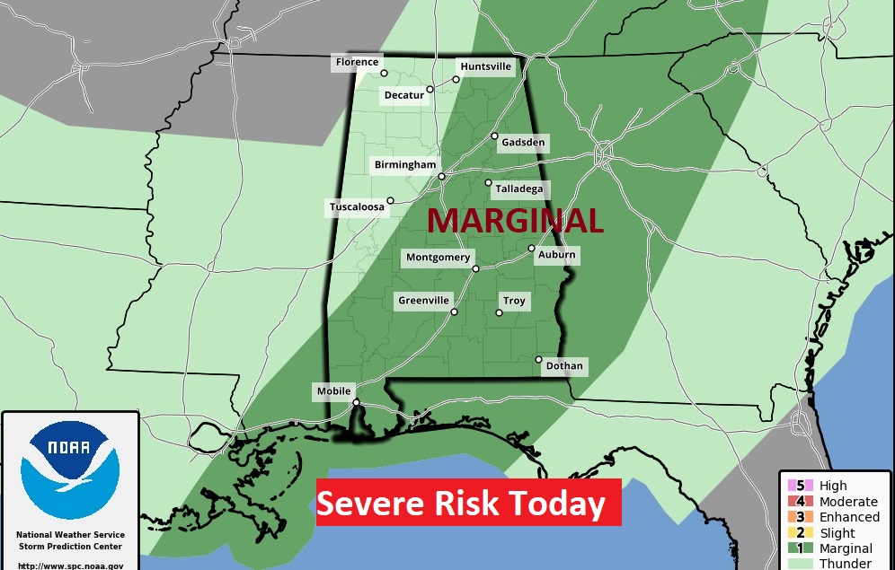
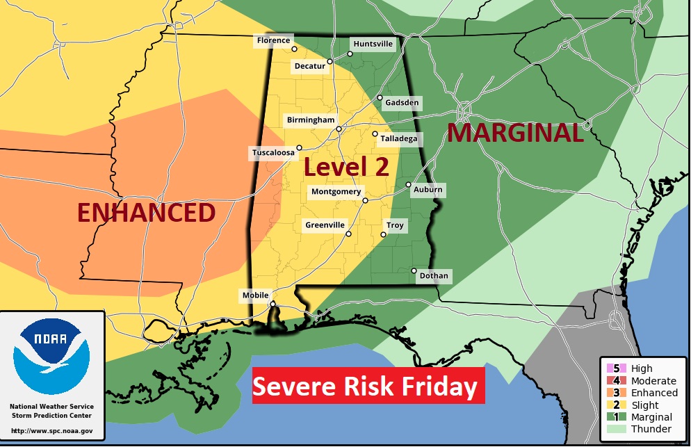
Friday…strong to severe storms are possible in the afternoon and evening. Damaging wind gusts are certainly possible. The tornado threat tomorrow afternoon and evening is relatively low. However, this risk map continues until 7AM Saturday. A second round of severe storms will enter the state overnight Friday and through early Saturday morning, including a tornado threat.’
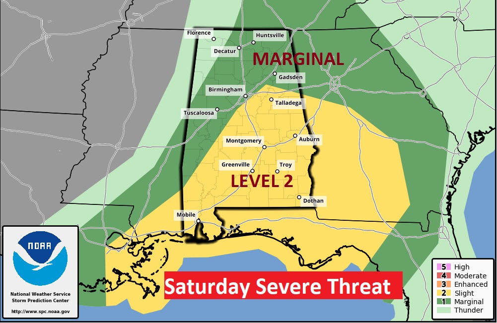
At 7AM Saturday, when the Day 3 outlook begins, sever weather will be ongoing in west moving into central and then southeast Alabama. All modes of severe weather are on the table including damaging winds, hail and tornadoes.
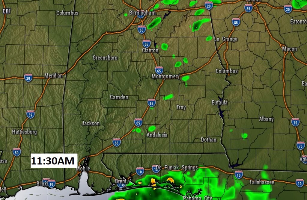
Rainfall amounts over the next few days could be excessive in spots.
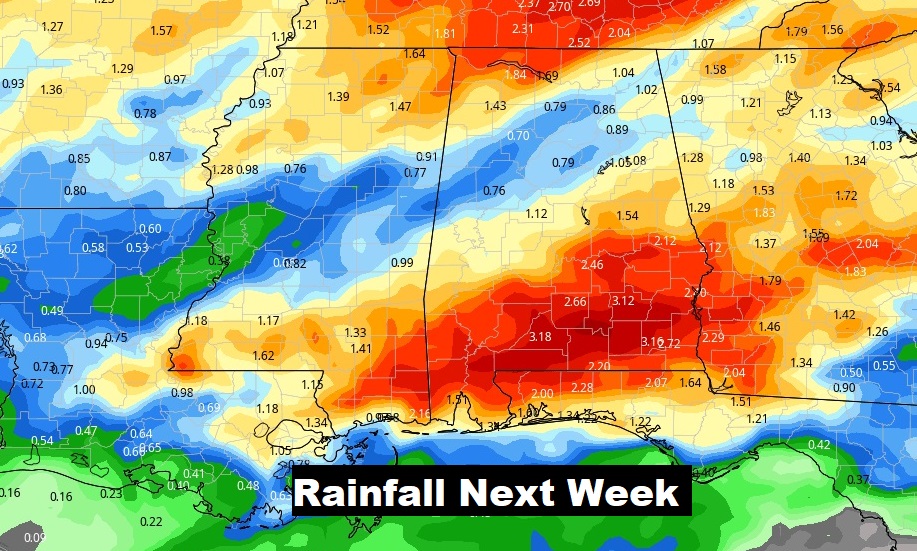
Wet and active through Saturday. I’ll leave in a small rain chance, for now, in the Sunday & Monday outlook.
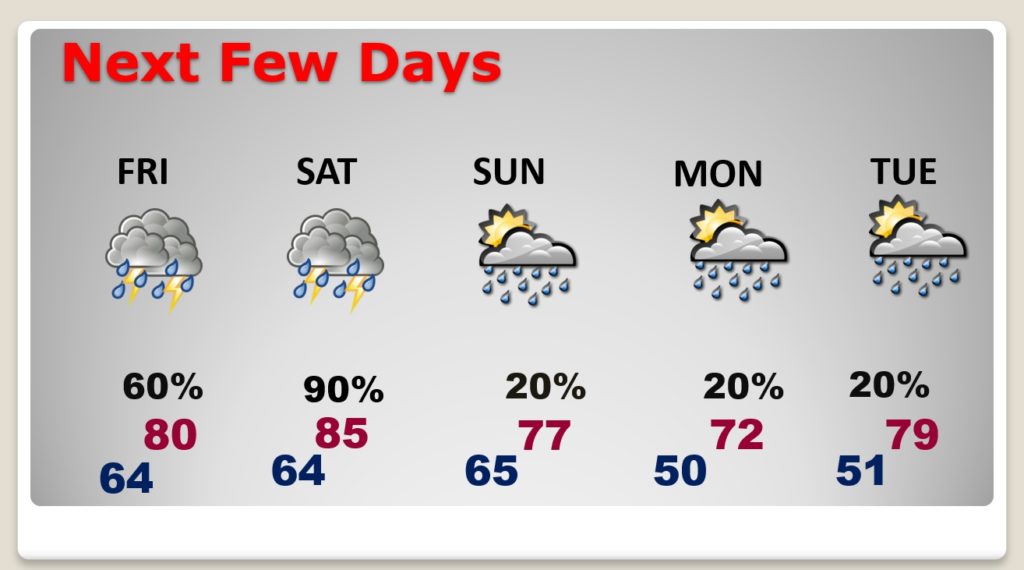
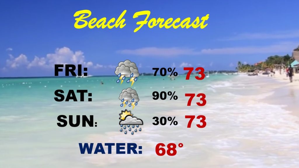
Obviously not a good Beach Forecast at all…