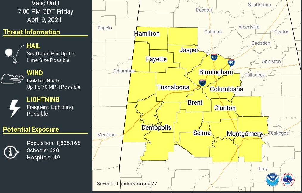
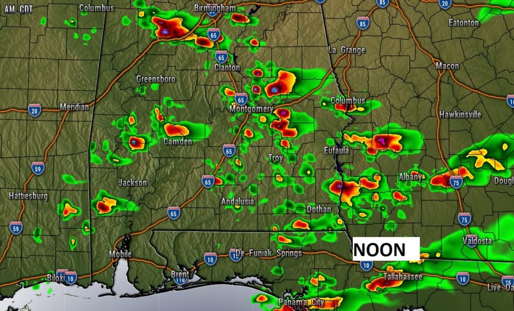
SEVERE THUNDERSTORM WATCH (12:45 pm 4/9/21)Severe thunderstorm watch is in effect for much of central and west Alabama until 7pm. Damaging thunderstorm winds and hail up to Lime size is possible. This is round one of Severe Weather. A second severe weather round will begin during the wee hours of Saturday morning and spread eastward during the morning. Damaging winds, large hail and tornadoes will be possible with Round Two. Stay weather aware.
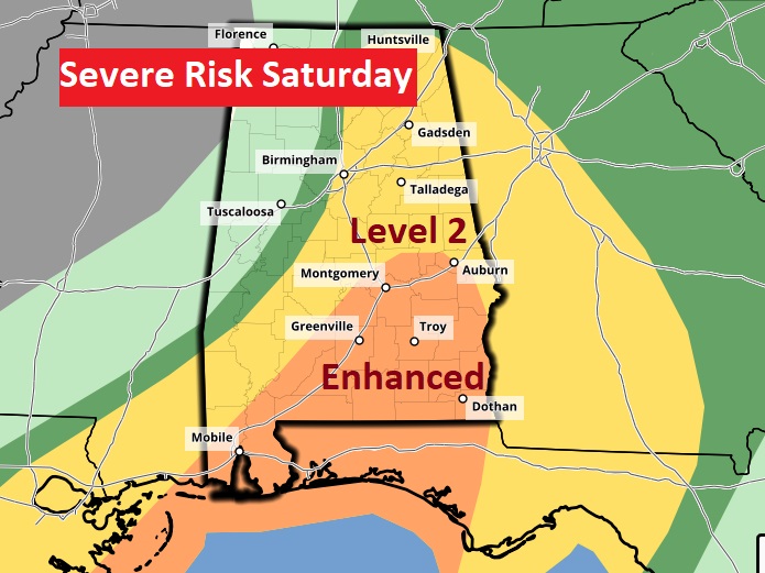
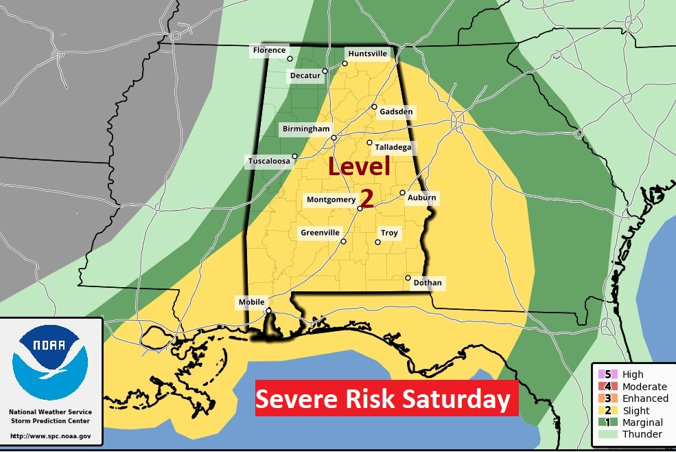
UPDATED Severe Weather Risk for Saturday, starting at 7AM. New ENHANCED risk for much of central and Southeast Alabama. Particularly high risk of widespread wind damage, large hail and risk of tornadoes.
EARLY MORNING UPDATE:
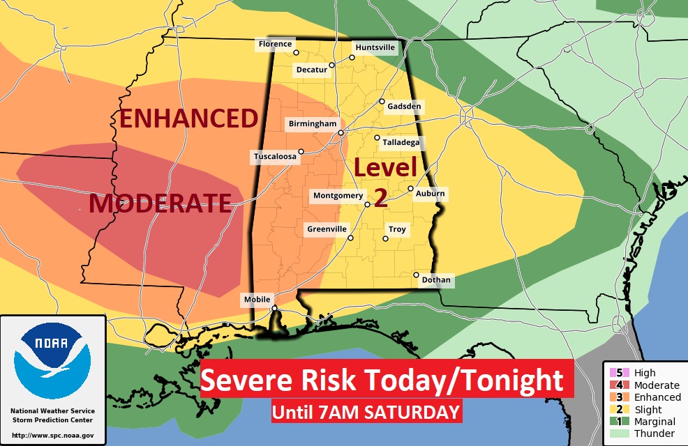
Strap yourself in for a rather rough times, with multiple rounds of severe weather, starting today, and beginning again in the overnight hours late tonight through Saturday morning, and into SE Alabama later Saturday. Today’s storms will produce damaging winds & Large Hail. The Saturday AM round, will produce all modes of Severe Weather including tornadoes. Sunday will be a better day. It’s a complicated forecast, but I’ll do my best to break it down for you on this video.
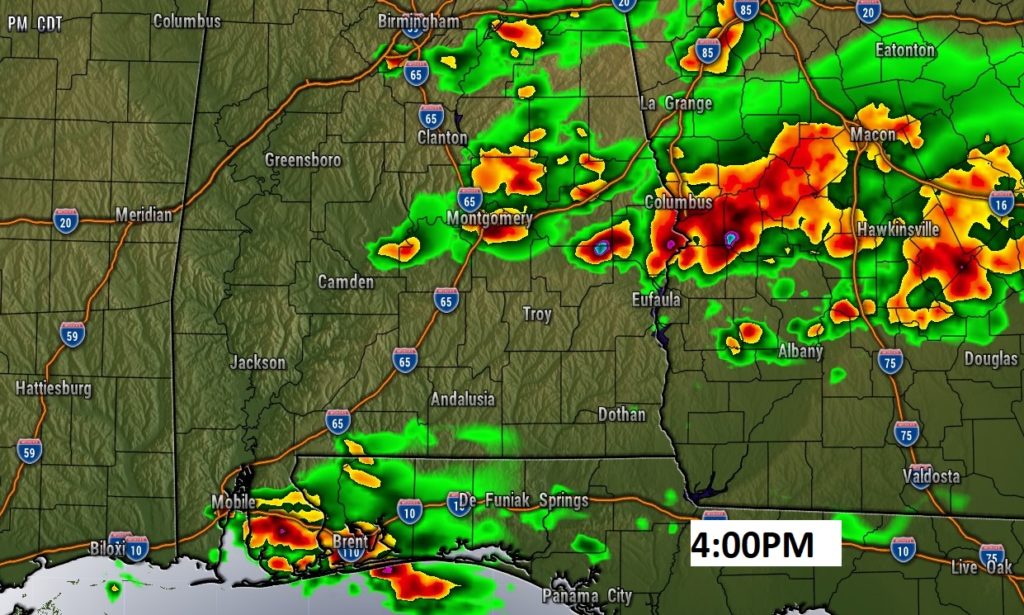
ROUND one of severe weather today could produce some particularly LARGE hail and Damaging wind gusts. Keep in mind…this severe weather outlook is a little deceiving, in that the outlook continues until 7AM Saturday…so it incudes the afternoon threat today and the overnight and ongoing Saturday morning threat as well.
Today…scattered supercell thunderstorms will produce particularly Large Hail and damaging winds to 70+ mph.
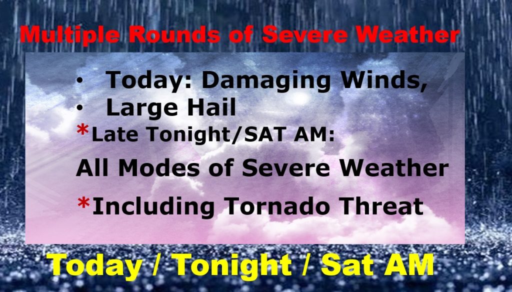
Severe Weather event which will begin in west Alabama at Midnight tonight and through Saturday morning could be quite dangerous with all modes of severe weather. Could be a significant damaging wind event and it will include the risk of tornadoes, too.
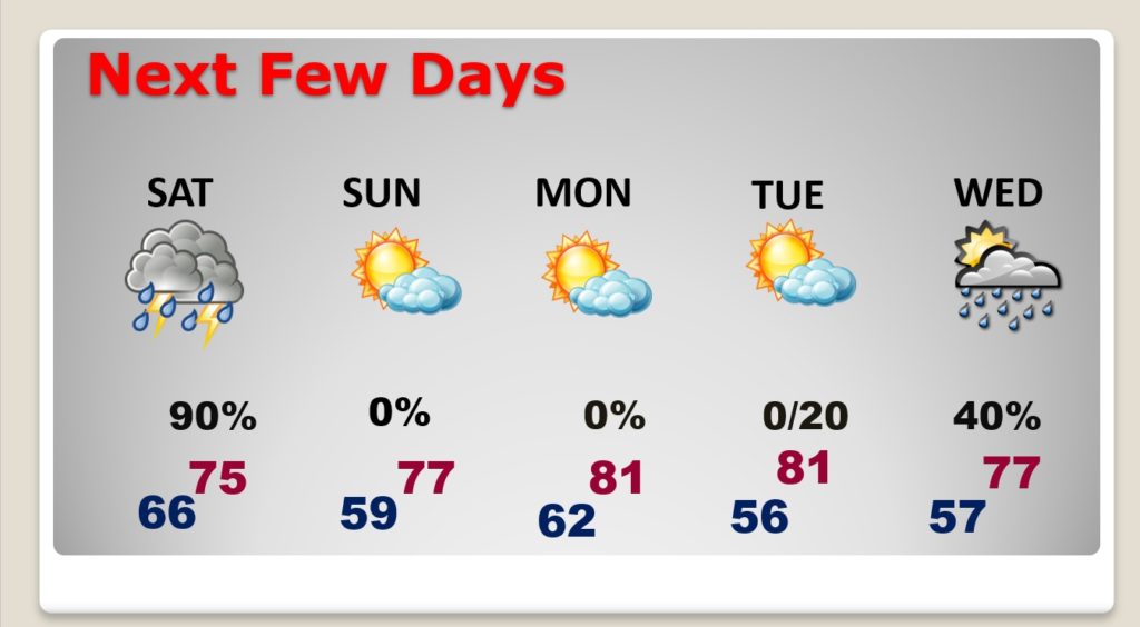
By Sunday, the drama is over. So far Sunday and Monday looks nice. More showers and storms Tuesday.
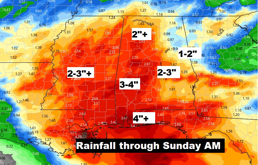
Could be some heavy rainfall amounts in spots.
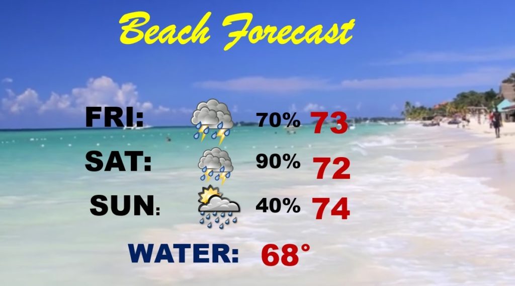
The Beach Outlook speaks for itself. Not good.