
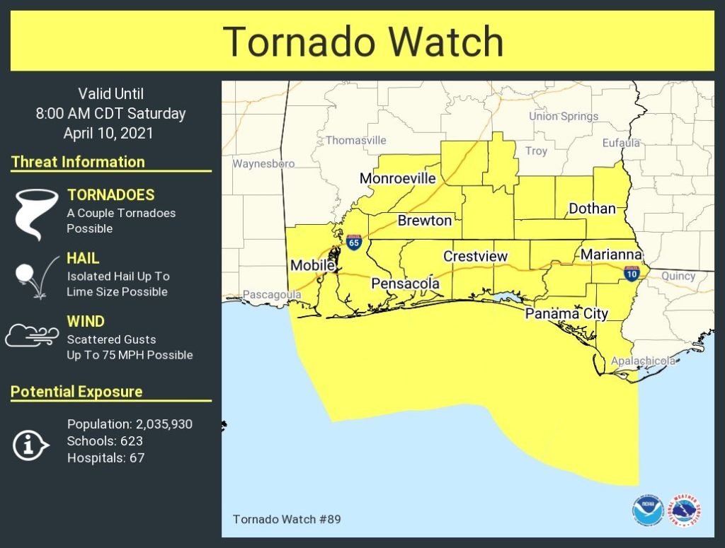
First off…TORNADO WATCH covers all of south Alabama until 8AM Severe thunderstorms with a strong damaging wind threat is also forecast. Large hail is possible.
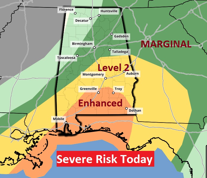
Today: ENHANCED Severe risk, with the strongest risk of damaging winds covers south Alabama, especially from Troy & Greenville southward. But, the level two risk reaches as far north as Talladega county. Today’s risk will mainly be this morning. By afternoon, the severe weather threat will diminish quickly.
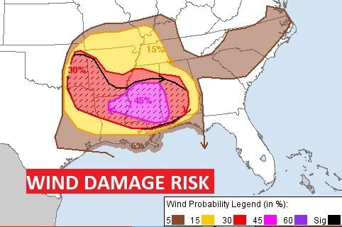
Significant wind damage threat as a line of strong storms sweeps across the area this morning.
Sunday, Monday and Tuesday will be nicer days. More showers and thunderstorms by mid week.

Brief update today, due to ongoing severe weather. There will be a more extensive update on Sunday morning. Have a good day.
–Rich