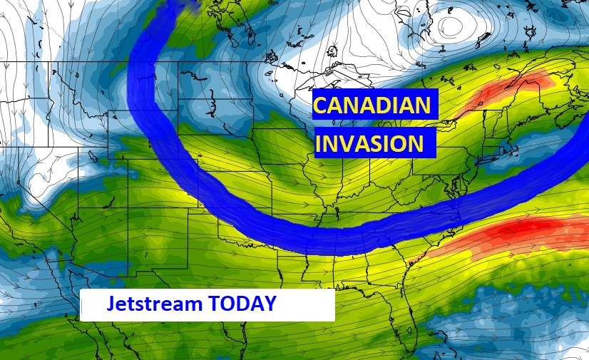
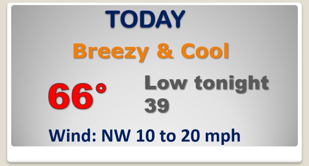
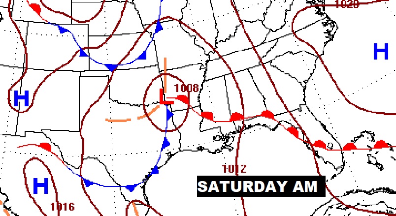
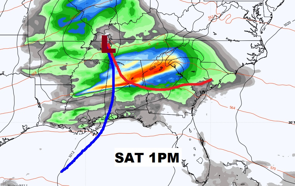
Good Morning! Big change today and tonight. We are going to sample some unusually cool Canadian Air. Today will be much below normal and kind of windy. Overnight tonight we may tease the all-time record low. But, at least the snow will stay north of Alabama. These late season cool-snaps don’t last long. We’ll be back to the mid 70’s Friday. But, will the next storm system bring us some strong storms by Saturday? We are in a Severe Weather Risk. I have updated the details of the weekend forecast.
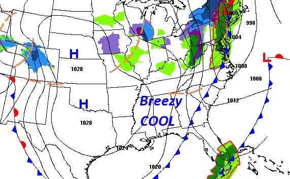
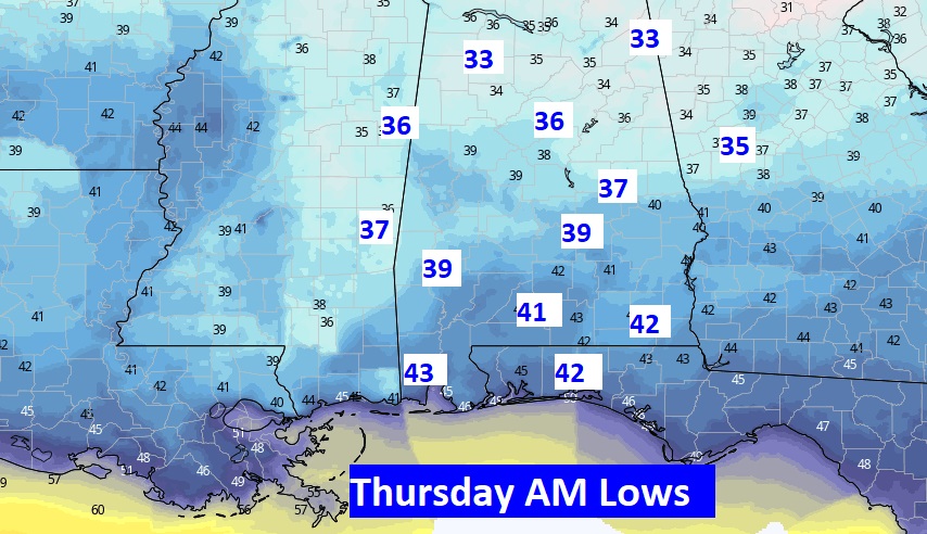
What a difference today. Much cooler Canadian air is funneling in on gusty winds. MUCH below normal today, tonight, Thursday and Thursday night. Late season cool snap.
The record low for tomorrow morning is 38. We’ll be in the neighborhood.
Cool Thursday. Warmer Friday. Severe Weather possible Saturday. Nice Sunday and Monday.
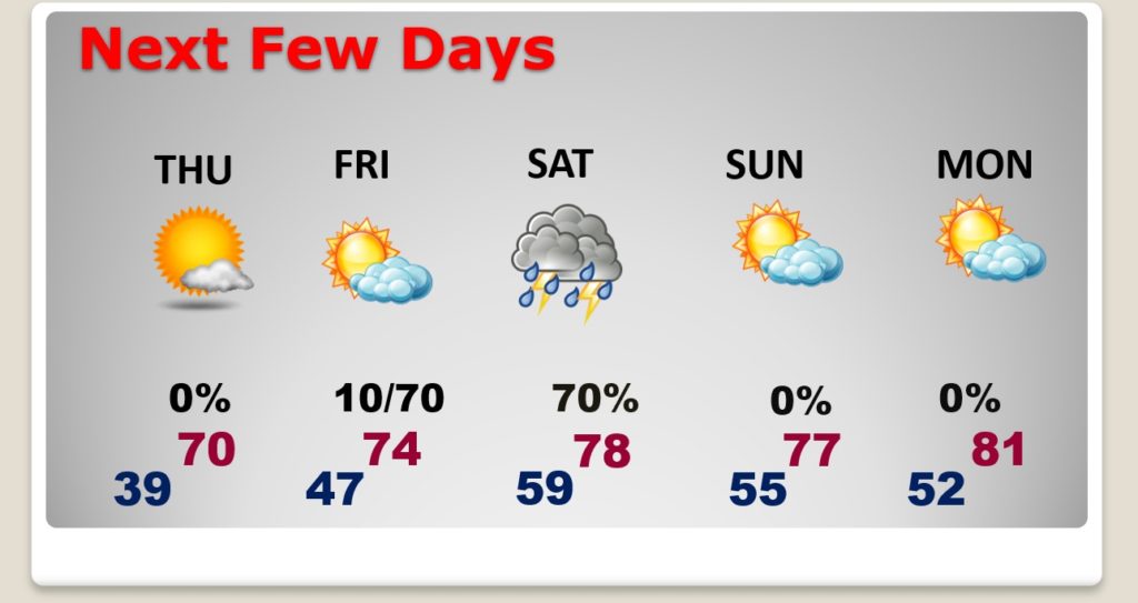
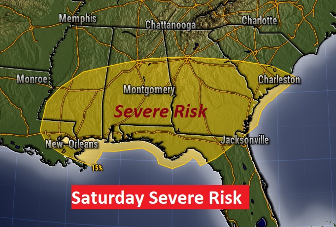
Still some question marks about Sunday, but increasing confidence that we could see some strong to severe storms Saturday, especially by Saturday afternoon, if not before.
Updated Severe Weather Risk from the Storm Prediction Center for Day 4…Saturday.
