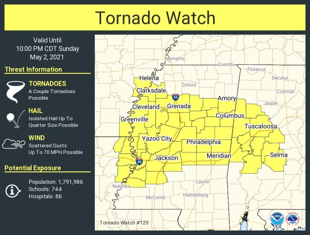
Tornado Watch covers much of west Alabama and into Mississippi. In Alabama the watch includes Dallas county westward until 10PM. Damaging wind gusts to 70 mph, large hail and a couple of tornadoes are possible.
EARLY MORNING UPDATE:
Good Morning! We’ve had a pretty nice weekend so far. A storm system is on the way, But, I’m optimistic that today will be mainly dry, and showers & storms will hold off until tonight. Your biggest complaint today, could be the amount of clouds that will be increasing during the day. Sunshine will be limited.
An active pattern begins tonight. Showers and storms will overspread the area. Some storms by later tonight could be strong to severe. It will be wet & stormy at times through Wednesday night. It looks like another Severe Weather Risk by Tuesday afternoon/evening.
On this blog update, I’ll look ahead to what is shaping up to be a nice Mother’s Day Weekend.
TODAY: Another warm day. Partial sunshine, but considerable clouds. High 85. Risk of some isolated showers later in the afternoon. Showers and thunderstorms become likely tonight. A few storms could be strong, possibly severe in the overnight hours. Damaging wind gusts would be the main threat. Low 68.
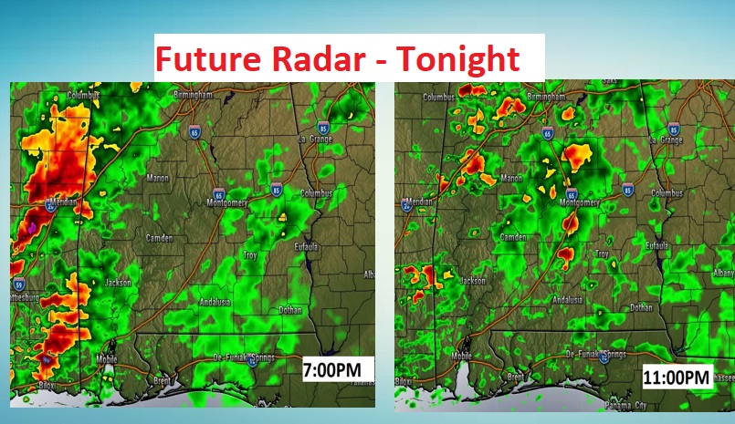
Here’s a couple Future Radar samples late tonight.
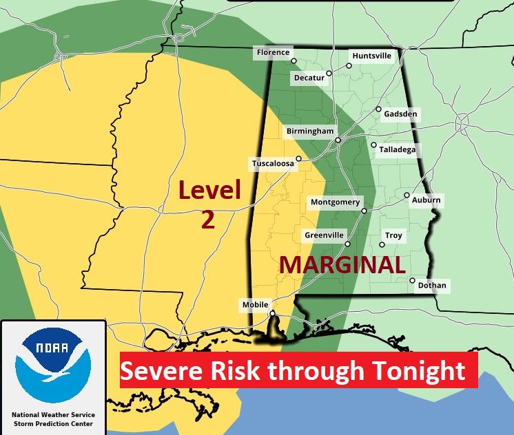
SEVERE WEATHER RISK: Tonight, SPC carries a Marginal Severe Risk as far east as a Montgomery/Andalusia line. The stronger Level 2 Risk covers the western counties, west of Selma. The main time window would be from about 6PM in the western counties to about 2AM Central. Damaging wind gusts would be the main threat.
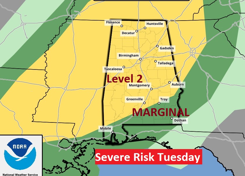
Tuesday’s situation is highly dependent on mesoscale details that won’t be known until Tuesday morning. An approaching front, combined with strong daytime heating will set the stage for strong to severe storms in the afternoon & evening. Right now, most of the state is in a Level 2 threat. Damaging wind gusts and large hail are the main threat. The tornado threat in this situation is not zero, but it appears very low.
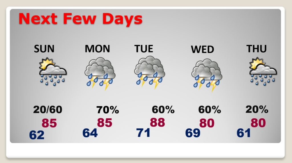
NEXT FEW DAYS: Wet and stormy tonight through Wednesday night. Locally heavy rainfall. Strong to severe storms at times. Right now, late week is looking much better, and that may carry well into the weekend, too.
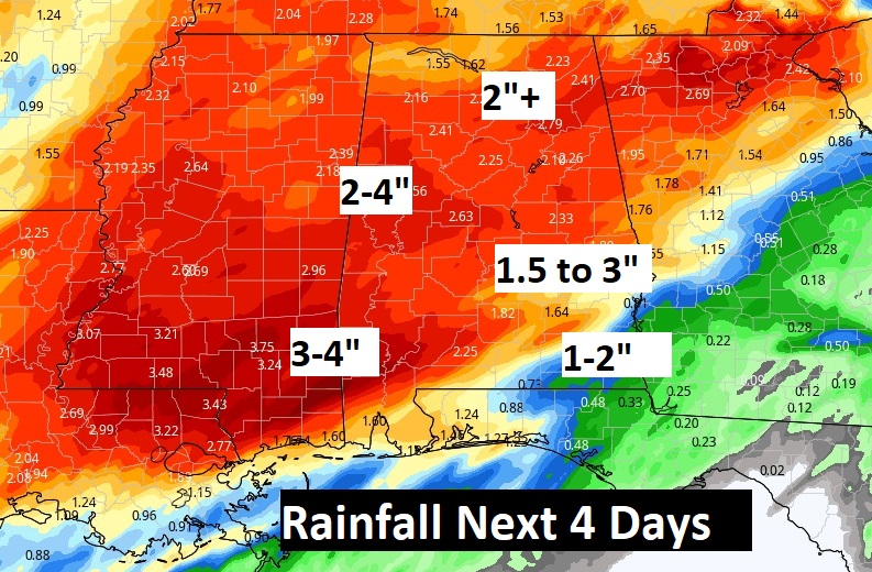
LOVALLY HEAVY RAINFALL: Rainfall amounts through Thursday morning could be heavy in spots. Some places could easily see 2 to 3”, if not more.
MOTHER’S DAY WEEKEND: Right now, I am very optimistic about Mother’s Day weekend. Saturday should be sunny & nice…high near 80. Sunday will be a warm day. Mid 80’s. A storm system will be approaching, but I optimistic that showers and thunderstorms may hold off until Sunday night.
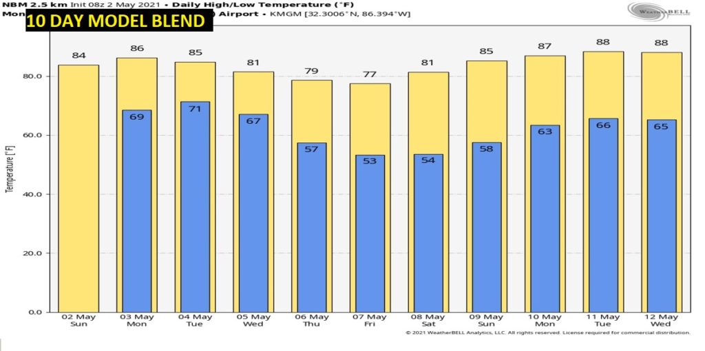
10 DAY MODEL TRENDS: It will turn a little cooler late week, Thursday & Friday behind the storm system. Then, look for another big warming trend next week May 9 – May 12th.
I’ll have a complete video update tomorrow morning. Have a nice Sunday!
–Rich
